Why in news?
The Mahi (Mahisagar) River in western India returned to the headlines after a section of the Gambhira–Mujpur bridge over the river in Gujarat’s Vadodara district collapsed on 9 July 2025, causing several vehicles to plunge into the river and killing at least eleven people. Later on 14 November 2025 a car travelling along the Delhi–Mumbai Expressway lost control near the river in Ratlam district, killing five occupants. These tragedies highlighted concerns about infrastructure safety along the river.
Background
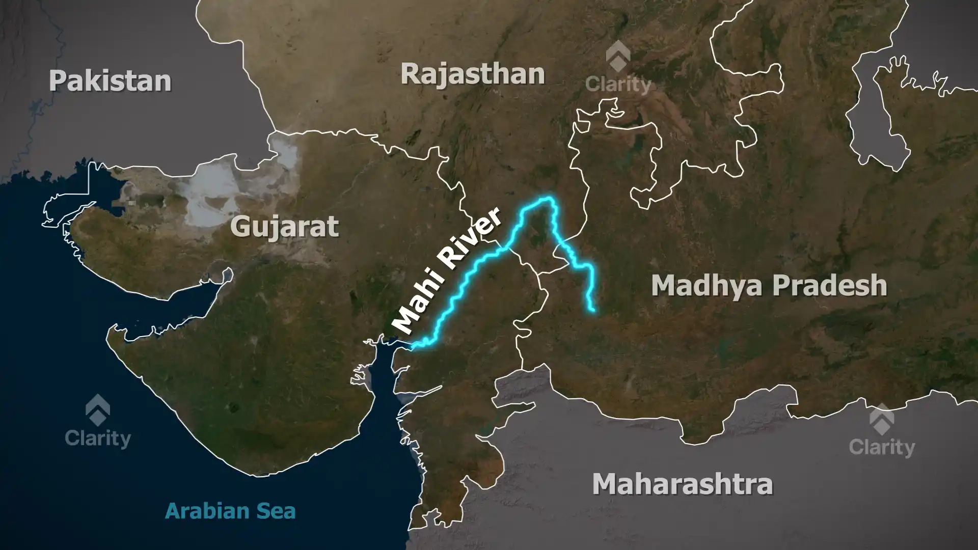
The Mahi is one of India’s few major west‑flowing rivers. Rising from the northern slopes of the Vindhya Range near Bhopawar village in Dhar district of Madhya Pradesh, it flows northwards through Dhar and Jhabua districts, loops through Banswara district in Rajasthan and then heads south‑west through the Panchmahal and Kheda districts of Gujarat before emptying into the Gulf of Khambhat in the Arabian Sea. The river is about 583 km long and drains an area of roughly 34,842 sq km. Its basin is bounded by the Aravalli Hills to the north, the Malwa Plateau to the east, the Vindhya Range to the south and the Gulf of Khambhat to the west.
Known in mythology as Mahati, the river is described in the Vayu Purana. Some legends say it is the daughter of the Earth and the sweat of King Indradyumna. Because of its broad expanse the river is popularly called Mahisagar.
Geography and tributaries
- Course: From its source at about 500 m elevation, the river flows north through Madhya Pradesh before turning west into Rajasthan and south‑west into Gujarat. It forms a characteristic U‑shaped loop in the Vagad region of Rajasthan and finally enters the sea near Khambhat.
- Major tributaries: The right‑bank tributaries include the Som (rising in the Aravalli Hills), while left‑bank tributaries include the Anas, Panam and Jakham rivers. Together they drain agricultural and forested tracts of western India.
- Hydro projects: The Mahi Bajaj Sagar Dam near Banswara, completed in 1983, is a multipurpose project providing irrigation and hydropower (about 140 MW). Downstream, the Mahi Hydel Power Station utilises the river’s gradient to generate electricity.
- Environmental issues: Silt carried by the river has contributed to the narrowing of the Gulf of Khambhat, and salinity intrusion threatens agricultural lands. The river’s low‑lying bed limits its use for surface irrigation. Pollution from industrial and domestic sources also affects water quality.
Recent incidents
- On 9 July 2025 a portion of the Gambhira–Mujpur bridge, built in 1985 across the river near Padra taluka, collapsed. Several vehicles fell into the river; rescue operations retrieved at least nine bodies and saved a few injured survivors. The accident prompted calls for inspection of old infrastructure.
- On 14 November 2025 a Maharashtra‑registered car travelling on the Delhi–Mumbai Expressway near Ratlam lost control near the Mahi river section and veered off the road, killing five people. Authorities cited overspeeding as a likely cause.
Significance
- The Mahi River sustains agriculture and hydropower in three states. Its cross‑state nature requires cooperative management to address flood control, pollution and sedimentation.
- The recent accidents underline the need for regular safety audits of bridges and highways crossing major rivers. Investment in infrastructure maintenance is essential to prevent tragedies.
- Understanding the river’s hydrology and ecology can help design projects that balance development with conservation, especially in the face of increasing salinity and pollution.

