Why in news?
Media discussions resurfaced about the unresolved Sir Creek dispute between India and Pakistan following fresh statements from both governments. The dispute affects fishing rights and the demarcation of exclusive economic zones (EEZs) in the Arabian Sea.
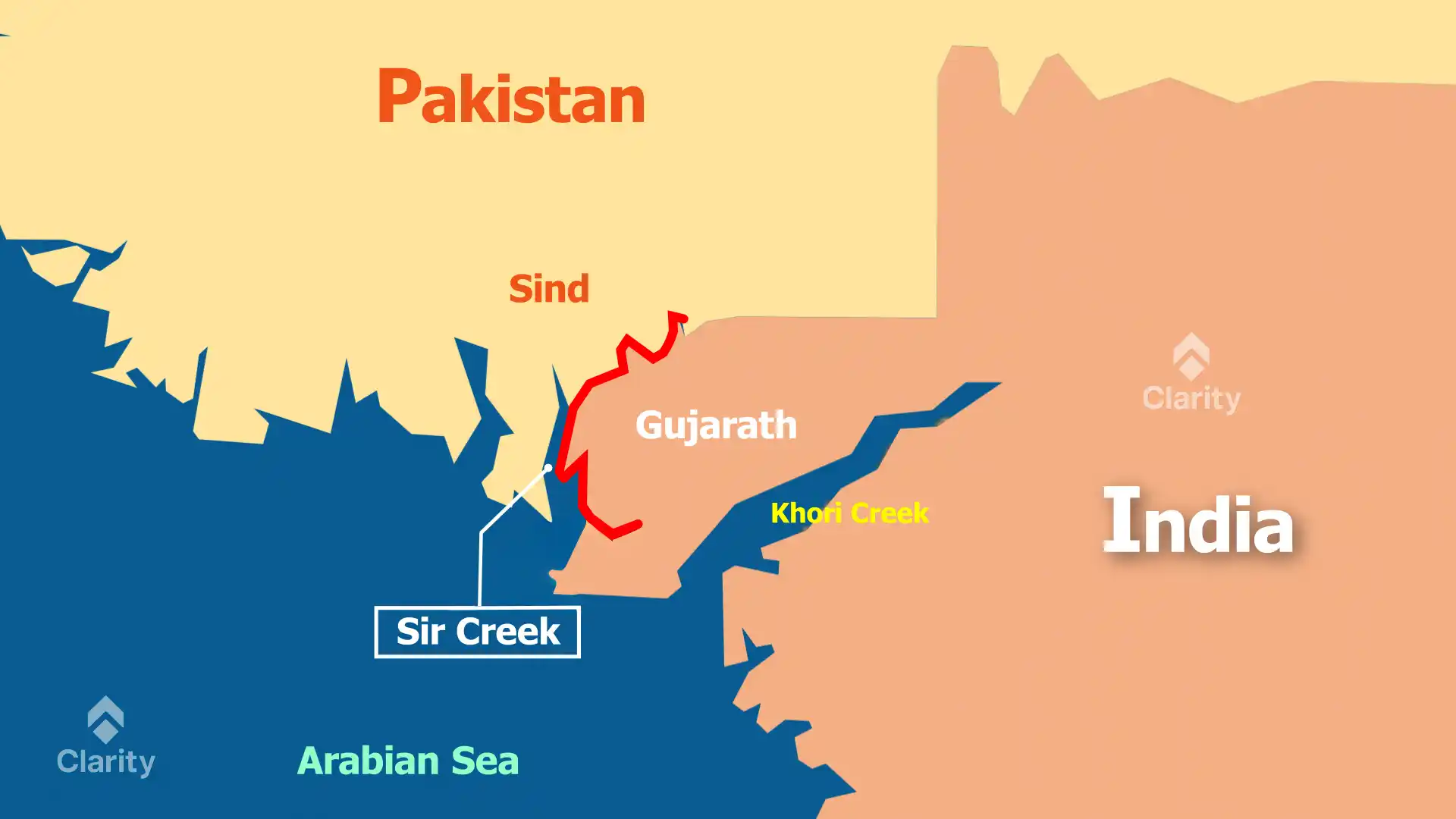
Geography of Sir Creek
Sir Creek is a 96‑kilometre tidal estuary in the marshy Rann of Kutch, where the Indus delta meets the Arabian Sea. The creek floods during high tide and nearly dries at low tide, making it difficult to fix a permanent channel.
Historical background
- The 1914 treaty between the rulers of Sindh (under British India) and the Maharaja of Kutch declared the middle of the creek as the boundary.
- After Partition, Pakistan claimed the entire creek based on the eastern bank, while India insisted on the mid‑channel line.
- The 1968 tribunal resolved the larger Kutch border dispute but left Sir Creek unsettled.
Why is the dispute important?
- A mid‑channel line would give Pakistan a larger maritime area, while India’s claim would extend its Exclusive Economic Zone by about 13,000 square kilometres.
- The creek is rich in fish, making it economically significant for local fishing communities.
- Unclear borders lead to frequent arrests of fishermen from both countries who stray into each other’s waters.
Steps towards resolution
- Several rounds of talks have been held since 2006, exploring options such as a joint survey to determine the navigable channel.
- Confidence‑building measures include joint border meetings and humanitarian releases of fishermen.
- A final settlement will require political will and perhaps involvement of neutral experts to draw an equitable boundary.
Resolving the Sir Creek dispute would reduce friction between India and Pakistan and enable better management of marine resources.