Why in news?
A devastating landslide in Sudan’s Darfur region in late August 2025 killed over a thousand people and destroyed an entire mountain village. The tragedy drew attention to the geography of Sudan, a country long affected by natural disasters and conflict.
Overview of Sudan
Sudan is a country in northeastern Africa. Medieval Arab geographers called it bilād al‑sūdān (land of the blacks). It gained independence from joint British‑Egyptian rule in 1956. Since the 2019 revolution the country has been under a transitional government led by General Abdel Fattah al‑Burhan.
Geography and physical features
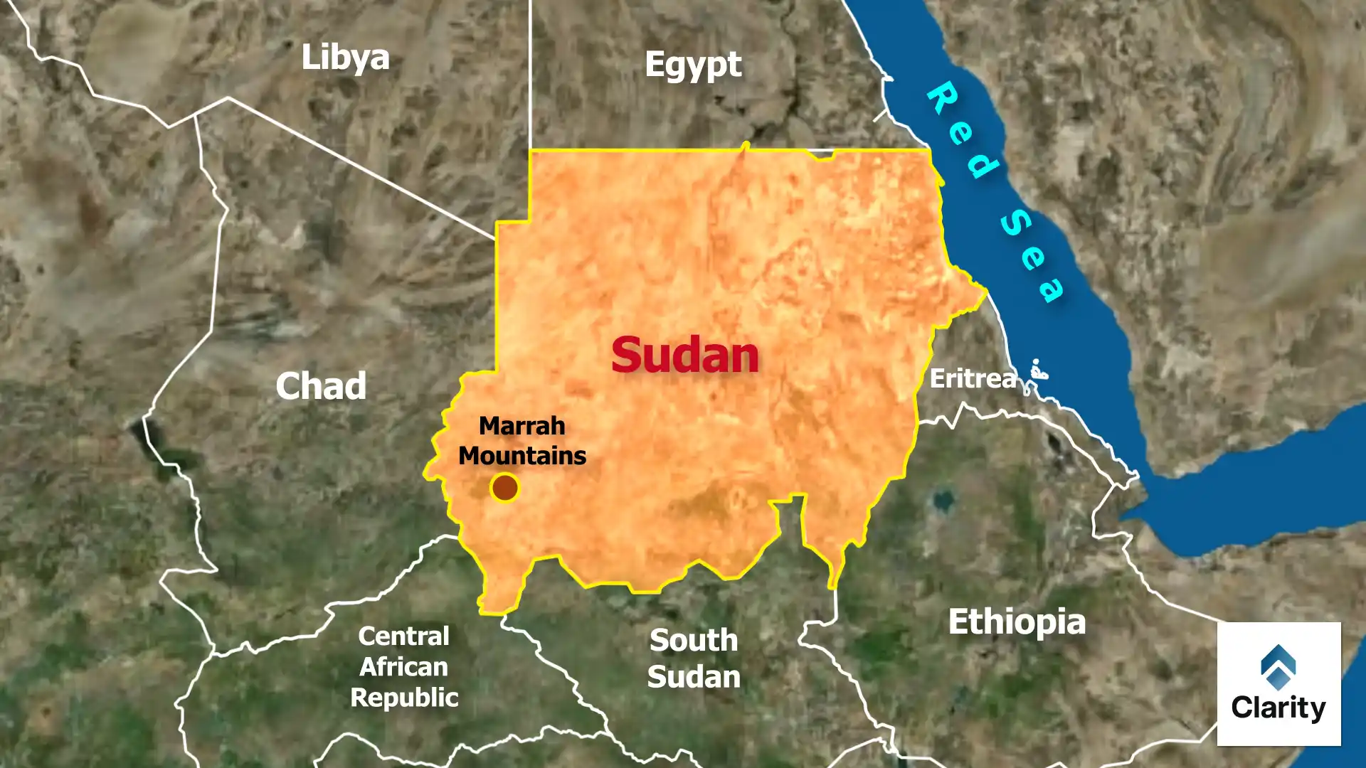
- Location: Sudan sits at the crossroads of Africa and the Arab world. It is bordered by Egypt to the north, the Red Sea to the northeast, Eritrea and Ethiopia to the east, South Sudan to the south, the Central African Republic to the southwest, Chad to the west and Libya to the northwest. South Sudan seceded in 2011, reducing Sudan’s land area but leaving it the third‑largest country in Africa.
- Capital: Khartoum lies at the confluence of the White Nile and Blue Nile. The combined river then flows northwards through Egypt as the Nile.
- Mountains: The Marra Mountains in Darfur are volcanic highlands rising to about 3,000 metres. The Nuba Mountains consist of isolated granitic hills scattered across south‑central Sudan.
- Rivers: Sudan is dominated by the Nile system. The White Nile originates in East Africa, and the Blue Nile begins in Ethiopia; they meet at Khartoum. Other rivers include the Bahr al‑Arab and the Sobat.
- Landforms: Northern Sudan is largely desert with dunes and rocky plateaux. Central regions have clay plains, while the south has wetter savannahs. Fertile alluvial soils are found in the Gezira plain between the White and Blue Nile.
Understanding Sudan’s geography helps explain its vulnerability to landslides, floods and desertification. Sustainable development in such varied terrain poses continuing challenges.