Why in news?
Venezuela has been in news recently. Understanding Venezuela’s physical features helps contextualise its economy and biodiversity, both of which influence India’s foreign policy interests in Latin America.
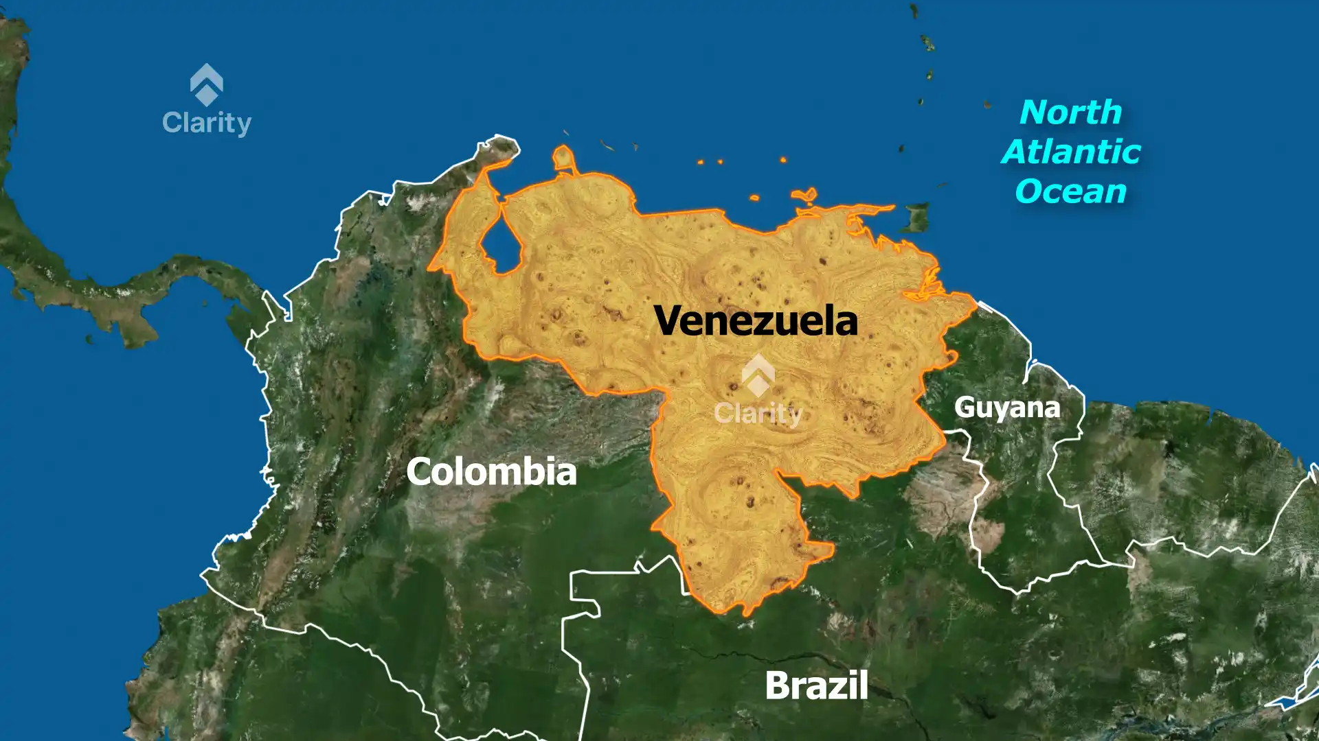
Location and borders
Venezuela is situated at the northern tip of South America. It is bounded by the Caribbean Sea and the Atlantic Ocean to the north, Guyana to the east, Brazil to the south and Colombia to the southwest and west. The country is roughly triangular and covers about 916 thousand square kilometres, making it slightly larger than the combined areas of France and Germany. The national capital, Caracas, lies near the northern coast.
Major physical regions
- Maracaibo Lowlands: Located in the far northwest, these lowlands around Lake Maracaibo are dry and windy. They contain Venezuela’s richest oil deposits.
- Andes Mountains and northern highlands: The Venezuelan Andes run northeast from the Colombian border. Pico Bolívar, the country’s highest peak, rises to 4,979 metres. These uplands have a temperate climate and support coffee plantations.
- Llanos (central plains): Spreading eastwards along the Orinoco River, the plains make up about a third of the country. They are low‑lying grasslands that experience wet and dry seasons and support cattle ranching.
- Guiana Highlands: Covering the southeast, these ancient, weathered highlands are hot and humid. They contain tepuis (table‑top mountains) and the world’s highest waterfall, Angel Falls, which plunges 979 metres (more than 12 times the height of Niagara Falls).
Rivers and lakes
- Orinoco River: One of South America’s longest rivers, the Orinoco stretches over 2,200 kilometres and drains about four‑fifths of Venezuela’s territory. It flows eastward before forming a vast delta on the Atlantic coast.
- Lake Maracaibo: The largest lake in South America, connected to the Gulf of Venezuela by a narrow channel. The surrounding basin is an important oil‑producing region.
- Other water bodies: Numerous smaller rivers such as the Apure, Caroní, Caura and Meta feed into the Orinoco. The Guiana Highlands also host rivers like the Cuyuni and Parguaza that flow into Guyana.
Islands and coasts
Venezuela controls several Caribbean islands, including Margarita Island, La Tortuga, Los Roques and Los Monjes. Its coastline of more than 2,800 kilometres provides access to major shipping routes and rich marine resources.