Why in news?
The Senapati Forest Division in Manipur recently launched a Participatory Rural Appraisal (PRA) exercise in villages near the source of the Barak River. The initiative aims to gather local knowledge and map resources as the first step toward restoring the river’s watershed and strengthening livelihoods.
Background
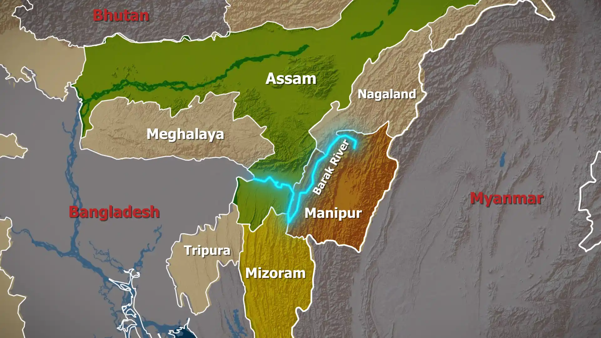
The Barak River originates in the hills of Manipur and flows westwards through Manipur, Mizoram and Assam before entering Bangladesh. Stretching about 900 kilometres, it is the second‑largest river in Northeast India. In Assam it forms the fertile Barak Valley, which comprises the districts of Cachar, Hailakandi and Karimganj. Near the town of Bhanga, the river splits into the Surma and Kusiyara branches that merge into the Meghna River in Bangladesh.
Key characteristics
- Basin and tributaries: The Barak basin spans parts of Meghalaya, Manipur, Mizoram, Assam, Tripura and Nagaland. Major tributaries include the Jiri, Chiri, Modhura and Sonai rivers. The Lakhipur–Bhanga stretch of the Barak has been declared National Waterway 16 for inland navigation.
- Dams and hydropower: Several small dams across the basin—such as Khoupum, Gumti and Myntdu–Leshka—provide hydroelectric power and irrigation. Plans for large projects are often debated due to ecological concerns.
- Environmental challenges: The river suffers from deforestation, soil erosion, frequent floods and siltation. Shifting cultivation, unregulated mining and sand extraction exacerbate degradation.
Participatory Rural Appraisal
- Community mapping: PRA involves villagers in drawing maps of natural resources, land use and socio‑economic conditions. This helps identify problems and priorities from the perspective of those who depend on the watershed.
- Baseline data: Information collected during PRA—such as soil quality, water sources, agricultural practices and forest cover—forms a baseline against which future interventions can be measured.
- Action planning: The exercise serves as the foundation for an integrated watershed management plan. Proposed actions may include reforestation, soil conservation, water‑harvesting structures and livelihood diversification.
Significance
- Local ownership: By involving communities directly, the initiative builds trust and encourages long‑term stewardship of the river and surrounding forests.
- Ecosystem restoration: A healthy Barak watershed supports biodiversity, regulates floods and supplies clean water. Rejuvenation efforts can improve fish stocks and agricultural productivity.
- Climate resilience: Watershed management reduces vulnerability to extreme weather events and helps communities adapt to climate change.
Conclusion
The PRA exercise in the Barak River basin signals a move toward participatory and science‑based watershed management in Northeast India. Success will depend on sustained collaboration among villagers, forest officials and development agencies.
Sources: India Today NE