Why in news?
The India Meteorological Department warned that two developing weather systems in the Bay of Bengal could interact through the Fujiwhara effect. Forecast models show the storms drawing close enough to influence each other’s paths, raising uncertainty about their track and intensity. Officials have urged coastal communities in Sri Lanka, India, Bangladesh and Myanmar to stay alert.
Background
The Fujiwhara effect, named after Japanese meteorologist Sakuhei Fujiwhara, describes the interaction between two cyclones or hurricanes that come within a certain distance of each other. First described in 1921 and observed during typhoons Marie and Kathy in 1964, the phenomenon occurs when the circulation patterns of two nearby storms begin to overlap.
How it works
- Mutual orbit: When cyclones approach within roughly 1,400 km (for tropical systems) or 2,000 km (for extratropical storms), they start to rotate around a common centre located somewhere between them.
- Size matters: The more powerful or larger storm moves more slowly around this pivot point, while the smaller storm is drawn in more quickly.
- Outcomes: The interaction can cause the storms to merge into a larger system, repel each other, or alter each other’s paths. In some cases one storm cannibalises the other; in others they both weaken.
Current situation
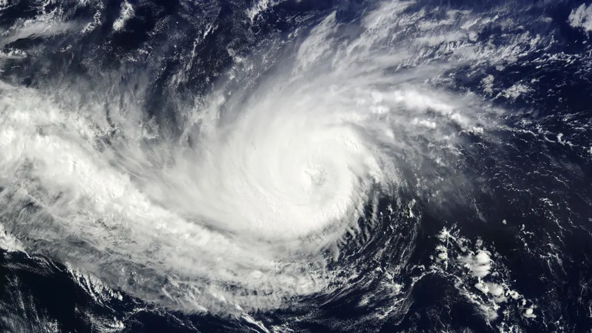
According to weather agency briefings, a well‑marked low‑pressure area over the Andaman Sea is expected to intensify into a cyclone as it moves west‑northwest. Another circulation near the Comorin region could develop into a depression. The U.S. Global Forecast System and the European model currently give different predictions about whether and how the two systems will interact, leading to uncertainty about landfall points and intensities. Meteorologists emphasise that such interactions, though rare, can significantly alter storm tracks and therefore require close monitoring.
Sources: Down To Earth