Why in news?
Researchers have demonstrated that NASA’s Plankton, Aerosol, Cloud and ocean Ecosystem (PACE) satellite can detect nitrogen dioxide pollution at a resolution fine enough to isolate emissions from individual factories and highways. By applying machine‑learning algorithms to the satellite’s hyperspectral data, scientists generated detailed maps of pollution plumes over Los Angeles and other cities, enabling more precise targeting of emission sources.
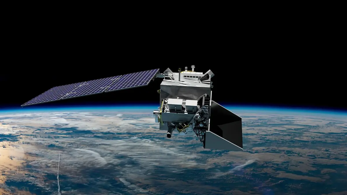
Background
Pace is an Earth‑observing mission launched by NASA in February 2024. The satellite orbits the Earth in a sun‑synchronous, polar orbit approximately 675 kilometres above the surface, completing one revolution every 98 minutes. Its primary goal is to study global ocean biology, aerosols and clouds to better understand how they affect climate and marine ecosystems.
Instruments and capabilities
- Ocean Color Instrument (OCI): A highly advanced optical spectrometer that measures reflected sunlight across wavelengths from ultraviolet to shortwave infrared. Its hyperspectral resolution provides the first global coverage of ocean colour every one to two days, allowing scientists to monitor phytoplankton blooms, water quality and ocean health.
- SPEXone: A Dutch‑contributed spectro‑polarimeter that measures the polarisation of light to characterise aerosols and clouds, improving our understanding of how they interact with sunlight and influence climate.
- HARP2: The Hyper Angular Research Polarimeter from the University of Maryland Baltimore County, which captures multi‑angle polarised light to study tiny particles in the atmosphere and their effects on cloud formation.
- Orbit and power: PACE carries a three‑panel solar array generating about 2.7 kilowatts of power. The satellite’s sun‑synchronous orbit ensures consistent lighting conditions for the sensors.
Detecting air pollution
Although designed primarily for ocean colour and aerosol research, OCI’s fine spectral resolution retains enough detail to detect trace gases such as nitrogen dioxide. Scientists trained a machine‑learning model using data from Europe’s TROPOMI instrument to interpret OCI signals. The resulting maps reveal individual pollution sources and highway corridors, offering sharper insight into urban air quality. Combined with NASA’s TEMPO mission, which provides hourly observations over North America, PACE data can help track how pollution plumes move and change over time.
Applications and significance
- Environmental monitoring: High‑resolution nitrogen dioxide maps enable regulators to pinpoint polluting factories, traffic hotspots and port emissions, leading to targeted mitigation strategies.
- Public health: Locating pollution sources near communities helps researchers link air quality to respiratory diseases and design interventions.
- Ocean and climate research: Beyond air pollution, PACE extends decades‑long records of ocean colour, revealing trends in phytoplankton productivity, harmful algal blooms and carbon cycling.
Conclusion
The PACE mission illustrates how a single satellite can serve multiple scientific purposes. By simultaneously advancing oceanography, climate science and air‑quality monitoring, PACE provides invaluable data for understanding and protecting our planet.

