Why in news?
Meteorologists have warned that a major polar vortex disruption could bring unusually cold weather to parts of Europe, North America and Asia in February 2026. As people brace for potential cold waves, it is useful to understand what the polar vortex is and how it affects weather patterns.
Background
A polar vortex is a large area of low pressure and cold air that sits over Earth’s poles. It always exists high in the stratosphere, strengthening in winter and weakening in summer. The term “vortex” refers to the counter‑clockwise flow of air that keeps icy air near the poles. The vortex is not a single storm but a circulation pattern that influences the jet stream.
How it influences weather
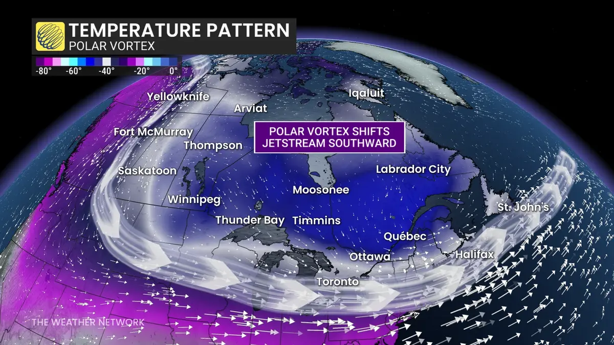
- Expansion and cold outbreaks: When the polar vortex is strong, it confines cold air around the poles. If it weakens or is disrupted by warming events in the stratosphere, parts of the cold vortex can break off and move southwards. This causes outbreaks of Arctic air in temperate regions, bringing snow and freezing temperatures.
- Jet stream behavior: A strong vortex helps maintain a stable, circular jet stream that separates cold northern air from warmer southern air. A weakened vortex leads to a wavy jet stream, allowing cold air to plunge south and warm air to surge north.
- Misconceptions: The polar vortex is not a new or single weather event, and not all cold spells are caused by it. It is a normal part of winter atmospheric circulation that sometimes becomes newsworthy when it shifts.
Preparation
While the polar vortex itself is not dangerous, the cold air it can deliver may pose risks. Meteorological agencies advise people to monitor forecasts and prepare emergency kits for homes and vehicles each winter. Dressing in layers, protecting pipes and taking care with heating equipment can help prevent injuries and damage.
Source: DEVD