Why in news?
In mid‑January 2026 wildfires swept across central and southern Chile, leaving at least 18 people dead, forcing 50,000 residents to flee and destroying hundreds of homes. Chilean President Gabriel Boric declared a state of catastrophe in the Biobío and Ñuble regions to mobilise military support for firefighting.
Background
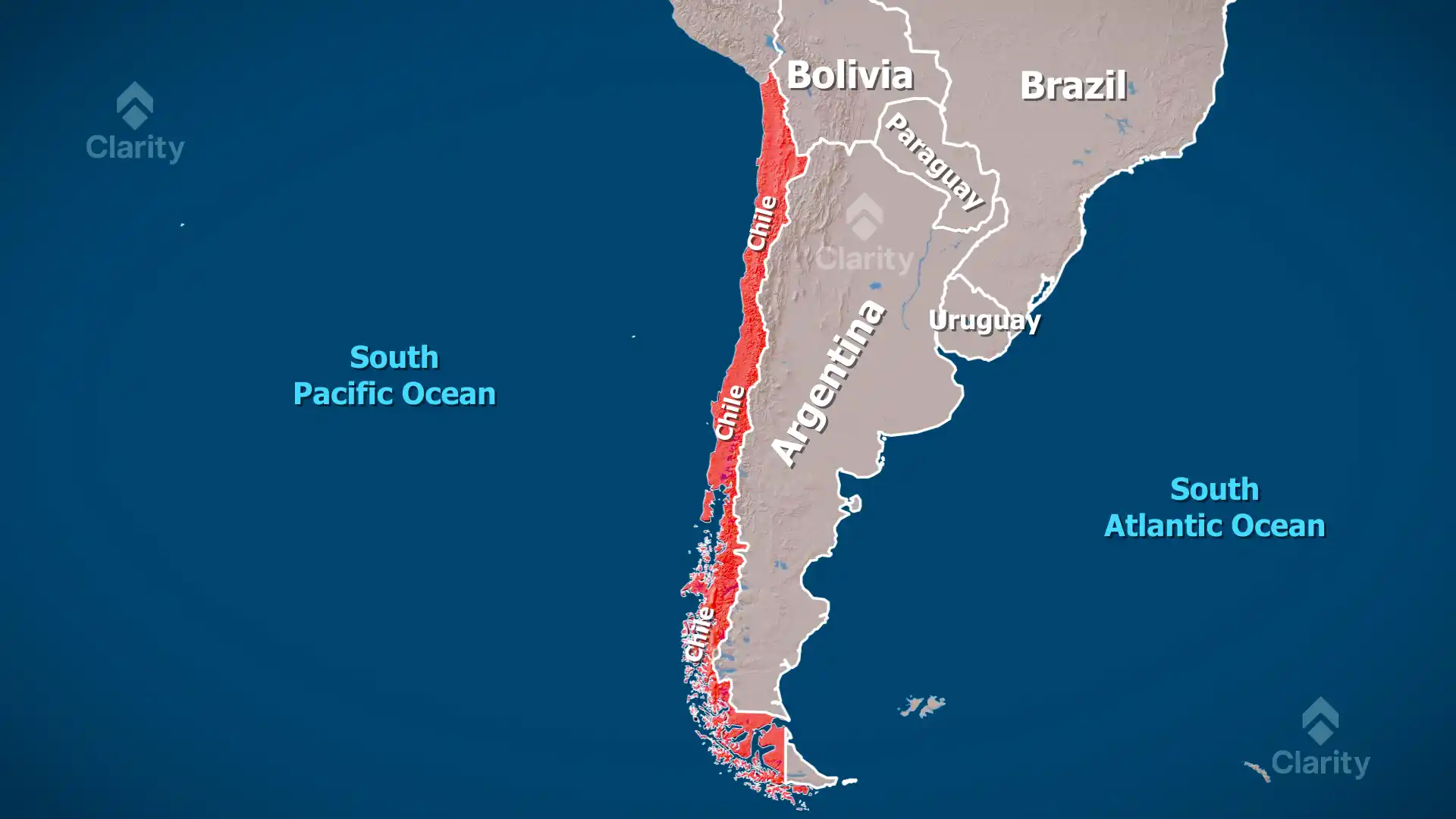
Chile stretches over 4,300 kilometres along South America’s western edge but averages only about 177 kilometres in width. To the east lie the Andes mountains and to the west the South Pacific Ocean. This unique geography creates diverse climates: arid deserts in the north, a Mediterranean zone around the capital Santiago, and cool, rainy forests in the south. Chile also sits on the Pacific Ring of Fire, making it prone to earthquakes and volcanic eruptions. Its natural resources include vast deposits of copper and lithium.
Recent wildfires
- Scale: According to Chile’s forestry agency, more than 8,500 hectares (21,000 acres) of land burned in January 2026. Earlier fires in 2024 had already been recorded as the country’s deadliest natural disaster since the 2010 earthquake.
- Casualties and damage: At least 18 people were confirmed dead and around 300 houses destroyed, with the toll expected to rise. Entire neighbourhoods in towns such as Penco were reduced to ashes as flames swept through late at night.
- Emergency measures: The state of catastrophe allows greater coordination with the armed forces. However, local officials complained of delays in receiving help as high winds and temperatures above 38 °C (100 °F) fanned the flames.
- Climate factors: Chile has endured years of drought and heat waves that dry out vegetation. In the 2020s prolonged La Niña conditions reduced rainfall, leaving central Chile especially vulnerable to fires.
Chile’s geography at a glance
- Location: A narrow strip of land on the western edge of South America, bordered by Peru to the north, Bolivia to the northeast and Argentina to the east. Its southern tip approaches Antarctica across the Drake Passage.
- Desert: Northern Chile is home to the Atacama Desert, the driest non‑polar desert in the world.
- Major river: The Loa River flows through the northern highlands before emptying into the Pacific.
- Volcano: Ojos del Salado, on the Argentina border, is the world’s highest active volcano and the second highest peak in the Andes at 6,880 metres.
- Resources: Chile is the world’s largest producer of copper and a leading producer of lithium. Other resources include molybdenum, iron ore, timber and hydropower potential.
Conclusion
The deadly wildfires highlight the vulnerability of Chile’s landscapes to climate‑driven disasters. Understanding the country’s geography helps explain why droughts and heat waves can have such devastating effects. As global temperatures rise, countries like Chile will need stronger fire management and climate adaptation strategies to protect communities.
Source: The Indian Express