

Why in news?
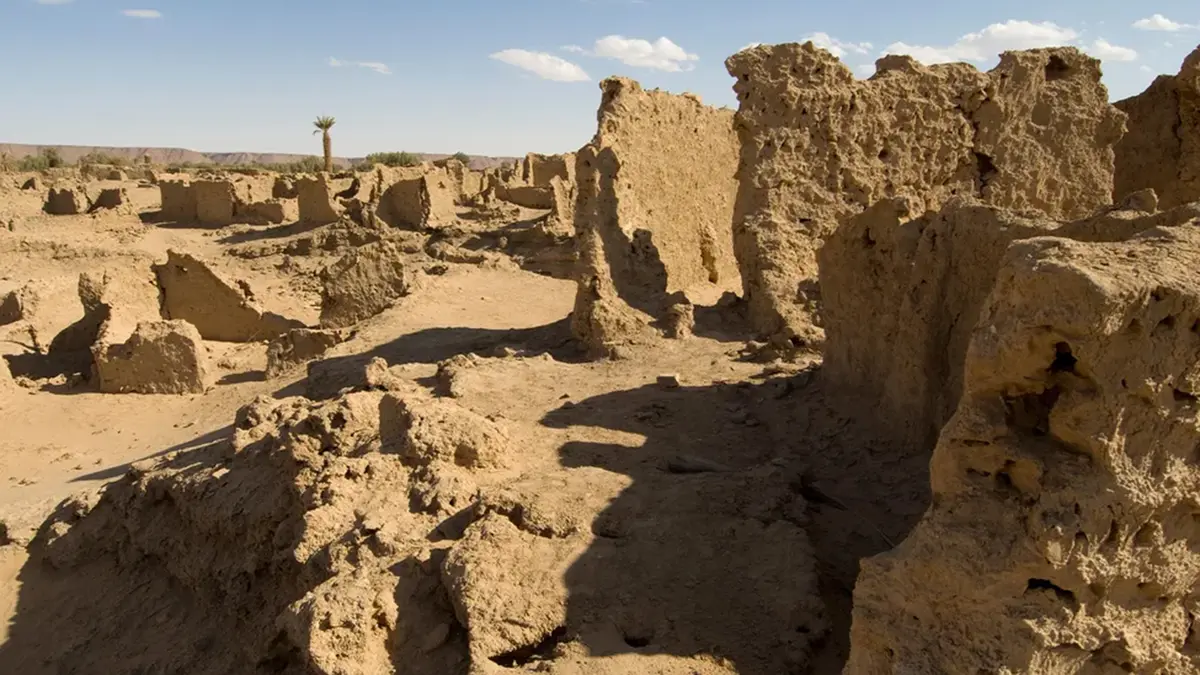
Fresh coverage has revisited satellite-assisted discoveries of Garamantian settlements in the Libyan Sahara. The Times of India's 22 September feature describes research reported in 2011, rather than a newly excavated civilisation. Archaeologists identified extensive farms, fortified villages and irrigation remains associated with this ancient desert society. These findings challenged an older picture dominated by hostile outsiders' accounts of nomadic raiders. The Garamantes built settled communities supported by farming, underground water channels and long-distance exchange. Their history explains how urban life could develop far from a permanent river, while also exposing the limits of dependence on slowly replenished groundwater.
A settled society in the central Sahara
The Garamantian heartland lay in Fezzan, in southwestern Libya. Its principal centre, ancient Garama, is associated with modern Germa in the Wadi al-Ajal. Here, an oasis landscape supported settlements within an otherwise arid region. A wadi is a valley or watercourse that need not carry water throughout the year. Locating the civilisation in this interior setting is essential: it was not a Mediterranean coastal city transplanted into the desert.
Garamantian society developed across several centuries before and during the early Common Era. Many settlements highlighted in the 2011 announcement date from the first to fifth centuries of the Common Era. Their inhabitants were contemporaries of the Roman world, but they were not simply Roman settlers. Local communities adopted and adapted outside materials and ideas. Archaeological evidence reveals their own settlement patterns, technologies and institutions. Similar-looking fortifications therefore need interpretation in their local setting, not automatic attribution to Roman occupation.
How the evidence changed the picture
University of Leicester researchers used satellite images to examine a landscape too large for rapid ground inspection. Repeated outlines of walls, enclosures and fields suggested organised settlement rather than isolated ruins. The 2011 account reported more than 100 fortified farms and villages, alongside towns and other features. Field visits then tested what those shapes represented. Remote sensing expanded the search area, while direct inspection helped establish construction, preservation and archaeological context.
The wider Trans-SAHARA project combined such mapping with radiocarbon dating and the analysis of artefacts. Its final report describes changing settlement forms and burial practices, not just a collection of spectacular buildings. Rectangular fortified villages with projecting corner towers were one important pattern. Dating evidence helps separate successive periods that may overlap on the surface. Together, these methods can reconstruct how communities changed, rather than treating every visible ruin as part of one moment.
This also changes how written sources are used. Accounts produced by neighbouring powers can preserve valuable observations while reflecting political rivalry and unfamiliarity. Descriptions of desert peoples as raiders reveal only part of their lives. Houses, cultivated plots, workshops and water infrastructure answer different questions. They show how people obtained food, organised labour and sustained exchange. Archaeology does not make every ancient text useless; it provides evidence against which particular claims can be assessed.
How underground channels sustained cultivation
The crucial water technology was the foggara, a gently sloping underground channel connected to a groundwater source. Water flowed towards cultivated land under gravity. Vertical shafts gave workers access during excavation and maintenance. Keeping much of the route underground reduced exposure to intense desert evaporation. Unlike a deep modern borewell, this system depended on a favourable relationship between the water table, the tunnel and the receiving fields.
Research presented by the Geological Society of America in 2023 examined that environmental setting. Earlier, wetter climatic periods had left groundwater stored beneath an increasingly dry landscape. Suitable geology and topography allowed the Garamantes to reach some of it using tunnels. Yet access to a large stored resource does not make it renewable at the rate people withdraw it. When groundwater falls below a channel's collecting level, gravity can no longer deliver the same supply.
That physical constraint provides a plausible explanation for increasing pressure on irrigated settlements. It should not turn a complex historical transformation into a story with one proven cause. Hydrological research addresses the availability of water; archaeology also records changing settlement and trade. Political relationships and the ability to maintain labour-intensive infrastructure belong to the wider historical question. The strength of the groundwater explanation lies in its mechanism, not in assuming that every community disappeared simultaneously.
A corridor of exchange, not an empty barrier
The project found evidence for substantial exchange before the spread of Islam across North Africa. Scientific analysis showed that Garamantian craftspeople reworked imported Mediterranean glass and metal. They made new objects for local use and onward circulation. Textiles and beads also formed part of these networks. Such evidence places the central Sahara within wider economic connections. It challenges the idea that long-distance Saharan interaction began only in the medieval period.
Oases could support travellers while producing goods and food themselves. Water infrastructure and trade therefore reinforced one another: reliable settlements made exchange easier, and exchange could support specialised work. This does not mean all desert routes operated continuously or under one authority. Routes and settlements changed over time. These findings place local societies within the history of those connections. The Sahara was not simply a gap between northern and southern worlds.
Conclusion
The renewed coverage concerns an older discovery with a lasting historical consequence. Garamantian settlements demonstrate that desert urbanism depended on technical skill, organised labour and regional exchange. Their water systems also show why the ability to extract groundwater differs from the ability to sustain extraction indefinitely. Reading irrigation remains alongside settlements and artefacts produces a fuller history. It reveals adaptation and exchange, without reducing centuries of change to a sudden collapse.