
Why in news?
Recent INSAT-3DR images showed extensive cloud cover over India. An analysis estimated coverage across roughly 60 to 70 per cent. Visible and infrared images offered different views of the same weather. The images renewed interest in India’s meteorological satellites.
Background
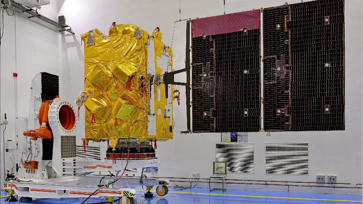
Within the Indian National Satellite (INSAT) system, INSAT-3DR provides advanced national meteorological services.
The Indian Space Research Organisation based the spacecraft on INSAT-3D, with the final letter marking a repeat mission.
Launch and orbit
| Feature | Details |
|---|---|
| Launch date | 8 September 2016 |
| Launch vehicle | Geosynchronous Satellite Launch Vehicle F05 |
| Launch site | Second Launch Pad, Sriharikota |
| Launch mass | 2,211 kilograms |
| Operational position | Geostationary orbit near 74 degrees east |
| Owner | Indian Space Research Organisation |
The launch vehicle, called GSLV-F05, placed the satellite into transfer orbit before onboard fuel carried it to final orbit.
Geosynchronous and geostationary are related
A geosynchronous satellite completes one daily orbit, but its apparent ground position can still move.
A geostationary satellite follows a circular equatorial orbit, moving eastward at Earth’s angular speed.
It therefore appears fixed above one longitude, roughly 35,786 kilometres above Earth’s equator.
| Orbit | Essential condition | Appearance from Earth |
|---|---|---|
| Geosynchronous | Orbital period matches Earth’s rotation period. | The satellite may trace a repeating path. |
| Geostationary | Orbit is circular, equatorial and eastward. | The satellite appears fixed over one longitude. |
Geostationary weather satellites repeatedly observe one region, allowing continuous tracking of changing clouds and storms.
Main payloads
| Payload | Main purpose |
|---|---|
| Multispectral Imager | It creates pictures in several visible and infrared bands. |
| 19-channel Sounder | It estimates vertical temperature and humidity conditions. |
| Data Relay Transponder | It forwards observations from remote ground instruments. |
| Search and Rescue Transponder | It relays emergency signals from compatible distress beacons. |
Visible and infrared pictures differ
| Image type | What the sensor detects | Main limitation or use |
|---|---|---|
| Visible | Sunlight reflected by clouds and Earth | It gives detailed daytime cloud texture. |
| Infrared | Heat energy emitted by surfaces and clouds | It works during both day and night. |
| Water-vapour band | Radiation influenced by upper-level atmospheric moisture | It shows broad moisture and circulation patterns. |
Infrared products reveal cold cloud tops during darkness, helping forecasters examine developing thunderstorms and cyclones.
What does an atmospheric sounder do?
A sounder sends no sound waves, but measures radiation within several narrow wavelength channels.
Computer models convert these measurements into temperature and moisture profiles used for rainfall, storm and numerical weather analysis.
Important improvements over earlier missions
- A middle-infrared band identifies low clouds and fog at night, while data services continue INSAT-3D capabilities.
- Two thermal-infrared bands improve sea-surface temperature estimation.
- Visible and thermal-infrared images both provide finer spatial detail.
Why was the launch vehicle important?
GSLV-F05 became the first operational GSLV using an indigenous cryogenic stage with extremely cold propellants.
The efficient stage lifts heavy satellites towards distant orbits, following successful earlier developmental demonstrations.
Does cloud cover always mean rain?
Cloud cover does not always produce rain, because thin high clouds may remain dry.
Rainfall depends upon cloud depth, water content, vertical motion, wind, temperature and local topography.
A national cloud percentage also changes continuously during the day.
Why INSAT-3DR remains useful
- Frequent observations over India and nearby oceans support cyclone detection and intensity assessment.
- It monitors fog, clouds and sea temperatures while relaying data from remote platforms.
- Its transponder also supports emergency search-and-rescue operations.
Newer satellites, including INSAT-3DS, strengthen service continuity and resilience.
Conclusion
INSAT-3DR turns repeated multispectral observations into practical weather, disaster and rescue information.