Why in news?
In March 2026 the Jhelum River in the Kashmir Valley fell below zero gauge at several monitoring stations – an unusual occurrence for early spring. Meteorologists attributed the decline to abnormally high temperatures and reduced winter snowfall, sparking concerns about water security and climate change.
Background
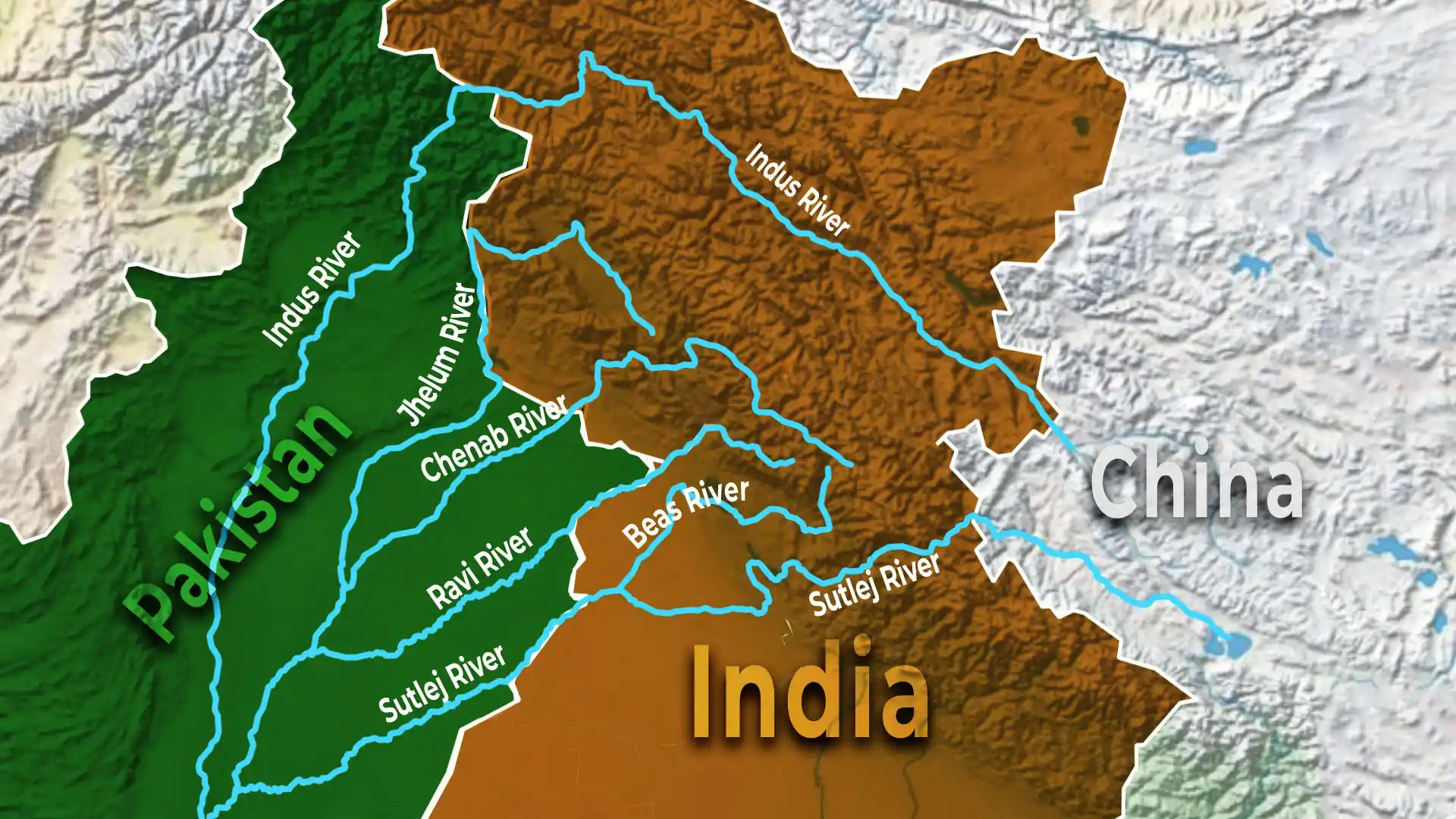
The Jhelum River, known in Sanskrit as Vitasta and to the ancient Greeks as the Hydaspes, is the westernmost tributary of the Indus. It rises from a spring at Verinag in Jammu & Kashmir’s Anantnag district. Flowing north and then west through the scenic Vale of Kashmir, it spreads into Wular Lake – one of South Asia’s largest freshwater lakes – before cutting through the Pir Panjal range into Pakistan’s Punjab province, where it eventually joins the Chenab near Trimmu.
Key facts about the river
- Length: About 725 kilometres from source to confluence with the Chenab.
- Tributaries: Major tributaries include the Kishenganga (Neelum), Kunhar, Pohru and Sindh rivers. These mountain streams swell with snowmelt and feed the main channel.
- Hydrology: The Jhelum depends heavily on winter snow and spring rains in the Pir Panjal and Himalayas. The river’s flow peaks during May–June when snowmelt and the first monsoon showers coincide.
- Uses: In Indian-administered Kashmir, the river supports agriculture and transport. In Pakistan, the Mangla Dam harnesses its waters for irrigation and hydropower generation.
- Ecological and cultural importance: The Jhelum provides habitat for fish and waterfowl and is woven into Kashmiri culture – it features in poetry and folklore and was historically a trade route.
Why are levels falling?
The river’s decline in March 2026 was attributed to three factors: a warmer‑than‑average winter that reduced snowpack; dry weather limiting rainfall; and increased sedimentation reducing channel depth. Such changes highlight the fragility of Himalayan rivers under climate change.
Sources: DTE.

