
Why in news?
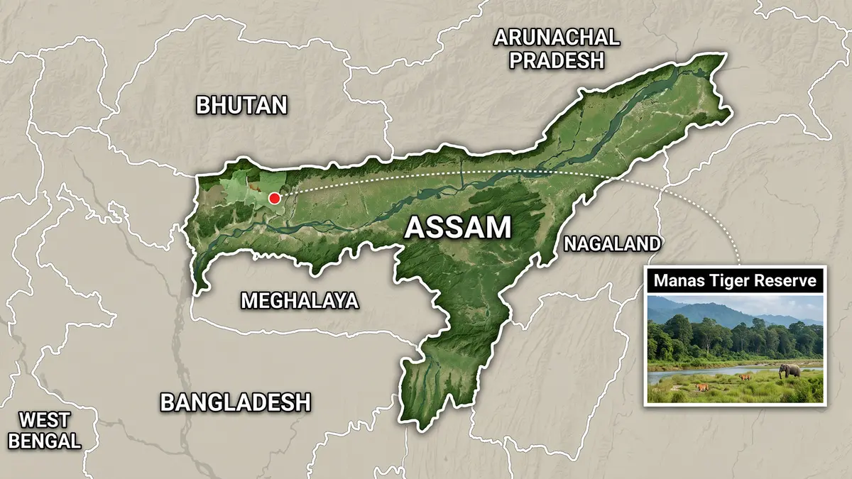
A new assessment examined rapid grassland loss inside Assam’s Manas Tiger Reserve. Between 1990 and 2019, researchers recorded shrinking grasslands and 14 aggressively spreading plants. Encroachment, grazing, fire and past conflict also changed the habitat.
Background
Manas lies along Assam’s Himalayan foothills and the Bhutan border, and it takes its name from the Manas River.
The reserve adjoins Bhutan’s Royal Manas National Park, creating a large transboundary conservation landscape.
The area contains alluvial grasslands, riverine forests and tropical forests, and this habitat variety supports exceptional wildlife diversity.
How did Manas receive protection?
- Manas became one of India’s first nine Project Tiger reserves in 1973.
- The core received national-park status in 1990.
- The United Nations Educational, Scientific and Cultural Organization listed it during 1985.
- Armed unrest placed it on the World Heritage in Danger list during 1992.
- Improved protection allowed its removal from that danger list in 2011.
Manas also forms part of a national biosphere reserve and elephant reserve. BirdLife International recognises it as an Important Bird Area.
Are all its protected boundaries identical?
No. The Manas Tiger Reserve covers 2,837.31 square kilometres, including a notified core of about 526.22 square kilometres.
The official profile lists a 2,310.88-square-kilometre buffer. The World Heritage property covers about 391 square kilometres.
The national park, tiger reserve and World Heritage property therefore overlap. However, they do not share exactly the same boundaries.
Boundary rule: One landscape can carry several conservation labels. Each label comes from a different law, programme or international convention.
How much grassland was lost?
Grassland covered 53.61 per cent of the study area in 1990. Its share fell to 30.24 per cent by 2019.
This is a decline of 23.37 percentage points. Compared with the original area, the relative loss equals 43.59 per cent.
Woodland increased from 40.42 per cent to 60.62 per cent. This change shows grassland conversion into woody vegetation.
Statistics clarification: The grassland did not fall by 43.59 percentage points. It fell by 23.37 points, or 43.59 per cent relatively.
Which plants are changing the habitat?
Researchers identified 14 especially problematic species, and some are alien invasive plants, while others are aggressively expanding woody species.
- Chromolaena odorata forms dense growth and suppresses native grasses.
- Mikania micrantha is a fast-growing climber that smothers other vegetation.
- Lantana camara creates difficult thickets and reduces usable grassland.
- Bombax ceiba and Dillenia pentagyna are expanding native woody species.
Calling every woody plant an alien invasive would be incorrect, and some become problematic because altered management encourages their spread.
What other factors caused grassland decline?
- Armed conflict between 1988 and 2004 weakened regular habitat management.
- Uncontrolled fires damaged desired vegetation and favoured some invasive plants.
- Livestock grazing disturbed native grass and spread plant seeds.
- Loss of large wild herbivores reduced natural grazing and browsing.
- Encroachment affected about 3,709 hectares of core habitat since the 1980s.
Why are grasslands essential?
Grasslands provide food and shelter for pygmy hogs, hispid hares and swamp deer. Wild buffalo and rhinoceroses also depend upon them.
These herbivores support predators, including tigers, and grassland loss can therefore affect the whole food web.
Manas supports Bengal floricans, elephants and greater one-horned rhinoceroses, and several threatened species require a grassland-forest mosaic, not continuous woodland.
What can restoration involve?
- Managers can remove invasive plants before they produce seeds.
- Prescribed fire can maintain grasslands under expert supervision.
- Native grasses should replace cleared invasive growth.
- Grazing and encroachment need consistent community-supported control.
- Satellite monitoring can identify new woodland expansion quickly.
One-time clearing cannot solve the problem, and surviving roots and seeds can rapidly restore invasive plant cover.
Conclusion
Manas needs active grassland management alongside forest protection. Restoring its habitat mosaic will support both rare herbivores and the predators depending upon them.