

Why in news?
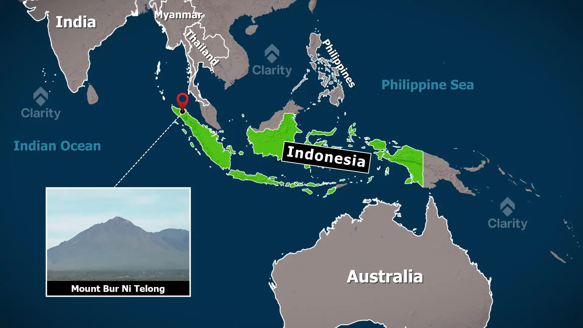
Indonesian disaster authorities raised the alert level of Mount Bur Ni Telong in Aceh to Level III after recording a series of shallow and deep earthquakes around the mountain. Officials warned residents and visitors not to approach within 4 kilometres of the crater because a sudden steam‑driven eruption or toxic gas release is possible. The volcano has been restless since mid‑2025 and heavy rain has already triggered landslides and floods in the surrounding regency.
Background
Bur Ni Telong is an active stratovolcano located in the province of Aceh on the northern tip of Sumatra. It forms the southern part of the Bur Ni Geureudong volcanic complex and rises to about 2,624 m above sea level. The mountain has a classic conical shape built up from successive layers of solidified lava and volcanic ash. Its summit crater has migrated southeast over time, leaving semi‑circular rims and lava flows on the southern flank. Historical records mention explosive eruptions in the nineteenth and twentieth centuries, but the volcano has generally been quiet in recent decades.
Understanding stratovolcanoes
- Construction: Stratovolcanoes (or composite volcanoes) are tall, steep‑sided cones formed by alternating layers of viscous lava flows and fragmented material. The viscous nature of andesitic and dacitic lava allows pressure to build within the volcano.
- Explosive eruptions: Gas trapped in the magma can lead to sudden, violent eruptions that eject ash, pumice and volcanic bombs. These eruptions often produce pyroclastic flows and lahars.
- Hazard zones: Because of their explosive potential, authorities usually establish exclusion zones around stratovolcanoes. At Bur Ni Telong the current danger zone extends four kilometres from the crater.
Current concerns
- Increased seismicity: Dozens of shallow and deep volcanic earthquakes have been detected since July 2025, indicating movement of magma or fluids within the volcano.
- Phreatic eruptions: Officials warn of steam‑driven blasts that can occur when ground water contacts hot rock. Such eruptions often happen without warning and can project ash and rocks into the surrounding area.
- Gas emissions: Hazardous gases such as sulphur dioxide and hydrogen sulphide may accumulate near vents and fumaroles, posing respiratory dangers to anyone nearby.
- Environmental impact: Heavy rainfall in Aceh has already led to floods and landslides on the volcano’s slopes. Further volcanic activity could exacerbate these hazards by destabilising slopes and producing lahars.
Conclusion
The raised alert at Mount Bur Ni Telong reminds us that even long‑quiet volcanoes can reawaken. By respecting exclusion zones, monitoring seismic activity and preparing for sudden eruptions, communities living around the mountain can reduce risks. Scientists will continue to analyse seismic data and gas emissions to anticipate any escalation in activity.
Source: ABC News