Why in news?
Researchers studying Africa’s Zambezi River have discovered that the river’s true length is about 11 percent greater than previously recorded. By tracing the headwaters in Angola, the team found that the river extends 3,421 kilometres instead of the earlier estimate of 3,079 kilometres. The revised figure highlights the importance of remote wetlands in southern Angola and has implications for water management in Southern Africa.
Background
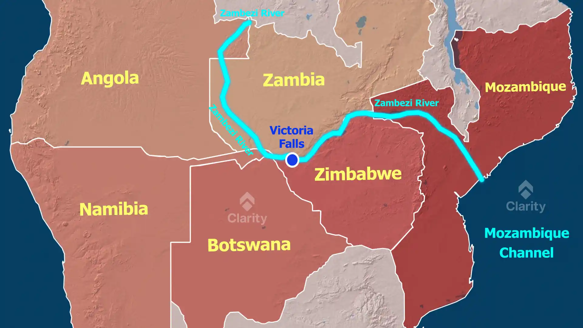
The Zambezi is Africa’s fourth‑longest river and one of its most spectacular. Rising in western Africa and flowing eastwards, it passes through Angola, Namibia, Botswana, Zambia, Zimbabwe and Mozambique before emptying into the Indian Ocean. Along its course it creates the world‑famous Victoria Falls and supplies water to massive hydroelectric schemes such as the Kariba and Cahora Bassa dams. Millions of people rely on the river and its floodplains for agriculture, fishing and transport.
Findings of the new study
- True source in Angola: By analysing satellite imagery and conducting field surveys, scientists concluded that the river’s main source is the Lungwebungu River – a peatland stream in Angola’s southern highlands. Earlier maps had marked the Zambezi’s source farther east.
- Extra length: Measuring from the Lungwebungu headwaters to the mouth on the Indian Ocean adds roughly 342 kilometres to the river’s known length, making it 3,421 kilometres long.
- Cross‑border significance: Nearly two‑fifths of the Zambezi’s flow originates in Angola. Recognising this contributes to a better understanding of water sharing and the need for Angola to participate in basin‑wide governance.
Implications
- Basin management: An accurate understanding of the river’s headwaters helps countries coordinate dam construction, irrigation and flood control. It also underlines the importance of protecting upstream wetlands that sustain flows downstream.
- Conservation: The Lungwebungu wetlands are rich in biodiversity and act as natural water filters. Their protection is vital for the health of the entire Zambezi basin.
- International cooperation: The Zambezi Watercourse Commission (ZAMCOM) brings together eight riparian countries. The new findings may strengthen Angola’s role in regional discussions on water allocation and climate‑resilient development.
Source: MBY