

Why in news?
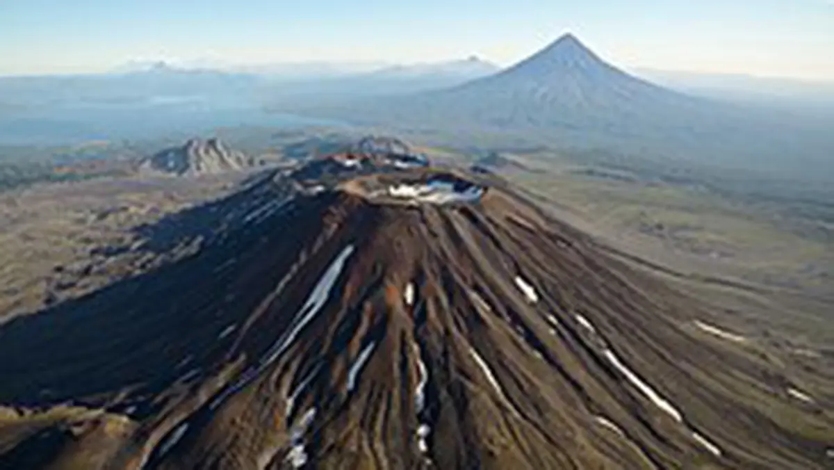
The National Aeronautics and Space Administration (NASA) released new satellite observations of Russia's Krasheninnikov volcano on 24 September. They show lava spreading within the Kamchatka volcanic complex. The observations come from the joint NASA–Indian Space Research Organisation Synthetic Aperture Radar mission, called NISAR. Its radar images follow changes between 25 December 2025 and 17 August 2026, including lava filling a crater and spreading outward. The volcano's renewed eruption began in August 2025 after centuries without a known eruption; September's development is the new account of its progress. Radar can observe surface changes despite cloud cover and darkness, providing a sustained view of a remote and active landscape.
Where the volcano sits
Kamchatka is a peninsula in Russia's Far East, with the Sea of Okhotsk to its west. The Bering Sea lies to the north-east and the Pacific Ocean to the south-east. Its volcanic belt forms part of the wider tectonically active margin around the Pacific. Krasheninnikov lies within that landscape, where volcanic structures, snow and remote terrain can make repeated ground observation difficult. Satellite coverage helps connect changes observed at different times.
The Kuril-Kamchatka arc marks a zone where the Pacific plate descends beneath the Okhotsk microplate. This process is called subduction. It contributes to the region's earthquakes and volcanic activity, although those hazards involve different immediate processes. An earthquake reflects movement and rupture in the crust, while an eruption involves magma reaching the surface. Their shared tectonic setting does not make every earthquake the proven cause of a nearby eruption.
A complex volcano rather than one simple cone
The Smithsonian's Global Volcanism Program describes Krasheninnikov as two overlapping stratovolcanoes inside a larger caldera. A stratovolcano grows through successive deposits of lava and erupted material. A caldera is a much larger volcanic depression, distinct from an individual vent or summit crater. This nested structure helps explain the satellite sequence: lava can fill a smaller depression before spreading across another part of the volcanic complex.
The documented earlier activity is dated approximately to 1350–1550, rather than to one precisely observed historical eruption day. Renewed activity began in August 2025. Describing the interval as “about five centuries” conveys its scale, but an exact 500-year clock would imply more certainty than the geological record provides. Long quiet periods also do not establish that a volcano is permanently extinct.
The earthquake and eruption timeline
A magnitude-8.8 earthquake struck off Kamchatka on 30 July 2025. The eruption began a few days later. NASA's account discusses the possibility of a connection, but timing alone cannot demonstrate the physical trigger. The important established sequence is the large earthquake followed by renewed volcanic activity. Any stronger causal explanation needs evidence about how the earthquake affected the volcanic system.
The new satellite sequence begins later, in December 2025. It therefore does not show the first moment of the eruption. NASA assembled 17 frames through August 2026 to display subsequent changes. Some lava visible in the wider scene may predate the first frame. Distinguishing the start of the eruption from the start of imaging prevents a time-lapse from being read as a complete record of every event.
How radar sees a changing surface
Unlike an ordinary camera that depends on reflected sunlight, radar sends a signal and measures the return from the surface. This allows observations during darkness and through clouds. The strength and character of the return depend on features such as surface roughness and geometry. Fresh lava can alter those properties, making changes visible across repeated images.
The displayed radar brightness is not a direct temperature map or the natural colour of glowing lava. NASA describes pixels representing areas about 10 metres across in this sequence. That spatial scale is different from the precision with which other radar analyses can measure movement. Readers should not assume that every feature smaller than a pixel is separately resolved, or that every bright area is hotter.
NISAR's orbit provides repeat observations that allow the same landscape to be compared over time. For this location, the mission describes views on ascending and descending passes within its 12-day cycle. Consistent comparison is central to the result: a single image shows a surface, while a sequence can reveal where it has changed. The interpretation still requires knowledge of the terrain and the radar's viewing conditions.
What the sequence reveals
The images show material accumulating within the inner crater before spreading more widely. NASA describes lava extending eastwards in a fan-like pattern, alongside other flows in the scene. This makes the development easier to understand as a changing landform rather than a single dramatic eruption image. Repeated coverage helps establish where new material appears and how it relates to the surrounding volcanic structure.
The mission combines two radar wavelengths, known as L-band and S-band. NASA supplies the L-band instrument and major radar hardware, while the Indian Space Research Organisation provides the spacecraft and S-band radar. Different wavelengths interact differently with vegetation and surface features. Their combination supports a wider range of land observations, including changes associated with natural hazards.
Observation is not prediction
Mapping lava movement can improve understanding of an eruption's development and the areas it affects. It does not provide an exact forecast of the next eruption or replace local hazard monitoring. Radar observations are one source of evidence alongside seismic measurements, ground observations and other satellite data. Combining them can strengthen interpretation, particularly where weather or access limits direct inspection.
Conclusion
Krasheninnikov's September news is a demonstration of sustained observation after an eruption that began in 2025. NISAR shows how radar can follow changes across a remote volcanic complex when ordinary views are limited. The sequence adds evidence about lava movement and surface evolution. Its value lies in that measured record, without turning it into an unsupported claim of eruption prediction or a newly proven earthquake trigger.