

Why in news?
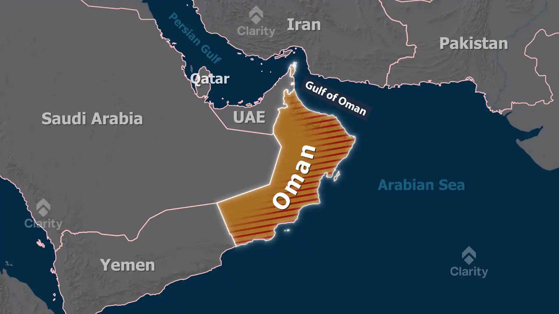
Rising tensions in the Strait of Hormuz have disrupted shipping routes through the Persian Gulf. To keep supplies flowing, Indian exporters and Gulf Cooperation Council (GCC) countries have increasingly used Oman’s ports—particularly Sohar and Salalah—which lie outside the strait on the Arabian Sea. Equipped with terminals for bulk agricultural products and advanced wave‑dampening systems, these ports have enabled the movement of grains and food products from India to Gulf markets during recent crises.
Background
The Sultanate of Oman is the third‑largest country on the Arabian Peninsula, covering about 309,500 square kilometres. It occupies the south‑eastern corner of the peninsula, facing the Arabian Sea, Gulf of Oman and Persian Gulf. Oman shares land borders with Saudi Arabia, the United Arab Emirates and Yemen and has a coastline of about 2,092 kilometres. Its interior is dominated by the Rub’ al Khali desert, while the northern and southern regions are fringed by the rugged Al Hajar mountains. The highest peak, Jabal Shams, rises to around 2,980 metres. The capital Muscat sits on the northern coast, whereas the port city of Salalah lies in the monsoon‑affected Dhofar region. Oman’s natural resources include petroleum, copper, asbestos, marble, limestone, chromium, gypsum and natural gas.
Sohar and Salalah ports
- Sohar: Located outside the Strait of Hormuz, Sohar Port is a 21‑million‑square‑metre deep‑sea hub with clusters specialising in logistics, petrochemicals and metals. In recent years it added a food cluster with Oman’s first terminal dedicated to handling bulk agricultural products. The port’s position allows access to major markets in the GCC, India and East Africa within about two weeks of sailing.
- Salalah: Situated in Oman’s southern Dhofar province, the Port of Salalah handles more than 2,500 vessel calls each year. An advanced wave‑dampening system reduces ship movement in port and allows high‑speed container unloading. Salalah’s location along the Arabian Sea makes it a major trans‑shipment hub linking the Middle East, Asia and Africa.
Geographical features of Oman
- Climate: The country has a dry desert climate, becoming humid along the coast. Southern Dhofar receives a south‑west monsoon between May and September, turning the landscape green.
- Terrain: A central gravel desert plain is flanked by the Al Hajar Mountains in the north and smaller ranges in the south. The fertile Batinah coastal plain supports date palms and agriculture.
- Natural resources: Oman’s economy is based on oil and natural gas but also benefits from minerals such as copper, chromium and marble. The ports at Sohar, Duqm and Salalah form part of a strategy to diversify the economy through logistics and manufacturing.
FAQs
- Which mountain range runs through northern Oman? The Al Hajar Mountains span the country’s north, with Jabal Shams as the highest peak.
- What is the bilateral naval exercise between India and Oman called? The two navies conduct the exercise Naseem Al Bahr (Sea Breeze).
- Why are Oman’s ports important for India? They offer alternative routes for food exports to the Gulf that bypass the crowded and vulnerable Strait of Hormuz.