
Why in news?
A new report examined the dispute surrounding Pallikaranai Marsh. Rapid southern Chennai development now conflicts with wetland protection. Courts and authorities are considering building restrictions nearby. Scientific boundary mapping remains central to the dispute.
Background
Pallikaranai is one of Chennai’s last remaining natural wetlands; it lies in southern Chennai near the city’s technology corridor.
Local Tamil usage calls such a waterlogged floodplain a “kazhuveli.”
The marsh receives both fresh rainwater and some tidal influence; it therefore contains freshwater, brackish and partly estuarine conditions.
Brackish water is saltier than freshwater but less salty than seawater.
Headline clarity: “Quicksand” described a difficult policy conflict; the report did not announce literal quicksand across the marsh.
How did the landscape develop?
Sediment evidence indicates that the marsh is at least 1,000 years old.
Southern Chennai historically contained a broad coastal floodplain.
The wider wetland, grassland and forest mosaic covered roughly 50 square kilometres.
Smaller lakes and ponds drained towards the low-lying marsh.
Farming communities used surrounding wetlands for irrigation; later urban growth replaced many channels, fields and water-storage areas.
The state wetland authority estimates that about 90 per cent was lost.
The remaining protected landscape represents roughly one-tenth of the historical system.
How does the marsh drain southern Chennai?
Pallikaranai drains a catchment of about 250 square kilometres; the catchment contains a network of 65 wetlands.
Rainwater reaches the marsh from surrounding neighbourhoods and satellite waterbodies; water leaves mainly through Okkiyam Madavu and Kovalam Creek.
It finally reaches the Bay of Bengal; Buckingham Canal and Old Mahabalipuram Road flank its eastern side.
The marsh’s low topography allows it to retain water after storms.
Prelims route: Sixty-five wetlands drain through Pallikaranai, Okkiyam Madavu and Kovalam Creek towards the Bay.
Why is it a natural flood buffer?
- Heavy rain flows from roads, buildings and upstream lakes.
- The broad, shallow marsh temporarily stores this excess water.
- Vegetation slows the flow and reduces a sudden downstream surge.
- Water then drains gradually through the natural outlets.
Filling a marsh removes this temporary storage; narrowed outlets can then make neighbourhood flooding deeper or longer.
A wetland therefore functions as urban infrastructure without concrete walls.
Which area figure should students remember?
Several valid figures describe the marsh’s different geographical and administrative units.
| Figure | What it describes |
|---|---|
| About 50 square kilometres | Historical southern Chennai floodplain mosaic |
| About 694 hectares | Area controlled by the Forest Department in the official state account |
| 1,247.537 hectares | Internationally listed Ramsar site |
| 250 square kilometres | Wider drainage catchment feeding the marsh |
Do not mix these figures: Catchment area, historical floodplain, forest land and Ramsar boundary describe different things.
What is its Ramsar status?
Pallikaranai Marsh Reserve Forest is a Wetland of International Importance; its Ramsar designation date is 8 April 2022.
India publicly announced the addition during July 2022; the site carries Ramsar number 2481.
Its listed area is precisely 1,247.537 hectares; the Ramsar Convention was adopted at Ramsar, Iran, during 1971.
It promotes wetland conservation and wise use; wise use means maintaining ecological character through sustainable management.
Legal effect: Ramsar status gives international recognition; it does not automatically settle every land boundary or ownership dispute.
What biodiversity does the marsh support?
Official state records list 625 plant and animal species; they include 176 recorded bird species.
Bird diversity reflects the condition of fish, insects, plants and water.
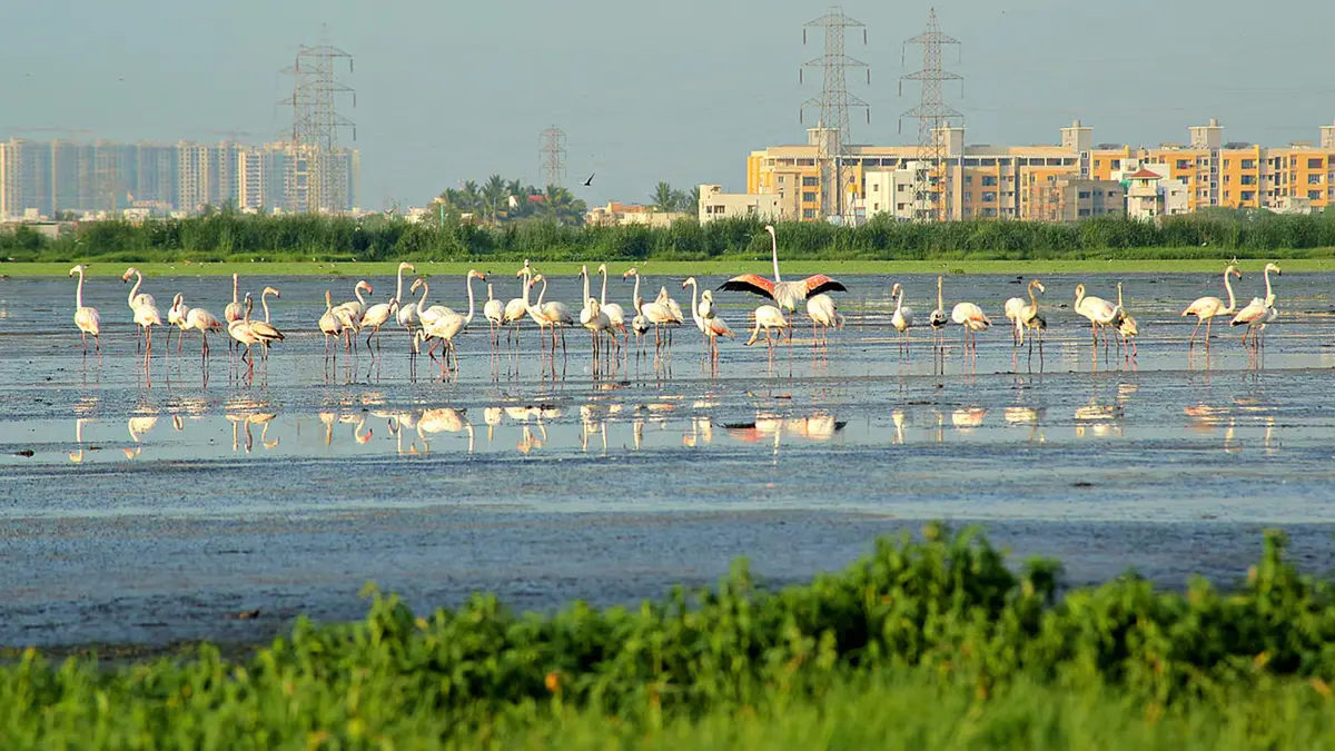
Glossy ibis and pheasant-tailed jacana are among recorded wetland birds.
The marsh also supports reptiles, amphibians, fish and small mammals; russell’s viper is among its notable reptiles.
Seasonal mudflats provide feeding places for waterbirds; mixed salinity produces several ecological niches within one landscape.
How did urban pressure increase?
- Chennai expanded southward during the late twentieth century.
- The technology corridor accelerated offices, roads and housing development.
- Construction spread around the wetland and its smaller feeder lakes.
- Landfill operations placed a major waste burden near the marsh.
- Drains brought sewage and polluted stormwater into the remaining water.
- Fragmentation weakened natural links between wetlands and outlets.
The Perungudi waste complex lies beside the marsh; dumping can create leachate, plastic pollution, smoke and altered drainage.
Leachate is polluted liquid draining through a waste pile.
What other threats remain?
- Encroachment reduces the wetland’s natural water spread and flood-storage capacity.
- Untreated sewage changes oxygen and nutrient levels within wetland water.
- Roads and embankments can block natural water movement between wetland sections.
- Invasive water hyacinth can cover open water rapidly.
- Construction may damage satellite wetlands outside visible marsh water.
- Climate-driven extreme rainfall can exceed already reduced storage.
A wetland can remain damaged even when its central water patch survives.
Its inlets, outlets and surrounding influence zone also need protection.
What is the present building-permission dispute?
The National Green Tribunal examined development around Pallikaranai during 2025.
It paused new approvals within a one-kilometre zone during scientific study.
Chennai’s planning authority implemented that direction through an October 2025 circular.
Residents and developers challenged the broad freeze before the Madras High Court.
They said it affected established layouts and private title lands; conservation groups argued that nearby development could damage marsh hydrology.
During July 2026, the state Wetland Authority clarified its scientific position.
It said one kilometre should not become an automatic permanent buffer.
The final zone must follow terrain, drainage, water flow and adjoining land use.
Therefore, the dispute concerns both ecological protection and precise legal mapping.
What is a zone of influence?
A wetland’s zone of influence extends beyond standing water; activities there can change water quantity, quality or ecological character.
The zone may include feeder channels, flood paths and satellite wetlands; its width need not remain equal in every direction.
Scientific mapping should therefore use ground surveys and elevation data; ground-truthing means checking mapped information through actual site visits.
Which law guides wetland management?
The Wetlands Rules, 2017 operate under the Environment Protection Act, 1986.
They require states and Union Territories to identify and manage covered wetlands.
State Wetland Authorities prepare documents, recommend notification and coordinate action; rules restrict reclamation, solid-waste dumping and untreated waste discharge.
Domestic notification adds mapped boundaries and site-specific regulation.
What should restoration prioritise?
- Authorities should publish clear and scientifically verified boundaries for every protected unit.
- Feeder lakes and outlets must remain hydrologically connected.
- Sewage should receive treatment before entering the wetland.
- Legacy waste needs safe remediation without further contamination.
- Invasive plant species require repeated removal and long-term ecological management.
- Urban plans should preserve flood-storage and drainage routes.
- Residents need transparent maps and predictable development rules.
Protection and clarity support each other; unclear boundaries can harm both conservation and lawful landowners.
Conclusion
Pallikaranai’s survival depends upon protecting its water system while resolving boundaries through transparent science.