

Why in news?
Sonai Rupai received renewed attention through an official account of tiger recovery. The National Tiger Conservation Authority documented its recent conservation trajectory. The account links returning tiger signs with habitat protection and the sanctuary’s role beside Nameri Tiger Reserve.
Location and legal identity
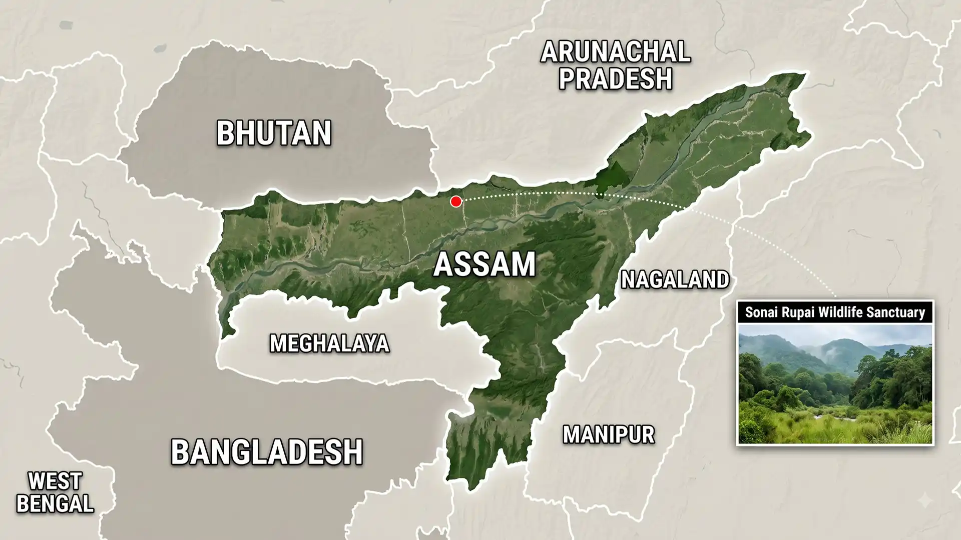
Sonai Rupai Wildlife Sanctuary lies in Assam’s Sonitpur district; it occupies the Himalayan foothills north of the Brahmaputra valley. Official Assam and national wildlife records give its notified area as about 220 square kilometres. The sanctuary was notified in 1998.
Its forests, grasslands and river systems form part of the bhabar-terai transition. This ecological gradient supports both woodland and grassland species.
Several perennial rivers cross or mark the sanctuary. Their channels shape habitat, movement and seasonal disturbance.
Different conservation databases sometimes show a larger site area. A Key Biodiversity Area boundary does not equal the legal sanctuary boundary.
A difficult conservation history
The landscape once supported rhinoceros, wild buffalo, tigers and the Bengal florican. Severe pressure emerged during the late 1990s and early 2000s. The official recovery account describes encroachment, forest loss and local disappearance of major mammals. Law enforcement and protection capacity had weakened.
Tiger signs reappeared during surveys in 2013–14. This did not mean that the entire ecosystem had recovered.
In 2015, roughly 120 square kilometres became a satellite core of Nameri Tiger Reserve. That decision strengthened its landscape-level protection role.
Satellite core status connects management with a larger tiger-conservation framework; the sanctuary retains its separate wildlife-sanctuary identity.
Why connectivity matters
Tigers need large, connected habitats with adequate prey and low human disturbance. A single protected patch may not sustain them over time. Sonai Rupai connects with forested foothills toward Arunachal Pradesh; the wider landscape includes Nameri, Doimara and the Eaglenest region.
Such connections also matter for elephants and gaur. Roads, settlements and fragmented forests can obstruct their seasonal movement.
Riverine grasslands add further ecological value; they support prey species and threatened birds, including grassland specialists.
Recovery needs more than tiger sightings
A tiger photograph is encouraging, but it is only one indicator. Managers must also track prey, breeding, habitat quality and conflict. Effective protection requires stable field staff, intelligence and community trust. Boundary enforcement alone cannot solve livelihood pressures around the sanctuary.
Restoration should protect native grassland mosaics rather than convert every opening into plantation. Fire management must follow local ecological conditions.
Human-wildlife conflict needs fast compensation and credible response teams. Delayed assistance can turn neighbouring communities against conservation measures.
Monitoring also needs transparent methods. Camera-trap detections should not be confused with a complete population estimate.
Reading the evidence correctly
The National Tiger Conservation Authority account presents an important recovery narrative; it does not declare every historical pressure resolved. Long-term success depends on secure habitat and movement across the wider Assam-Arunachal landscape.
Conclusion
Sonai Rupai shows that damaged habitats can regain ecological function when protection improves; its returning tigers are a promising signal. The next test is durable coexistence and connectivity. Recovery must extend beyond one species and survive changing administrative attention.