Why in news?
The Bhakra Beas Management Board (BBMB) plans to sign a memorandum of understanding with the Geological Survey of India for a comprehensive study of hillocks surrounding the Bhakra Dam. Frequent landslides during monsoon seasons have prompted authorities to undertake this preventive assessment.
Background
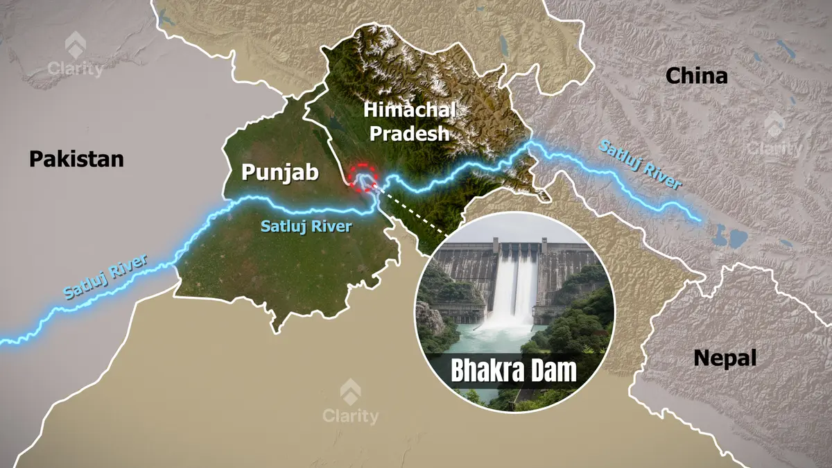
Bhakra Dam is a concrete gravity dam on the Sutlej River near the village of Bhakra in Himachal Pradesh. Standing about 225.5 metres high, it is one of India’s tallest dams and forms the Gobind Sagar reservoir. Completed in 1963, it supplies water for irrigation, generates hydroelectricity and controls floods. Together with the downstream Nangal dam, it is often referred to as the Bhakra–Nangal project, hailed by Jawaharlal Nehru as a “temple of modern India.”
Need for the study
- Landslides: Heavy rainfall and weathering have caused landslides in the hills around the reservoir, raising concerns about slope stability. Although the dam itself remains structurally sound, nearby slides could threaten access roads and ancillary infrastructure.
- Geological assessment: The proposed study will analyse rock strength, slope angles, fault lines and drainage patterns. Modern techniques like laser scanning and geophysical surveys will help map potential hazards.
- Preventive measures: Findings will guide slope‑stabilisation work using retaining walls, rock anchors and afforestation. The aim is to mitigate risks before they pose a danger to the dam or surrounding settlements.
Significance
- Infrastructure safety: Bhakra Dam is critical for irrigation and power supply in northern India. Ensuring the stability of the surrounding terrain is vital for its long‑term operation.
- Environmental management: Understanding geological processes helps in planning disaster‑resilient infrastructure in other mountainous regions as well.
- Proactive approach: Conducting a study before any catastrophic event demonstrates responsible stewardship of an ageing but essential asset.
Conclusion
The planned geological survey around Bhakra Dam is a prudent step to safeguard one of India’s key water and power structures. By identifying and addressing vulnerabilities early, authorities can ensure the dam continues to serve millions while preserving safety and environmental integrity.
Sources: The New Indian Express, Rupnagar District Administration