Why in news?
In May 2026 the Bhakra Beas Management Board (BBMB) detected that the main wall of the 63‑year‑old Bhakra Dam on the Sutlej river was deflecting outward by about 1.77 inches – exceeding the permissible limit of 1.03 inches. To assess the situation, BBMB commissioned an emergency structural study led by the Indian Institute of Technology Roorkee, with assistance from foreign consultants. Officials emphasised that there is no immediate danger but that preventive action is necessary.
Background
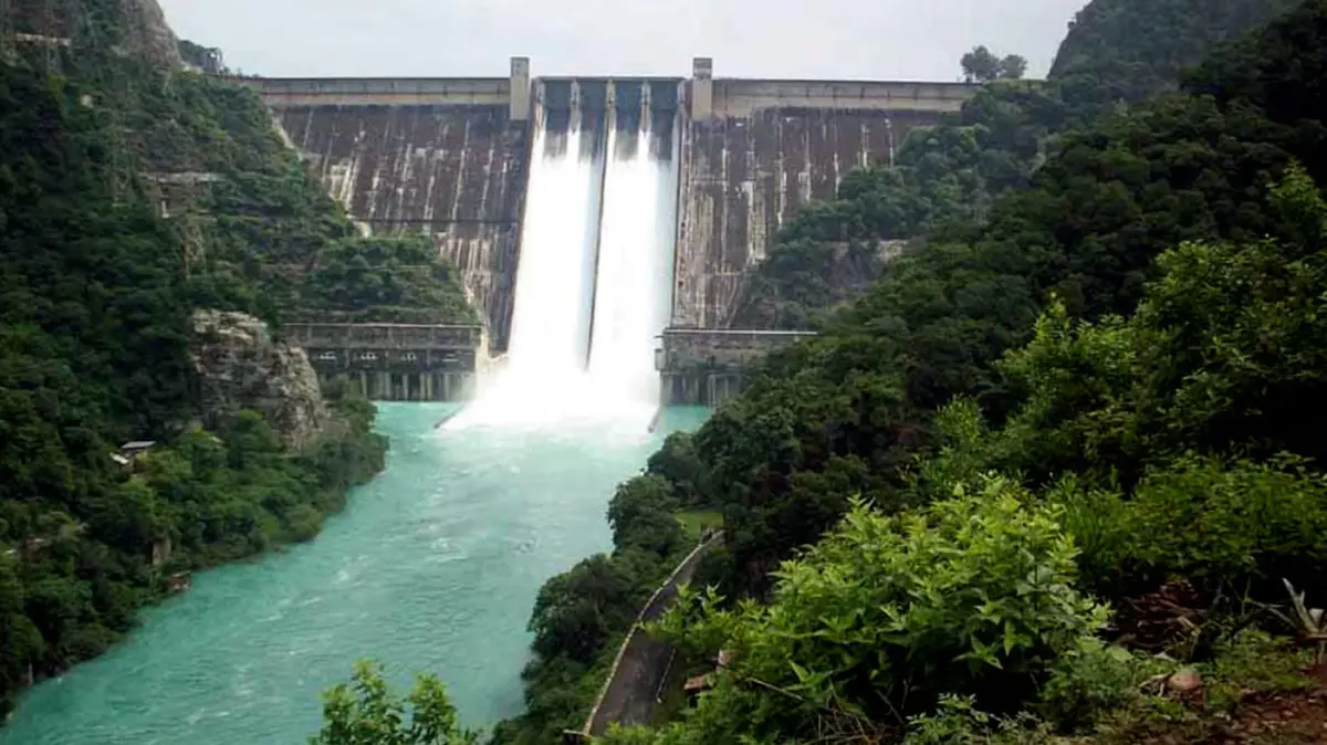
Bhakra Dam is a concrete gravity dam located on the Sutlej river at the Punjab–Himachal Pradesh border near the village of Bhakra. Built between 1948 and 1963 under the direction of American engineer Harvey Slocum, it stands 225.55 metres high and is 518 metres long, making it one of the tallest gravity dams in Asia. Its reservoir, Gobind Sagar, stores up to 9.34 billion cubic metres of water across an area of 168 square kilometres. The dam is jointly operated by Punjab, Haryana and Rajasthan and is often referred to as Bhakra–Nangal because a smaller barrage downstream diverts water into canals.
Importance and issues
- Agricultural lifeline: The dam feeds the Bhakra–Beas– Indira Gandhi Canal system, irrigating about 10 million hectares of farmland across Punjab, Haryana and Rajasthan. Its powerhouses generate around 1,325 megawatts of electricity.
- Reason for tilt: Continuous high water levels and heavy siltation in Gobind Sagar have exerted constant pressure on the dam wall. Water levels have not dropped to the minimum draw‑down level of 1,472 feet for over a decade, reducing the structure’s elasticity and causing outward deflection.
- Silt build‑up: The reservoir has lost more than 25 % of its original storage capacity because of sedimentation; mounds of silt up to 1,535 feet high lie just 10 km upstream. Clearing this silt will require new dredging techniques or sediment bypass tunnels.
- Proposed measures: Experts have suggested lowering the reservoir to its minimum level before the monsoon, injecting grout into the dam’s foundation to stabilise weak zones, increasing drainage through relief wells, and adopting innovative sediment removal techniques. Real‑time monitoring with additional tilt‑meters and stress gauges is also recommended.
- Safety assurances: BBMB officials and independent engineers say the structure remains sound for now and that early intervention will prevent any crisis. Nonetheless, downstream districts in Punjab and Haryana have asked for transparent updates and emergency preparedness plans.
Conclusion
Bhakra Dam is both an engineering icon and a vital lifeline for northern India. The recent tilt underscores the need for regular maintenance and sediment management in ageing infrastructure. Timely repairs and modern monitoring will ensure that Bhakra continues to supply water and power safely for decades to come.