Why in news?
India rejected reports alleging deliberate flooding through increased Chenab River flows. The Government attributed the rise to intense monsoon rainfall during 20–23 July 2026. Rain fell across Jammu and adjoining upper catchments. Pakistan’s own flood advisory had also linked high flows with heavy rainfall.
Background
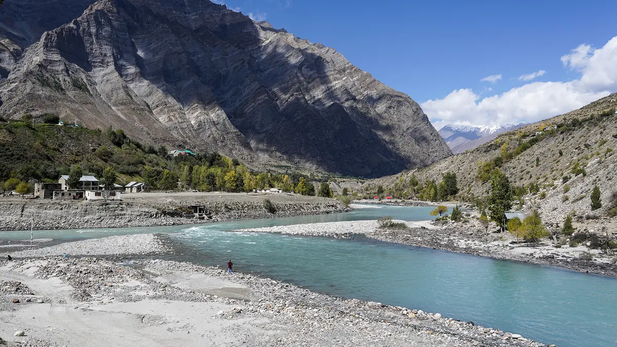
The Chenab is an important western Himalayan tributary within the wider Indus River system.
Its upper course is called the Chandrabhaga, joining the names of its Chandra and Bhaga headstreams.
These streams rise near Baralacha La and meet at Tandi in Himachal Pradesh’s high Lahaul region.
Journey from the Himalayas to the Indus
- The Chandra and Bhaga headstreams begin near Baralacha La.
- They meet at Tandi within Himachal Pradesh.
- The combined river crosses Lahaul and the remote Pangi valley.
- It enters the Union Territory of Jammu and Kashmir near Paddar.
- It flows through Kishtwar, Doda, Ramban, Reasi and Akhnoor regions.
- The river then enters Pakistan near the Jammu plains.
- The Jhelum joins the Chenab near Trimmu in Pakistani Punjab.
- The Chenab later joins the Sutlej and forms the Panjnad.
- The Panjnad finally enters the Indus near Mithankot.
Important tributaries in India
- The Marusudar is the largest important tributary in the Indian section.
- The Miyar Nallah joins from the right within Himachal Pradesh.
- The Tawi joins the Chenab after flowing through Jammu.
- Smaller tributaries include Niru, Kalnai, Ans and Bichleri.
The 410-kilometre Indian course from Tandi to Akhnoor creates deep gorges and considerable hydropower potential.
Major hydropower projects
| Project | Location or river connection | Broad status |
|---|---|---|
| Salal | It is on the Chenab in Reasi district. | It is an operating project. |
| Baglihar | It is on the Chenab in Ramban district. | It is an operating project. |
| Dul Hasti | It is on the Chenab in Kishtwar district. | It is an operating project. |
| Ratle | It is on the Chenab near Drabshalla. | It was under construction during 2026. |
| Kiru and Kwar | Both use the Chenab within Kishtwar district. | Both were under development during 2026. |
| Pakal Dul | It lies on the Marusudar, a Chenab tributary. | It was under development during 2026. |
How can heavy rain rapidly raise Chenab flows?
A catchment is the complete land area whose rainfall drains towards one connected river system.
Rain across numerous upper slopes enters mountain streams and larger tributaries at different speeds.
Already saturated ground absorbs less additional water, thereby increasing rapid surface runoff into river channels.
Steep Himalayan valleys can deliver this runoff to the main river quickly.
The resulting flood wave then travels downstream through Indian territory and several monitoring points within Pakistan.
Therefore, rainfall conditions over the entire upper catchment matter much more than one isolated local shower.
What happened during July 2026?
Intense rain affected Jammu and adjoining catchments between 20 and 23 July.
The increased river flow then moved downstream towards Marala and other important Pakistani monitoring stations.
Pakistan’s Flood Forecasting Division linked high flows with upper-catchment rainfall.
India cited that advisory while rejecting allegations of deliberate flooding.
Indus Waters Treaty background
India and Pakistan signed the 1960 Indus Waters Treaty after World Bank-supported negotiations.
The treaty broadly divides six major rivers of the Indus system into eastern and western groups.
| Group | Rivers | Broad allocation |
|---|---|---|
| Eastern rivers | Ravi, Beas and Sutlej | India receives unrestricted use, subject to transition provisions. |
| Western rivers | Indus, Jhelum and Chenab | Pakistan receives unrestricted use, subject to specified Indian uses. |
The treaty permits India certain domestic, agricultural and non-consumptive uses upon the three designated western rivers.
It also permits run-of-river hydropower under detailed design conditions.
A bilateral Permanent Indus Commission normally supports technical cooperation, regular meetings and continuing information exchange.
What is the current treaty position?
India placed the treaty in abeyance after the April 2025 Pahalgam attack and maintained that position during July 2026.
This current political status must be distinguished from the treaty’s original allocation rules.
Conclusion
The Chenab connects Himalayan hydrology with international relations, making transparent data vital during every flood season.