

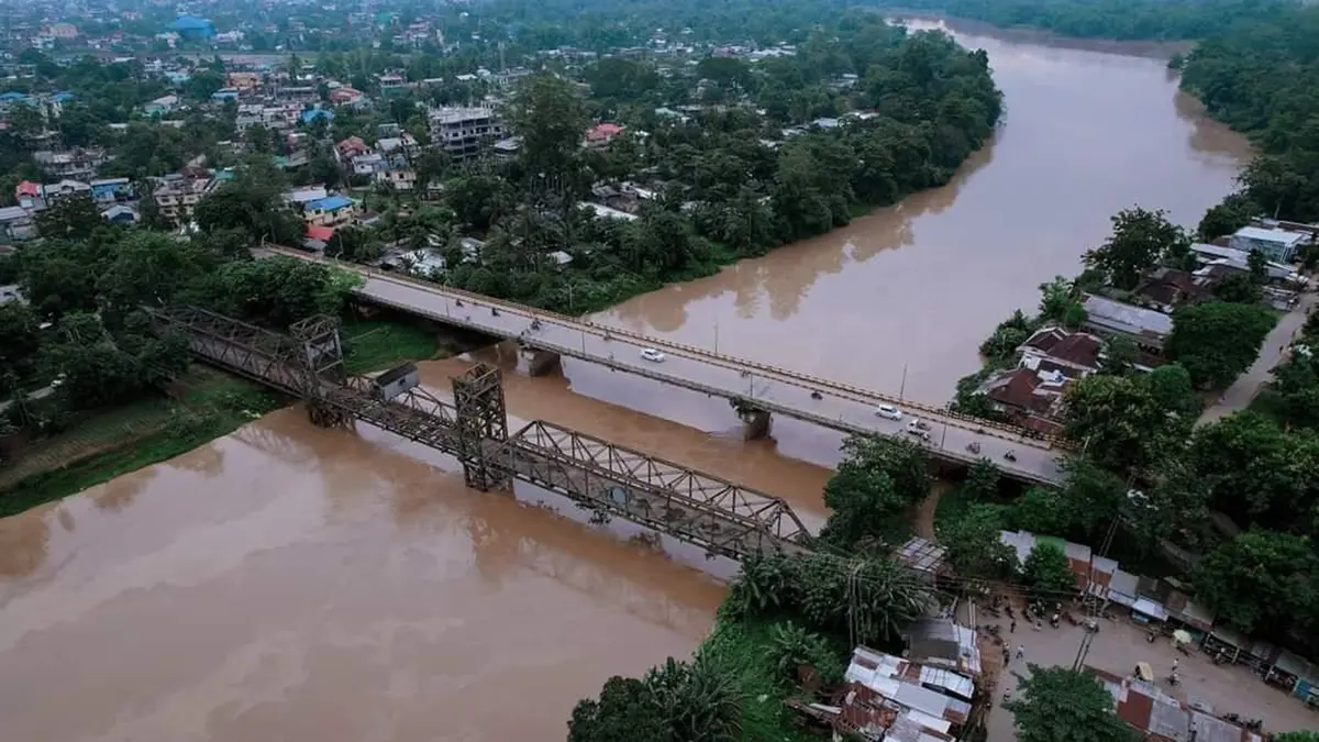
Why in news?
The swollen Dikhow River devastated Nepali Khuti village in Assam. Floodwater reportedly overwhelmed homes within about one hour. Around two hundred Gorkha families faced severe displacement and livelihood losses. The disaster formed part of wider monsoon flooding across Assam.
Background
Called Dikhu in Nagaland and Dikhow in Assam, the river rises in the hills before reaching the Assam plains. It then passes through the wider Sivasagar landscape.
Near Naginimora, the channel leaves steep hills and enters a gentler floodplain before passing Simaluguri and Sivasagar. At Dikhowmukh, it joins the southern side of the Brahmaputra.
Its position makes it a south-bank tributary, also described as a left-bank tributary when viewed downstream. Both formulations concern the same direction of entry.
Published river lengths vary considerably because sources choose different starting points and channel measurements. Figures around 160 kilometres and 236 kilometres both circulate. A precise single length should therefore identify its mapping source.
The Nepali Khuti disaster
Nepali Khuti was a largely Gorkha dairy-farming settlement in Sivasagar district. Rapid flooding swept through homes, cattle shelters and access roads, leaving little time for evacuation.
Reports said around two hundred families were affected, describing the village as disappearing within one hour. This language reflects destruction, not a surveyed finding that every structure vanished.
Clean drinking water and animal care became immediate needs after displacement. Dairy households lose income quickly when cattle die, fall ill or cannot reach fodder. Rehabilitation must therefore address livelihoods alongside housing.
Why flooding can develop rapidly
Steep Nagaland catchments can deliver rainfall runoff quickly into the river. Once the channel enters Assam's flatter land, water slows and spreads across the floodplain. High Brahmaputra levels may also obstruct drainage near the confluence.
Monsoon rivers carry large sediment loads and frequently reshape their channels. Meanders may cut across bends, leaving oxbow lakes and abandoned channels. Settlements near old courses can remain exposed even when far from the present bank.
Embankment damage, local drainage obstruction and saturated soil can intensify impacts. The exact sequence at Nepali Khuti requires hydrological and engineering investigation. General river behaviour should not substitute for a site-specific cause.
Floodplain management and recovery
Floodplains store excess water and sustain agriculture, fisheries and wetlands, while completely confining a monsoon river is rarely possible. Planning must instead reduce dangerous exposure while preserving room for water.
Early warnings need rainfall forecasts, upstream gauges and local communication linked to known routes and shelters. Livestock evacuation plans are essential in dairy-dependent settlements.
Post-flood surveys should map erosion, channel change and damaged embankments. Reconstruction in the same high-risk strip may recreate the disaster. Relocation decisions require consent, land rights and access to schools and markets.
Relief data should count tenants, migrant workers and people lacking formal documents. Compensation systems often focus upon titled houses and overlook shared livestock. Transparent village lists can reduce exclusion.
Interstate catchment coordination
The river connects Nagaland's uplands with Assam's floodplain. Rainfall, land use and river works upstream can affect communities downstream. Data sharing between both states can improve warning time and catchment management.
Long-term planning should track forest change, road drainage and sediment movement. It must also preserve wetlands that temporarily store floodwater. Engineering, ecological restoration and community knowledge work best together.
Conclusion
Nepali Khuti demonstrates how quickly a hill-fed tributary can devastate a floodplain community. Recovery should combine livelihood support, risk mapping and interstate warning systems.