Why in news?
France is in the spotlight because of renewed discussions on India’s Jaitapur nuclear project and France’s role in supplying reactors. Understanding the country’s geography and resources helps explain its energy expertise and global influence. France also holds many unique geographic features relevant for world geography questions.
Background
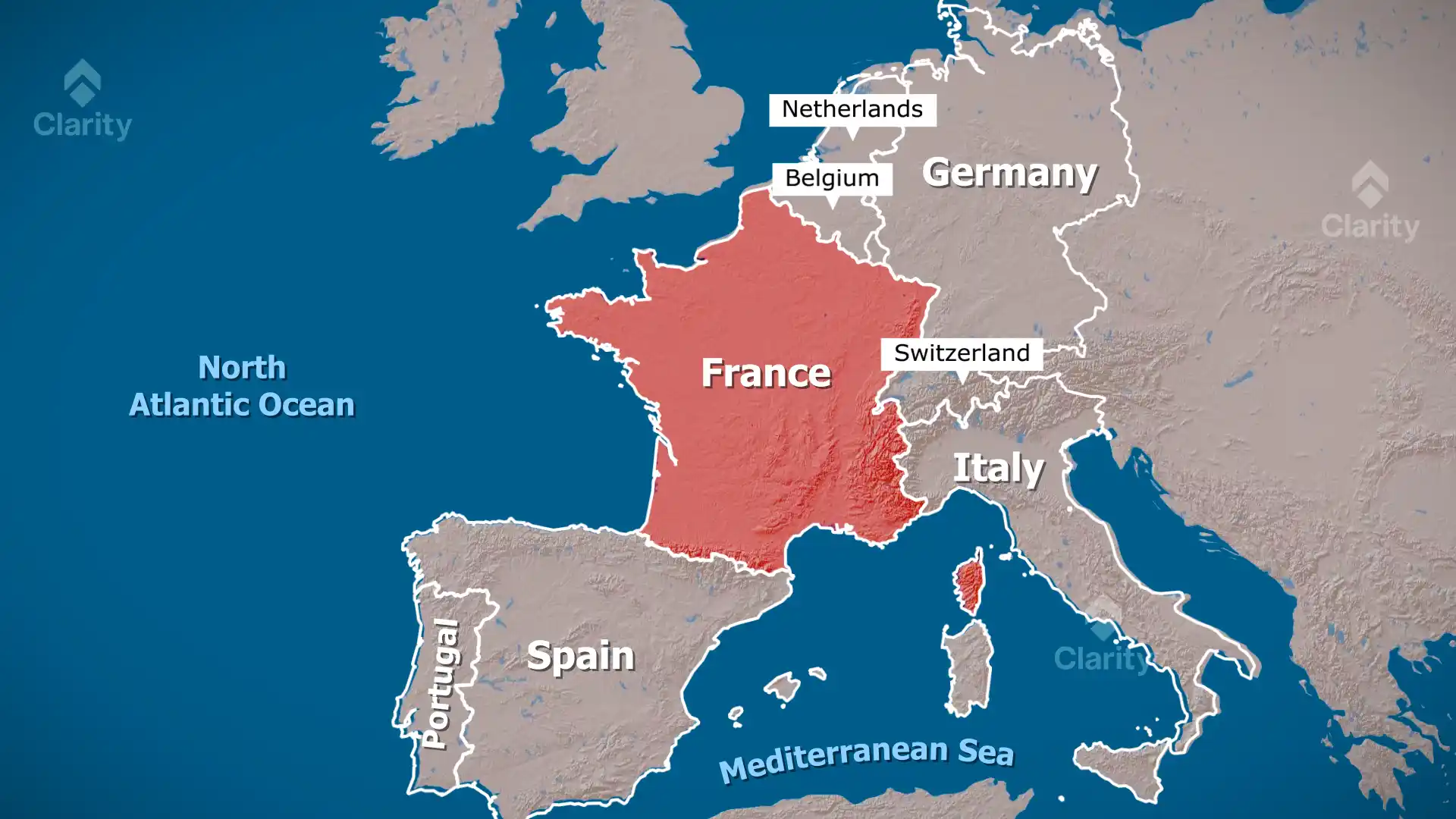
Metropolitan France lies in Western Europe. It borders Belgium and Luxembourg to the north‑east, Germany and Switzerland to the east, Italy and Monaco to the south‑east and Spain and Andorra to the south‑west. The Bay of Biscay lies to the west and the English Channel to the north. France also has five overseas regions: Guadeloupe, Martinique, Guyane, La Réunion and Mayotte. Paris is the national capital and largest city.
Key facts
- Climate: Mostly temperate with oceanic conditions in the west, continental winters in the interior, Mediterranean summers in the south and alpine weather in high mountains.
- Major rivers: Loire (longest), Seine, Garonne, Rhône and Rhine. These rivers support navigation, agriculture and hydropower.
- Mountains: The Alps (Mount Blanc is the highest at 4 807 m), Jura range and Pyrenees form natural borders.
- Natural resources: Coal, iron ore, bauxite, zinc, uranium, antimony, potash, feldspar, fluorspar and timber. Offshore territories also yield petroleum and gold.
- France hosts one of the world’s largest nuclear energy fleets and exports reactors and fuel technology.
Conclusion
France’s varied geography supports agriculture, tourism and industry. Abundant rivers and mountains provided early hydropower and transport routes. Its mineral wealth and advanced nuclear sector make the country an important partner in global energy projects.
Source: India Today