Why in news?
On 26 March 2026 a magnitude‑6.2 earthquake struck off the east coast of Japan’s Honshu island. The quake occurred at a depth of about 10 kilometres and triggered brief tremors across the region, but no major damage or tsunami was reported.
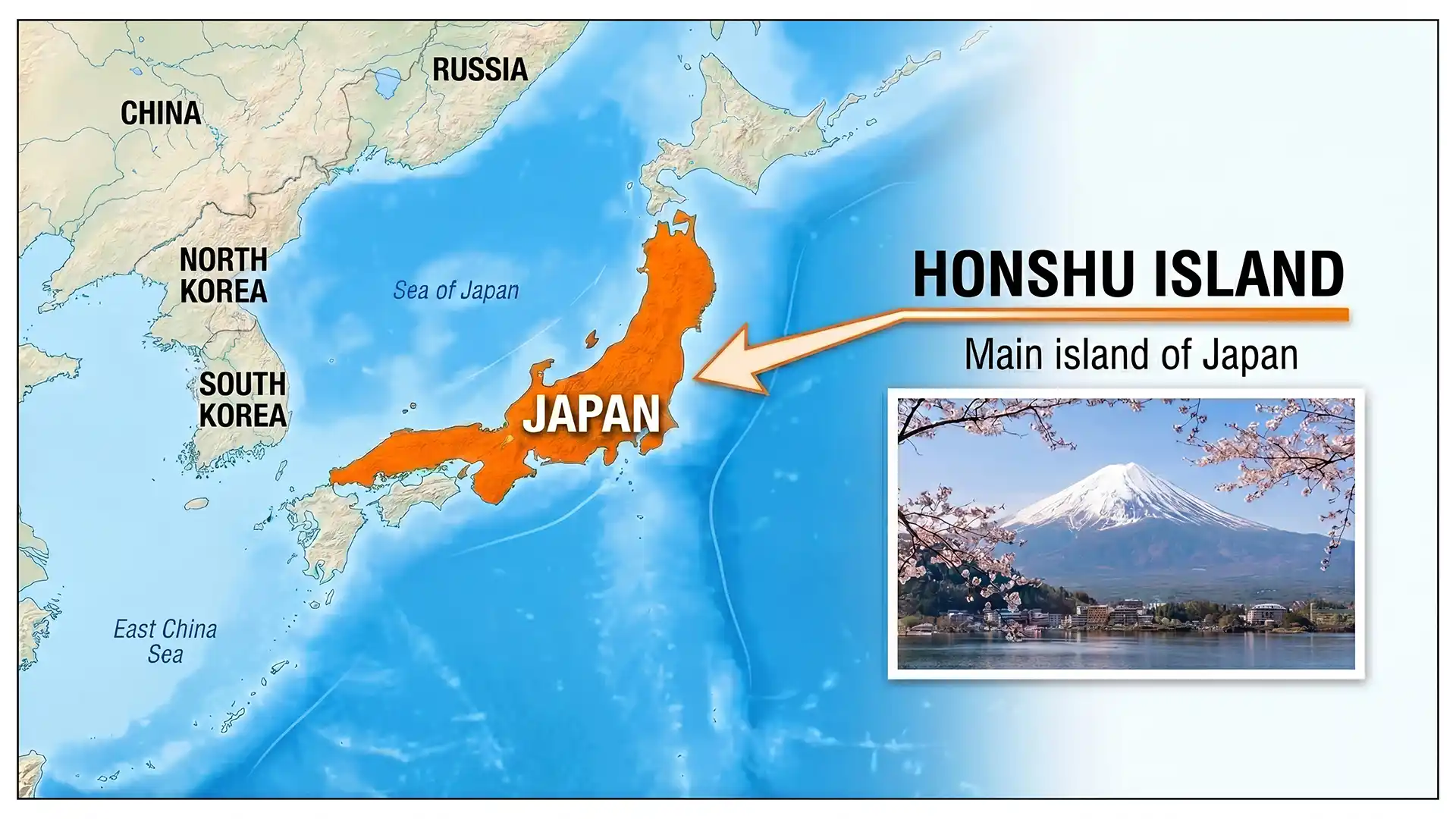
Background on Honshu
Honshu is the largest and most populous of Japan’s four main islands. Stretching roughly 1,287 km from northeast to southwest, it covers an area of about 227,898 square kilometres. The island lies between the Pacific Ocean to the east and the Sea of Japan to the west. It is home to more than 100 million people—over 80 % of Japan’s population—and houses major cities such as Tokyo, Osaka, Kyoto, Nagoya, Hiroshima and Yokohama.
Geographically, Honshu is dominated by a central spine of mountains and volcanoes known as the Japanese Alps. Mount Fuji, Japan’s highest peak, rises on its Pacific coast. The island also contains Lake Biwā, the country’s largest freshwater lake. Honshu sits near the boundary of several tectonic plates, making it prone to earthquakes. The Pacific Plate subducts beneath the Philippine Sea, Okhotsk and Amurian plates along the Japan Trench, generating frequent seismic activity.
Impact of the March 2026 quake
- Location and magnitude: The earthquake’s epicentre was off Honshu’s eastern coast. Its magnitude of 6.2 classifies it as strong, but because it occurred offshore and at moderate depth, ground shaking on land was limited.
- No tsunami warning: Japanese authorities did not issue a tsunami alert, and there were no reports of serious casualties or infrastructural damage. The event nevertheless served as a reminder of Japan’s vulnerability to seismic hazards.
- Preparedness: Japan’s strict building codes, early‑warning systems and public drills reduce the risk of disaster. Residents in Honshu are accustomed to following safety protocols such as taking shelter under sturdy furniture and securing heavy objects.
Relevance for India
For civil‑services aspirants, Honshu’s geography illustrates how tectonic processes shape landscapes and influence human settlement. Comparing Japan’s disaster‑management practices with India’s own efforts can provide insights into enhancing resilience against earthquakes and tsunamis.
Sources: Encyclopaedia Britannica · World Population Review · Reuters