

Why in news?
On 28 July 2026, a powerful earthquake struck Kumamoto Prefecture on Kyushu. The archive reported 13 confirmed deaths during continuing rescue work. Japan’s agency measured magnitude 7.1 and maximum seismic intensity seven. The casualty figure remained provisional while emergency teams searched damaged sites.
Latest dated update
Later reports on 30 July raised the confirmed death toll to at least 23.
Other possible earthquake-related deaths were still under investigation at that time.
Figures may differ across reports because verification continues during rescue operations.
Background
Japan regularly experiences earthquakes because several active plate boundaries meet around its island arc.
The 2026 event struck the same prefecture affected by destructive earthquakes during April 2016.
The Japan Meteorological Agency, or JMA, published the official rapid event information.
Basic event details
| Date and time | 28 July 2026 at 4:27 p.m. Japan Standard Time. |
|---|---|
| JMA location | Kumamoto region within Kumamoto Prefecture. |
| JMA magnitude | 7.1 at a depth of about ten kilometres. |
| Maximum intensity | Seven on the Japan Meteorological Agency scale. |
| United States estimate | Moment magnitude 6.8 using a different calculation method. |
The agency issued rapid earthquake and tsunami information after the shock.
A tsunami advisory was issued and later lifted without a major destructive wave.
Magnitude and intensity are different
Magnitude estimates the total energy released at the earthquake source.
An earthquake receives one magnitude estimate under each chosen measurement method.
Intensity measures shaking at a specific place and therefore varies across the affected region.
Distance, depth, local geology and building response all influence experienced intensity.
The JMA intensity scale contains ten levels from zero through seven.
Levels five and six each have lower and upper subdivisions.
Why was damage severe?
The earthquake was shallow, placing strong ground motion close to populated areas.
Maximum intensity seven can move heavy furniture and severely damage weaker structures.
Collapsed buildings, damaged roads and industrial accidents complicated rescue work.
Power and water failures also increased heat risks during extreme summer temperatures.
Aftershocks threatened unstable structures, slopes and already damaged infrastructure.
Japan’s plate setting
Japan lies near several interacting plates along the Pacific Ring of Fire.
The Pacific Plate descends beneath northern and eastern parts of the Japanese arc.
The Philippine Sea Plate subducts along southwestern portions, including areas near Kyushu.
Continental blocks commonly called the Amur and Okhotsk plates add further tectonic complexity.
Subduction stores elastic strain, produces earthquakes and supplies magma to volcanic arcs.
Understanding subduction hazards
- Sudden underground fault movement generates destructive seismic waves and surface ground shaking.
- Large offshore vertical displacement can sometimes produce a dangerous regional tsunami.
- Loose waterlogged ground may suddenly lose strength through soil liquefaction.
- Unstable steep slopes can fail during shaking or after heavy later rainfall.
- Damaged gas pipelines and electricity systems can trigger serious urban fires.
Japan’s geography
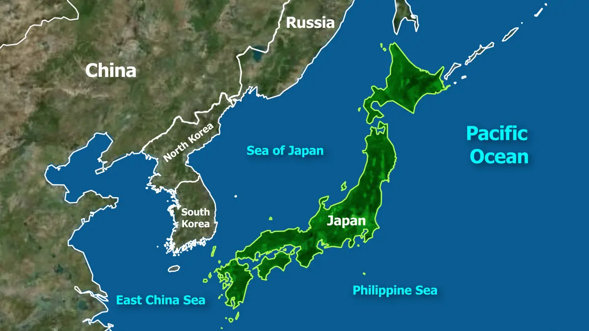
Japan is an East Asian archipelago within the northwestern Pacific Ocean.
Its four largest islands are Hokkaido, Honshu, Shikoku and Kyushu.
Tokyo, the capital, lies on Honshu beside the Pacific coast.
The Sea of Japan lies west, while the Pacific Ocean lies east.
The East China Sea borders Japan’s southwestern island chains.
Roughly three-quarters of Japan is mountainous, limiting broad plains for settlement and farming.
Selected physical features
| Feature | Fact |
|---|---|
| Highest mountain | Mount Fuji, a 3,776-metre stratovolcano on Honshu. |
| Longest river | The Shinano River, flowing across central Honshu. |
| Largest lake | Lake Biwa, a freshwater tectonic lake in Shiga Prefecture. |
| Active volcanic region | Kyushu includes Mount Aso and several other active volcanoes. |
Disaster preparedness
Japan combines dense seismic monitoring, early warnings, building standards, drills and tsunami evacuation planning.
These measures reduce risk but cannot prevent every collapse, disruption or cascading accident.
Older buildings, local ground conditions and infrastructure interdependence remain major vulnerabilities.
Risk reduction therefore requires continued retrofitting, public readiness and resilient utility networks.
Conclusion
The Kumamoto disaster shows how strong preparedness must continually adapt to compound seismic and climate risks.