Why in news?
Heavy rains in early 2026 have raised water levels in Lake Kariba, the giant reservoir on the Zambezi River between Zambia and Zimbabwe. The rise promises more electricity from the Kariba Dam, better fish catches and renewed tourism after years of drought and power shortages.
Background
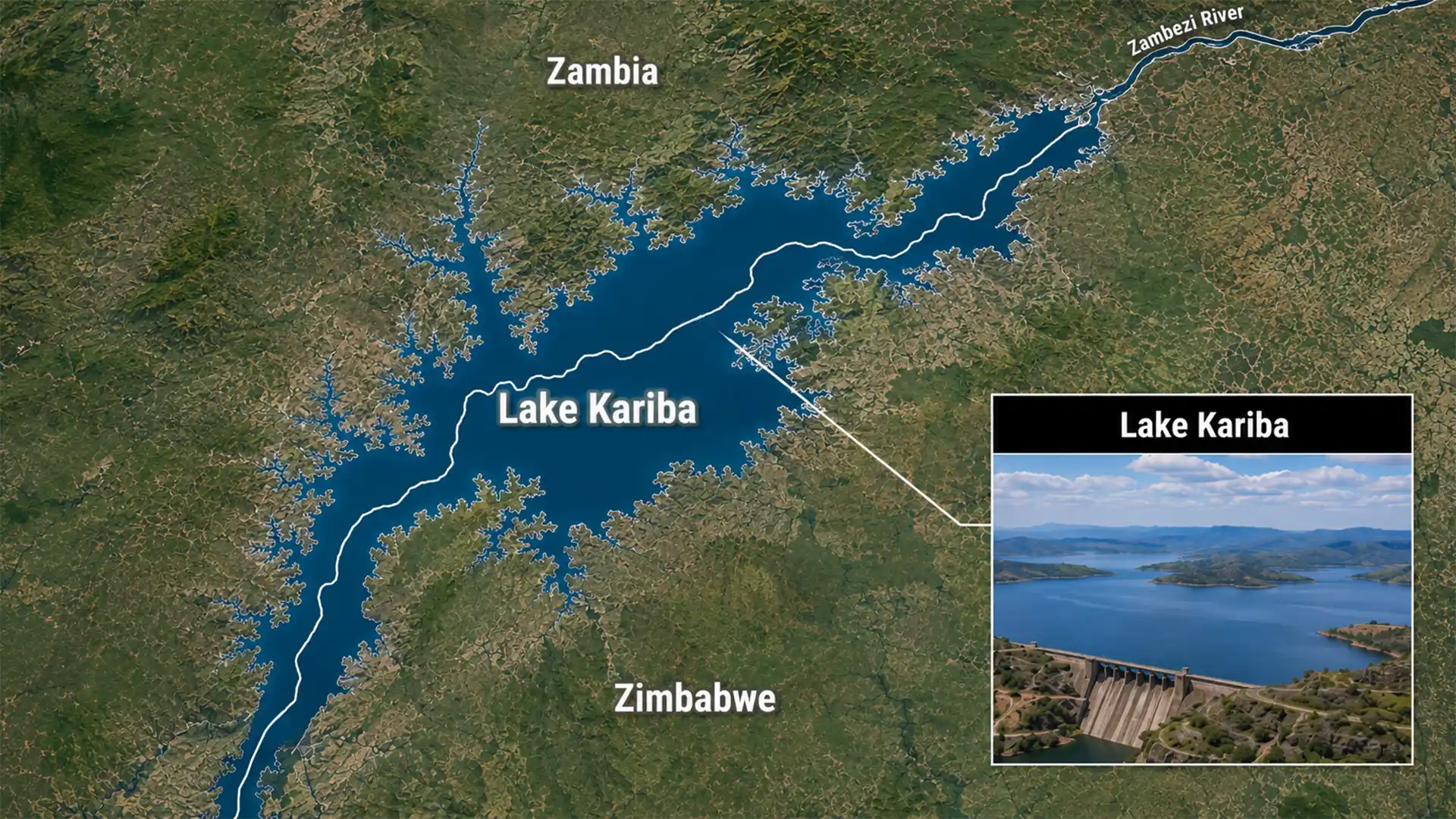
Lake Kariba is the world’s largest man‑made reservoir by volume. It was created by damming the Zambezi River at Kariba Gorge. Construction of the double‑curvature concrete arch dam began in 1956 and finished in 1959 under the design of engineer André Coyne. The dam is 128 metres high and 617 metres long. When the lake filled to capacity in 1963 it stretched about 280 kilometres long and up to 32 kilometres wide, holding roughly 185 billion cubic metres of water.
The project displaced around 57,000 Batonga people and inundated wildlife habitats. “Operation Noah,” a large animal rescue campaign, saved thousands of animals stranded on small islands as the waters rose. Lake Kariba now supports two hydroelectric stations, one on each bank, with a combined capacity of about 2,130 MW. It also sustains a fishing industry and attracts visitors for houseboat cruises and wildlife viewing. Local legends speak of the River God Nyaminyami, whose anger during construction was linked to floods that delayed the building process.
Recent developments
By May 2026 inflows from the Upper Zambezi have lifted the lake to levels not seen for several years. Higher water will allow the Zambezi River Authority to generate more electricity for Zambia and Zimbabwe, reducing load‑shedding. The wider flooded areas create new breeding grounds for fish such as kapenta and bream, helping fishers earn better incomes. Tourism operators expect an uptick in boat safaris and recreational fishing as the scenic lake returns to a healthier state.
Key facts
- Dam dimensions: 128 m high, 617 m long arch dam built between 1956 and 1959.
- Reservoir size: Up to 280 km long, 32 km wide; capacity about 185 billion cubic metres.
- Hydropower: North and south bank power stations produce roughly 2,130 MW, supplying a large share of electricity for Zambia and Zimbabwe.
- Social impact: Resettlement of Batonga communities and rescue of wildlife during filling; the lake continues to support fisheries and tourism.
Conclusion
Lake Kariba’s revival highlights the delicate balance between human engineering and natural cycles. Sustained rain offers welcome relief for power generation and livelihoods, but long‑term management of the Zambezi’s waters remains essential to safeguard ecosystems and communities.