Why in news?
Myanmar has been in the spotlight following high‑level meetings between Indian and Myanmar leaders in June 2026. To understand the country’s strategic importance it is helpful to explore its geography, climate and natural resources.
Background
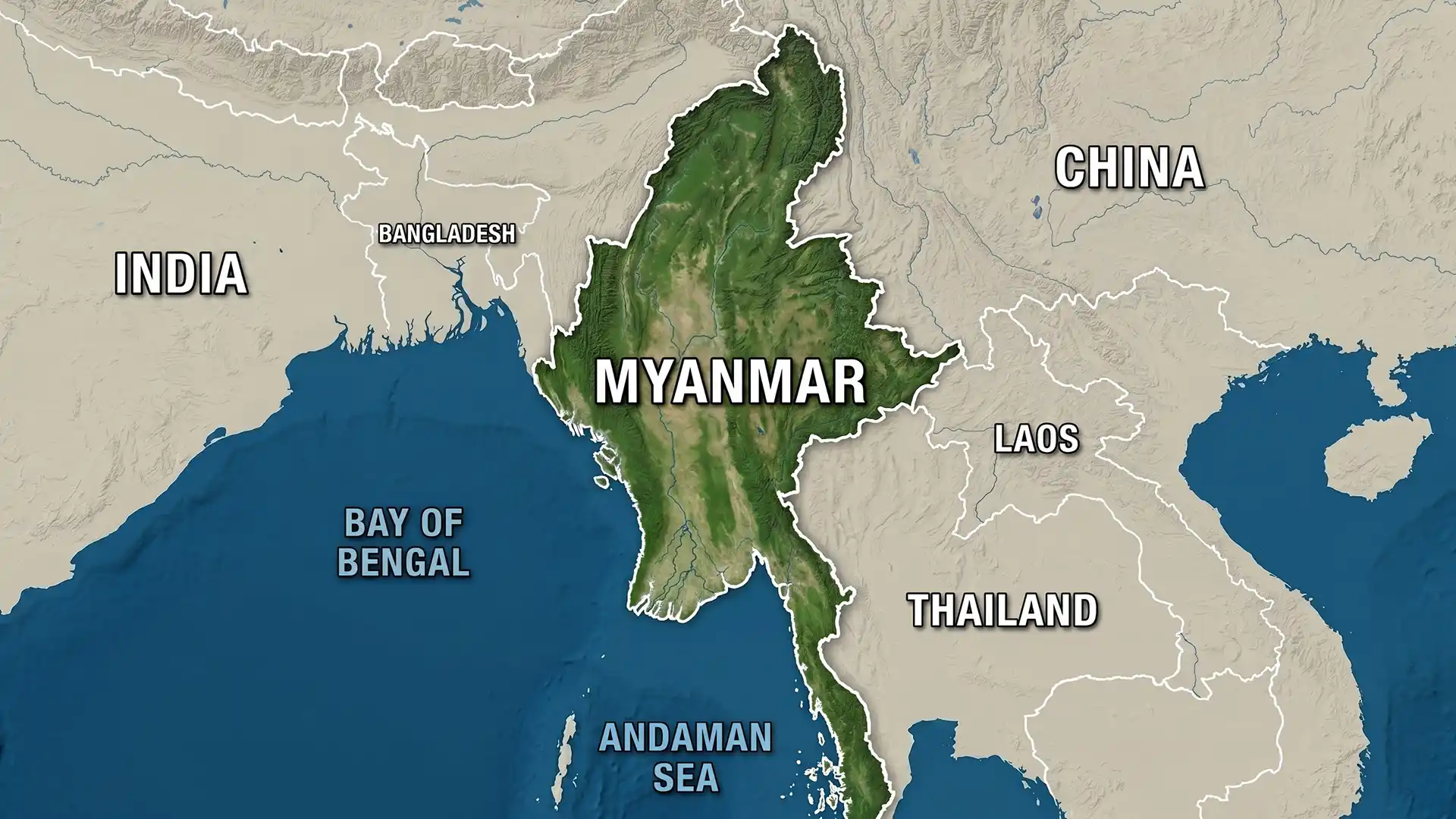
Myanmar (also called Burma) is the largest nation on mainland South‑East Asia, covering about 676,600 square kilometres—roughly the size of France and the United Kingdom combined. It is bordered by India and Bangladesh to the west, China to the north and northeast, Laos and Thailand to the east and southeast, and has a long coastline on the Bay of Bengal and the Andaman Sea. The country’s shape resembles a rhombus with a narrow tail in the south.
Physical features
- Mountains: A horseshoe of highlands surrounds the central lowlands. The northern mountains are part of the eastern Himalayas and include Hkakabo Razi (5,881 m), Myanmar’s highest peak. The rugged Arakan (Rakhine) and Chin hills run parallel to the Bay of Bengal in the west. To the east lies the Shan Plateau and its attendant ranges, while the Tenasserim hills extend down the long narrow peninsular tail in the south.
- Central basin: The heart of Myanmar is the broad valley of the Ayeyarwady (Irrawaddy) River and its tributary, the Chindwin. This fertile plain supports rice cultivation and hosts cities such as Mandalay and Naypyidaw. The Ayeyarwady empties into a vast delta southwest of Yangon before entering the Andaman Sea. East of the Ayeyarwady lies the Sittang (Sittaung) River basin, while the Salween (Thanlwin) River flows along the eastern border in deep gorges before reaching the Gulf of Martaban.
- Climate: Myanmar experiences a tropical monsoon climate with three seasons: a hot dry season (March–May), a rainy season (June–October) and a cooler dry season (November–February). Rainfall varies dramatically—western coastal areas receive more than 5,000 mm annually, while the central “dry zone” in the rain shadow of the Rakhine mountains gets less than 1,000 mm.
- Natural resources: The country is rich in hardwood forests (notably teak), petroleum and natural gas deposits, and minerals such as tin, tungsten, copper, lead and coal. Myanmar is also famous for its precious stones, particularly jade and rubies. However, decades of unsustainable extraction and conflict have limited the equitable distribution of these resources.
- Biodiversity: Dense tropical forests cover nearly half the country, supporting tigers, elephants, gibbons and countless bird species. The remote northern mountains and the wetlands of the Ayeyarwady delta are biodiversity hotspots.
Significance for India
- Strategic location: Myanmar sits at the crossroads of South and South‑East Asia and provides land and sea routes from India’s northeast to the Indo‑Pacific. Projects such as the Kaladan Multi‑Modal Transit Transport Project aim to link India’s eastern ports with Myanmar’s river and road networks.
- Neighbourhood policy: India’s Act East and Neighbourhood First policies recognise Myanmar as a bridge to ASEAN markets. Cooperation in border management, trade and cultural exchanges helps stabilise the region.
- Resource potential: Myanmar’s natural gas reserves and hydropower potential could complement India’s energy needs, while joint conservation of forests and wildlife would protect shared ecosystems.
Conclusion
Myanmar’s geography—a central rice‑growing basin encircled by mountains, long coastline and rich natural resources—has shaped its history and interactions with neighbours. Understanding these features helps explain why the country is both a strategic partner and a fragile neighbour for India.