

Why in news?
A fresh draft proposes an eco-sensitive zone around Karnataka’s Nagarahole Tiger Reserve, according to Deccan Herald’s 16 September report. It describes a 2 September notification covering 573.95 square kilometres and including all or parts of 101 villages. An eco-sensitive zone regulates activities around a protected area to reduce damaging pressures from neighbouring land uses. Nagarahole connects with other forests used by elephants, tigers and their prey, making these surrounding areas important to conservation. The reported draft provides a 60-day opportunity for objections and suggestions. It is not a final notification, and its proposed area must not be confused with the area of the tiger reserve itself.
A protected area within a connected southern landscape
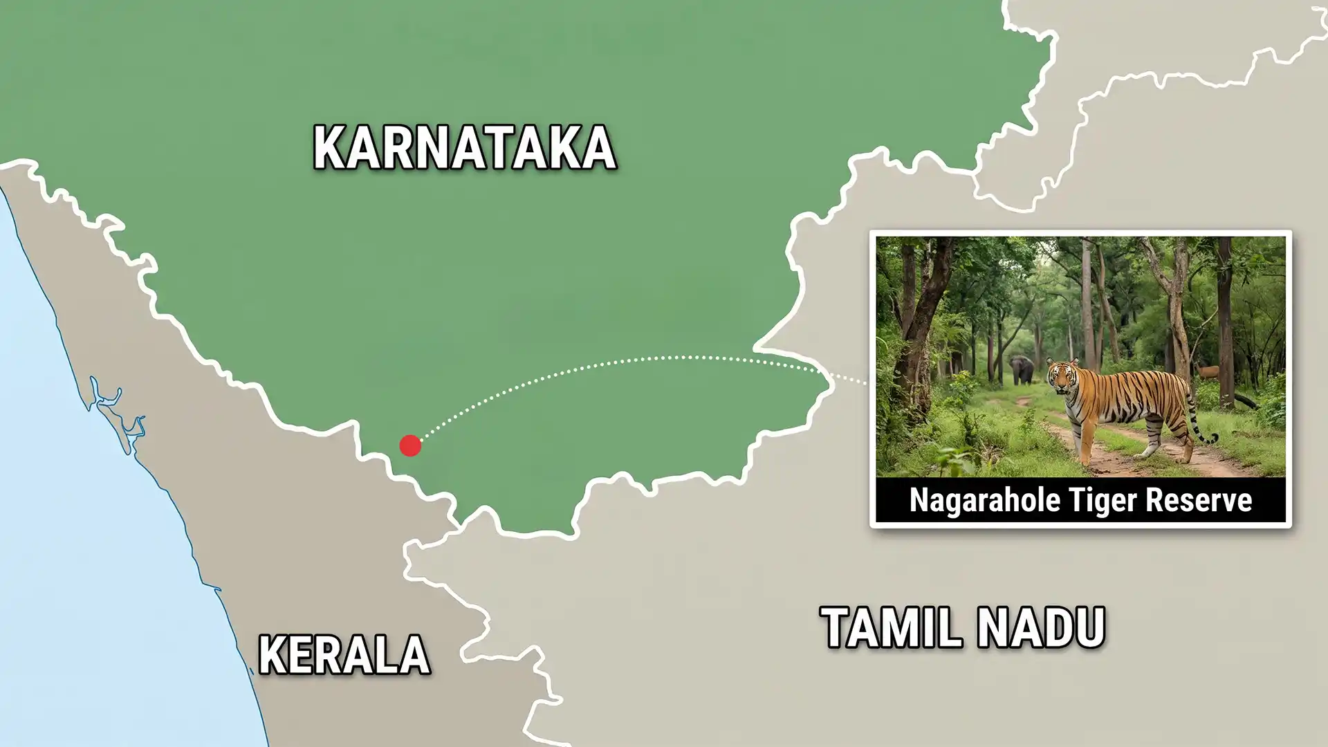
Nagarahole lies in Karnataka’s Mysuru and Kodagu districts. The National Tiger Conservation Authority places Bandipur Tiger Reserve to its southeast and Kerala’s Wayanad Wildlife Sanctuary to its southwest. Together, these adjoining habitats form part of a much larger forest landscape. Administrative boundaries divide management responsibilities, but wildlife movement does not stop at a district or state border.
The reserve takes its name from the Nagarahole stream, which winds through the habitat before joining the Kabini. Kodagu’s district account identifies the Kabini River as separating Nagarahole from Bandipur. This river relationship is central to locating the reserve correctly. It should not be replaced by a loose reference to any nearby river in the wider Nilgiri region.
Nagarahole also forms part of the Nilgiri Biosphere Reserve, a landscape extending across Karnataka, Kerala and Tamil Nadu. Its international biosphere recognition comes under the United Nations Educational, Scientific and Cultural Organization’s Man and the Biosphere programme. That recognition concerns conservation and sustainable relationships between people and ecosystems. It is distinct from a World Heritage inscription.
Rainfall creates a changing habitat
The reserve is not covered by one uniform forest type. The tiger authority describes drier deciduous forest towards the east, with moister and semi-evergreen vegetation towards the west. This transition follows increasing rainfall. Understanding that gradient helps explain why a single protected landscape can support different plant communities and wildlife habitats.
Grassy, swampy openings locally called hadlu occur among the forests and are used by herbivores. These feeding areas are part of the habitat mosaic rather than empty gaps with no conservation value. Tigers, leopards and dholes use a landscape supported by prey and vegetation. Protecting carnivores therefore also involves maintaining the conditions supporting animals lower in the food web.
Why an eco-sensitive zone is a separate instrument
A tiger reserve’s core and buffer serve wildlife-management purposes. An eco-sensitive zone is a separate environmental-regulation mechanism under the Environment (Protection) Act, 1986. Government explanations distinguish prohibited, regulated and promoted activities within such zones. Its purpose is not adequately described as banning all human life around a forest.
That distinction matters where settlements, farms and other land uses meet protected habitat. Different activities can create different pressures, including disturbance, pollution or disruption of movement routes. A notification must specify the applicable boundaries and conditions. Inclusion within a proposed zone should not be equated automatically with eviction or the cancellation of every existing livelihood.
What the reported boundary proposal means
Deccan Herald reports that the proposed width varies rather than forming a uniform ring. It reaches 24.08 kilometres on the northwestern side and is zero where the reserve adjoins Bandipur and Wayanad. Those figures describe different stretches of a proposed boundary. They do not mean that the entire surrounding landscape would have a 24-kilometre restriction belt.
The public-comment stage allows the proposal’s mapped extent and practical implications to be examined before finalisation. Village inclusion, existing land use and ecological connections are all relevant to that examination. For residents and businesses, the final boundary map and activity schedule will determine which conditions apply to a particular location.
Connectivity needs management outside the park line
The tiger authority identifies important elephant connections towards Bandipur and through the Wayanad–Brahmagiri landscape. It also notes varied land uses and human presence in connecting areas. A corridor is therefore not necessarily an untouched strip of forest. Its usefulness depends on whether animals can move through the actual landscape with manageable levels of disturbance and conflict.
This makes local participation and accurate mapping central to implementation. Rules that ignore movement routes may protect the wrong places; rules that ignore residents’ needs can create avoidable conflict. The ecological task is to retain connections while applying clear, proportionate conditions to surrounding development. The draft stage is where those specific relationships should be examined.
Conclusion
The proposed zone addresses a real landscape problem: Nagarahole’s wildlife depends on habitats and connections extending beyond its protected boundary. Its effectiveness will depend on the final mapped rules and their implementation, not merely the size announced. Clear distinctions between the reserve, its buffer and the proposed environmental zone are essential for both conservation and affected communities.