

Why in news?
Nagarjuna Sagar marked fifty-nine years since water entered its right canal. Prime Minister Indira Gandhi opened that canal flow on 4 August 1967. The project itself had begun construction during 1956. The anniversary therefore marks canal commissioning, not the dam's original foundation.
Background
Nagarjuna Sagar is a multipurpose project across the Krishna River; it stands between Telangana and Andhra Pradesh. The site lies beside Nalgonda district and the Palnadu side of the river.
The project grew from plans to use Krishna waters for drought-prone areas. Jawaharlal Nehru performed the project foundation ceremony on 10 December 1955. Major construction then proceeded between 1956 and 1967.
Indira Gandhi released water into the right canal on 4 August 1967. Canal development and associated works continued around that milestone; a single “completion date” therefore simplifies a staged project.
The name refers to nearby Nagarjunakonda, an important Buddhist centre. Archaeological remains were documented before reservoir submergence; many objects and structures were relocated to an island museum.
Engineering dimensions
The Krishna River Management Board records a masonry dam length of 1,449.628 metres. Maximum height above the deepest foundation is 124.663 metres. Popular summaries often round both figures too aggressively.
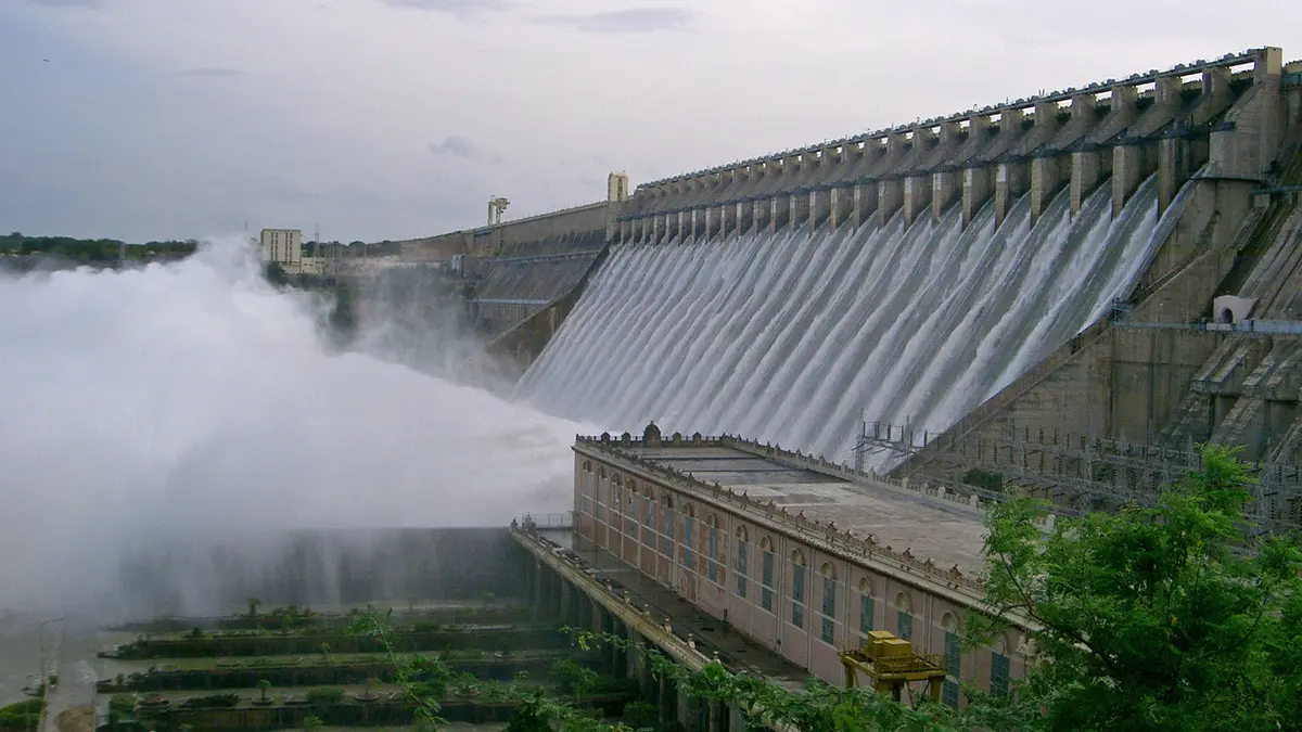
The spillway contains twenty-six crest gates; each gate measures about 13.716 metres by 13.410 metres. Their operation releases major flood flows when reservoir conditions require it.
Full reservoir level is 590 feet, or 179.832 metres above mean sea level. The water spread at that level is about 285 square kilometres. Actual area changes with reservoir elevation.
Official agencies often describe Nagarjuna Sagar as the world's highest and largest masonry dam. That description depends upon the category and measurement used. Global comparisons change when concrete gravity and other dam types are included.
Why storage numbers appear inconsistent
Several official tables publish different capacities for the same reservoir. One project profile lists original full storage near 408.24 thousand million cubic feet. That unit is commonly abbreviated as TMC.
An operational table gives about 312.045 TMC at full reservoir level. The difference can reflect revised surveys, sedimentation and changed accounting. Dead storage and live storage must also remain separate.
Live storage describes water usable between selected operating levels. Gross capacity includes water below that range; neither figure alone measures annual water delivered.
Sediment gradually occupies reservoir space and can reduce effective capacity. Updated bathymetric surveys therefore matter. Any capacity claim should state the survey, level and storage definition.
The often-repeated figure of 11,472 million cubic metres approximates an older gross estimate. It should not be mixed with a current operational capacity. Calling the reservoir the world's third-largest artificial lake also lacks a stable universal basis.
Irrigation and power
The right canal is commonly called Jawahar Canal; the left is Lal Bahadur Shastri Canal. Together they support agriculture across extensive command areas.
Canal irrigation allowed more reliable cultivation in many dry tracts. It also created waterlogging and salinity risks where drainage remained poor. Efficient scheduling and field channels determine actual benefits.
The main powerhouse combines one 110-megawatt conventional unit with seven reversible 100-megawatt units; canal powerhouses add further generation. Total installed capacity is commonly stated near 960 megawatts.
Reversible units can operate as turbines and pumps under suitable conditions. Hydropower output still depends upon water levels and irrigation releases; installed capacity is not the same as continuous electricity production.
The reservoir also supports drinking water, fisheries and tourism; these demands can compete during drought. Operating rules must balance multiple users rather than maximise one sector alone.
Interstate governance after 2014
The Andhra Pradesh Reorganisation Act, 2014, created the Krishna River Management Board. The Board coordinates specified projects and water management between both successor states. Central directions and tribunal allocations shape its work.
Operational control at Nagarjuna Sagar has remained politically sensitive. Telangana and Andhra Pradesh have disputed releases and security arrangements. Describing one state as having simple permanent control hides this continuing framework.
River allocations involve reservoirs across the entire basin, not only one structure. Upstream rainfall and releases affect downstream availability. Transparent real-time data can reduce avoidable conflict.
Tribunal decisions, court proceedings and central notifications may alter legal responsibilities. Historical project ownership does not answer every present operational question. Current orders should accompany any legal claim.
Safety, ecology and future management
An ageing dam needs continual inspection of gates, masonry and mechanical systems. Emergency plans should identify downstream inundation zones; public warnings must reach communities quickly during unusual releases.
Large reservoirs alter sediment movement, fish habitat and downstream flow. Canal expansion can also change groundwater and local ecology; environmental management should address effects beyond the dam wall.
Climate variability creates alternating flood and drought pressure. Forecast-based operation can improve advance decisions; it cannot eliminate difficult trade-offs when inflows remain uncertain.
Modernisation should include accurate gauges, transparent dashboards and coordinated reservoir rules. Farmers need predictable schedules, while cities need secure drinking supplies. Basin-level planning offers the strongest long-term approach.
Conclusion
Nagarjuna Sagar remains a central irrigation and power asset on the Krishna. Its legacy deserves precise dates, category-specific records and cooperative modern management.