

Why in news?
The southwest monsoon and tropical cyclones Luis and Maymay affected large parts of the Philippines. More than 2.27 million people were recorded as affected.
How the weather systems evolved
Luis developed east of Quezon on 1 August. It weakened into a low-pressure area near Cagayan two days later. Maymay developed west of La Union on 4 August. It crossed near Magsingal in Ilocos Sur on 6 August.
Maymay weakened into a low-pressure area by 7 August. Moist south-westerly flow continued bringing rain after both systems weakened.
Geographic setting
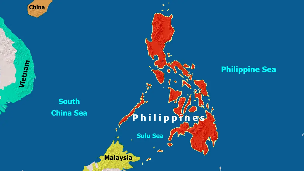
Luzon is the country’s large northern island. The Ilocos coast faces the South China Sea, locally called the West Philippine Sea. Quezon faces the Philippine Sea on Luzon’s eastern side. Western Visayas occupies islands farther south in the central archipelago.
This maritime setting exposes different coasts to changing winds and cyclone tracks. Mountain ranges can further intensify rain on windward slopes.
Why cyclones enhance the monsoon
A tropical cyclone can draw moist south-westerly winds across the archipelago. Heavy rain may therefore occur far from the cyclone centre.
Hazards include flooding, landslides, rough seas and urban drainage failure. Exposure continues even after a named storm loses cyclone status.
By 11 August, the government recorded 684 damaged houses. Reported assistance exceeded 72.5 million Philippine pesos.
Impact figures change during response
The numbers above come from the 11 August morning report. Later validation can revise households, damage and assistance totals.
Policy implications
Warnings must describe monsoon enhancement, not only cyclone landfall. Local authorities need rainfall, landslide and coastal guidance in usable formats.
Repeated displacement also tests shelters, health services and livelihoods. Recovery should rebuild drainage and housing for recurring multi-hazard conditions.
One event cannot establish climate attribution by itself. Resilience investments remain justified because exposure and repeated heavy rainfall already create measurable losses.
The national report combined impacts across several administrative regions. Local validation remains necessary because one household can appear in successive updates.
An archipelagic country must move relief across water and damaged roads. Pre-positioned supplies and redundant communications can shorten isolation after landfall.
Assistance figures describe government and partner support, not total economic loss. Damage assessments require separate validation across housing, farming and infrastructure. Transparent methods prevent emergency assistance, estimated damage and verified destruction from being confused in later public debate.
Conclusion
The emergency shows why cyclone risk extends beyond the storm track. Monsoon interaction can spread severe impacts across distant islands.