Why in news?
India’s External Affairs Minister recently congratulated Tone Kajzer on his appointment as Slovenia’s Foreign Minister and expressed a desire to deepen bilateral cooperation. This diplomatic exchange has brought attention to Slovenia’s geography and its role in Europe.
Background
Slovenia is a small, high‑income country located at the crossroads of Central and South‑Eastern Europe. Historically it was part of the Habsburg Monarchy and later the Kingdom of Serbs, Croats and Slovenes—which evolved into Yugoslavia. Slovenia declared independence from Yugoslavia on 25 June 1991 after a brief Ten‑Day War. It joined the European Union and NATO in 2004 and adopted the euro currency in 2007. The country’s capital and largest city is Ljubljana.
Geography and features
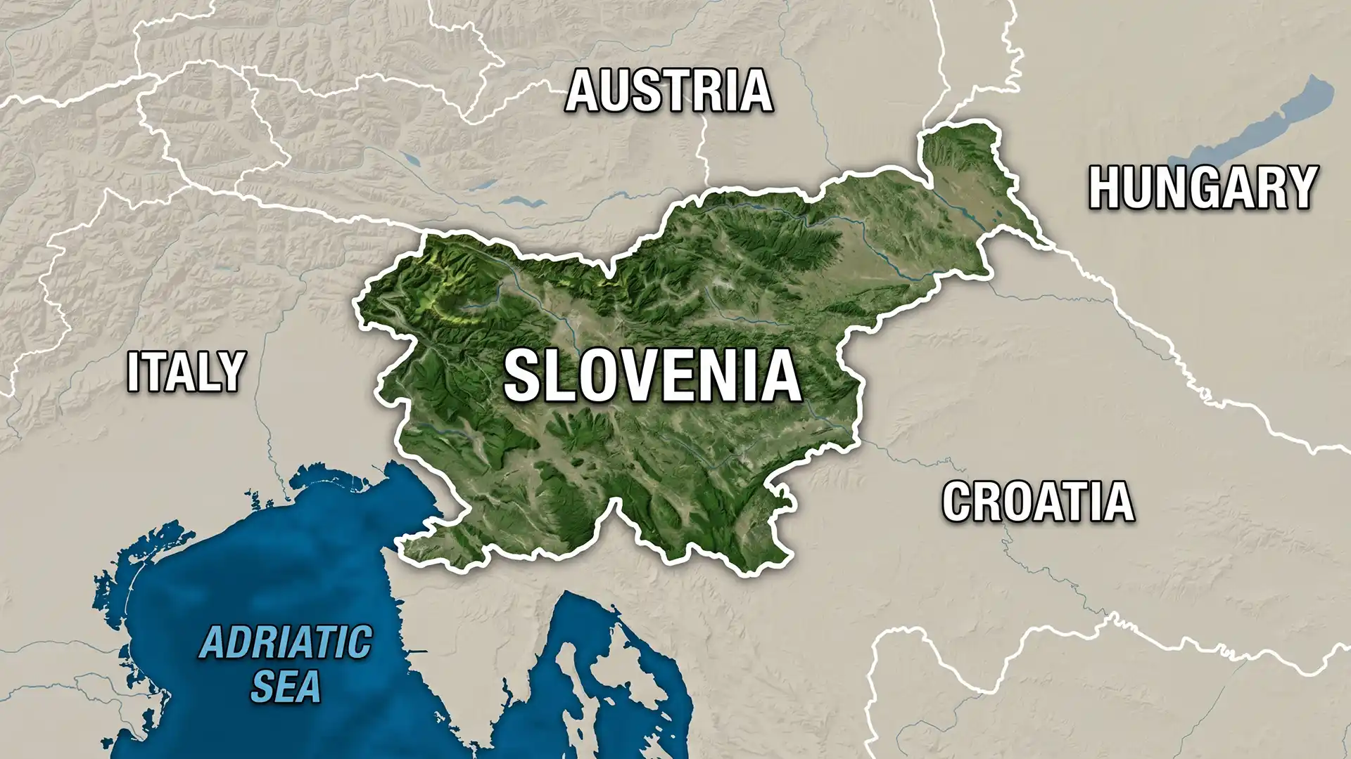
- Borders: Slovenia shares land borders with Austria (north), Hungary (northeast), Italy (west) and Croatia (southeast). It also has a 47‑kilometre coastline along the Adriatic Sea at the Gulf of Trieste.
- Landscape: More than 40 percent of the country is mountainous. It lies at the junction of four major European geographic regions—the European Alps, the Dinaric Alps, the Pannonian Basin and the Mediterranean coast. Mount Triglav (2,864 m) is the highest point.
- Climate: The coast experiences a Mediterranean climate with mild winters and warm summers, while the interior valleys and plateaus have a continental climate marked by hot summers and cold winters.
- Natural resources: Slovenia’s resources include lignite (brown coal), lead, zinc, forests and abundant hydropower potential. Major rivers such as the Drava and Sava flow through the country, supporting agriculture and energy generation.
Historical timeline
The Slovenes trace their roots to Slavic tribes who settled the region in the sixth century. From the 14th century the area came under Habsburg rule and remained part of the Austrian Empire until 1918. After World War I it joined the Kingdom of Serbs, Croats and Slovenes and later became a constituent republic of socialist Yugoslavia. The democratic reforms of the late 1980s paved the way for independence, which was achieved peacefully compared with the conflicts elsewhere in the former Yugoslavia.
Conclusion
Slovenia’s strategic location links the Alps with the Balkans and the Mediterranean. Although small, it plays an active role within the European Union and has cultivated friendly relations with India. Understanding its geography and history helps explain its economic success and why diplomatic outreach matters for both countries.