
Why in news?
Bihar and Jharkhand completed internal approvals for sharing Sone River water. The Union government proposed signing an agreement during August 2026. Bihar would receive 5.75 million acre-feet from the old joint share. Jharkhand would receive the remaining 2 million acre-feet.
Background
The Sone River, also written as Son, is a major tributary entering the Ganga from its southern right bank.
The river rises near Amarkantak in Madhya Pradesh, close to the Narmada and Johila headwaters.
However, Narmada flows west while Sone ultimately flows east.
Course of the river
- Sone begins around 1,067 metres in Amarkantak, then flows north-west across Madhya Pradesh.
- The Kaimur Range turns the river sharply towards the east.
- It then flows near or through Uttar Pradesh and Jharkhand.
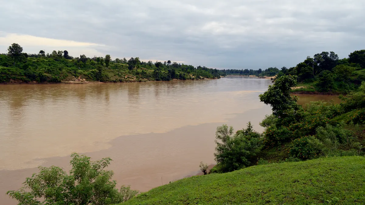
- The river enters Bihar and spreads across a wide sandy channel.
- Finally, it joins the Ganga near Maner, west of Patna.
Key geographical facts
| Feature | Details |
|---|---|
| Source region | Amarkantak highlands, Madhya Pradesh |
| Source elevation | About 1,067 metres |
| Approximate length | Roughly 800 kilometres |
| Drainage system | Ganga river system |
| Confluence | Near Maner, west of Patna |
| River character | Wide, sandy and strongly seasonal |
Official lengths vary by method, with the River Basin Atlas supporting approximately 784 kilometres.
The Bansagar Control Board gives 820.74 kilometres, so “roughly 800 kilometres” avoids false precision.
Why is the channel so wide and sandy?
Sone crosses old rocks, while strong monsoon floods carry large quantities of sand and other sediment.
During dry months, falling discharge leaves the active channel occupying only part of the sandy riverbed.
This seasonal contrast once made navigation difficult.
Important tributaries
| Tributary group | Examples |
|---|---|
| Northern and upper tributaries | Johila, Banas and Chhoti Mahanadi |
| Southern plateau tributaries | Gopad, Rihand, Kanhar and North Koel |
Rihand and North Koel drain mineral-rich plateaus, while Rihand Dam stands on a tributary, not Sone.
Major projects
| Project | River | Main role |
|---|---|---|
| Bansagar Dam | Main Sone | Irrigation, hydropower and water regulation |
| Indrapuri Barrage | Main Sone | Diverts water into Bihar’s canal network |
| Rihand Dam | Rihand tributary | Reservoir storage and hydropower |
A short history of Sone irrigation
During 1873–74, British engineers built an anicut, or low water-diversion barrier, at Dehri.
Its canals irrigated southern Bihar, before Indrapuri Barrage replaced and expanded the system.
Construction began during the 1960s, and commissioning followed in 1968.
The 1,407-metre structure is described by Bihar Tourism as the world’s fourth-longest barrage.
The 1973 Bansagar Agreement
Madhya Pradesh, Uttar Pradesh and undivided Bihar signed this water-sharing agreement on 16 September 1973.
| State under the 1973 agreement | Allocated water |
|---|---|
| Madhya Pradesh | 5.25 million acre-feet |
| Uttar Pradesh | 1.25 million acre-feet |
| Undivided Bihar | 7.75 million acre-feet |
The Union government established the Bansagar Control Board during January 1976.
The Board coordinates the interstate project and related agreement responsibilities.
What is a million acre-feet?
An acre-foot covers one acre with one-foot-deep water, equalling about 1.233 million litres.
One million acre-feet (MAF) means one million such standard water volumes.
Why did a new division become necessary?
Jharkhand separated from Bihar on 15 November 2000, but the 1973 agreement contained one combined Bihar share.
The missing internal division created a long-running administrative and planning problem for both successor states.
How was the present formula reached?
| Stage | Development |
|---|---|
| 10 July 2025 | The Eastern Zonal Council discussed the unresolved allocation. |
| Central review | A committee chaired through the Central Water Commission examined it. |
| Committee recommendation | Members unanimously supported a 5.75–2.00 MAF division. |
| January 2026 | Bihar’s Cabinet approved the proposed formula. |
| July 2026 | Jharkhand’s Cabinet also completed approval. |
| 14 July 2026 | The Union ministry proposed an August signing ceremony. |
Proposed new division
| Successor state | Proposed share | Part of old Bihar share |
|---|---|---|
| Bihar | 5.75 MAF | About 74.2 per cent |
| Jharkhand | 2.00 MAF | About 25.8 per cent |
| Total | 7.75 MAF | Entire original allocation |
The formula divides only undivided Bihar’s allocation, leaving Madhya Pradesh’s and Uttar Pradesh’s original shares unchanged.
The outcome is a negotiated agreement, not a tribunal award.
Why does the agreement matter?
- It removes planning uncertainty and can improve dry-season canal management.
- It can support the proposed Indrapuri Reservoir Project.
- It clarifies water accounting between two successor states.
- It demonstrates a negotiated path for an interstate issue.
The proposed reservoir could support eight Bihar districts, including Bhojpur, Buxar, Rohtas, Kaimur and Aurangabad.
Patna, Gaya and Arwal are also expected to benefit.
Conclusion
A clear Sone allocation can support irrigation planning while preserving the original interstate agreement.