Why in news?
The U.S. Navy’s nuclear‑powered aircraft carrier USS Gerald R. Ford triggered public tracking systems while sailing swiftly toward the Strait of Gibraltar. Analysts noted that such vessels usually conceal their positions, so the decision to activate the tracking beacon drew attention to heightened naval activity near this key maritime chokepoint.
Background
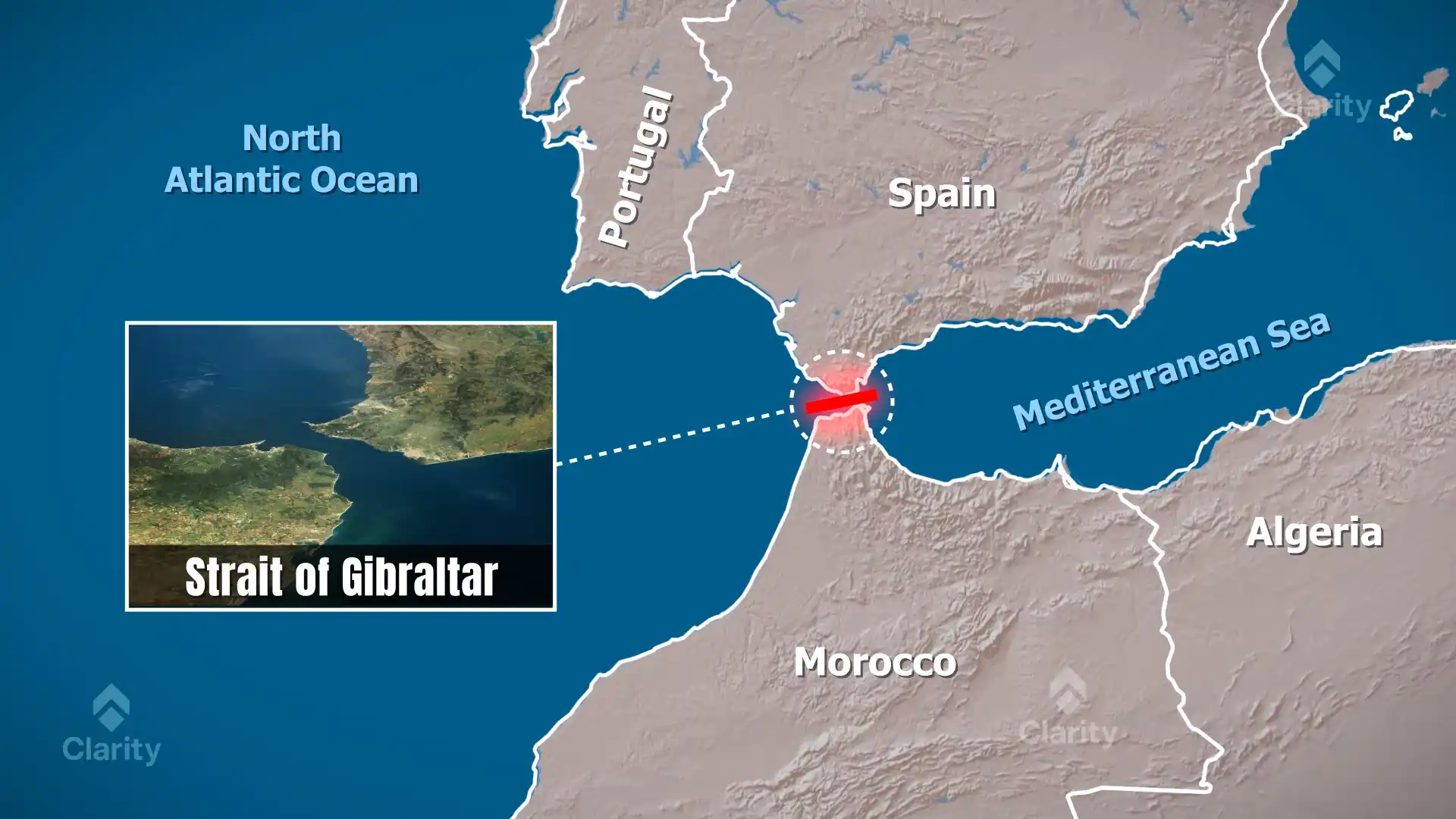
The Strait of Gibraltar is the narrow waterway linking the Atlantic Ocean to the Mediterranean Sea. Located between Spain’s Cape Trafalgar and Morocco’s Cape Spartel in the west and between the Rock of Gibraltar and Morocco’s Mount Hacho in the east, it measures about 58 km in length. At its narrowest point between Point Marroquí in Spain and Point Cires in Morocco, the strait is roughly 13 km wide. Depths range from 300 m to 900 m, forming a deep gap between the Iberian Peninsula and the Atlas Mountains.
Why the carrier’s movement matters
- Unusual transparency: Aircraft carriers on operational missions generally disable their Automatic Identification System beacons for security. The Ford’s decision to broadcast its position suggests a deliberate show of presence amid tensions with Iran.
- Military deployment: Tracking data indicated the carrier was en route from the Caribbean toward the Mediterranean to join another carrier group, potentially positioning U.S. forces closer to the Middle East.
- Geopolitical context: The transit coincides with ongoing U.S.–Iran talks and regional tensions. Analysts warn that the movement of two carrier strike groups could signal escalating pressure and readiness for possible operations.
About the strait
- Strategic location: The strait separates Europe (Spain and the British territory of Gibraltar) from Africa (Morocco and the Spanish enclave of Ceuta). Before the Suez Canal opened in 1869, it was the only maritime route between the Mediterranean and the Atlantic.
- Busy shipping lane: Nearly 300 ships transit the strait every day, making it one of the world’s busiest waterways.
- Oceanographic dynamics: Cooler, less salty Atlantic water flows eastward near the surface into the Mediterranean, while warmer, saltier Mediterranean water flows westward at depth. This exchange helps maintain the Mediterranean’s ecological balance.
Significance
- Global trade: As a critical chokepoint, the strait’s stability affects international shipping and energy routes.
- Military strategy: Control over this passage offers navies rapid access between the Atlantic, Mediterranean and Indian Ocean theatres.
- Environmental importance: The unique water exchange supports diverse marine life and influences climate patterns in the region.
Source: Indian Defence Review