

Why in news?
Ongoing conflicts and humanitarian crises in Sudan have kept the country in global headlines. Understanding its geography, climate and resources helps explain why stability remains elusive.
Background
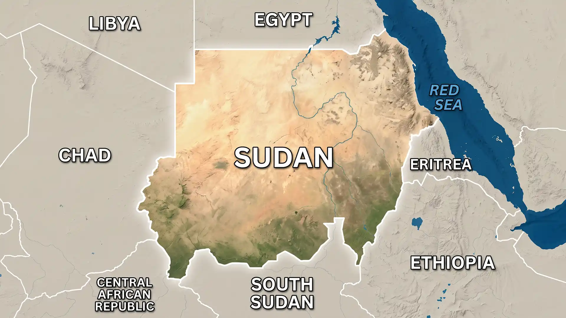
Sudan, located in north‑east Africa, is the continent’s third largest country with an area of about 1.89 million km². It shares borders with Egypt, the Red Sea, Eritrea, Ethiopia, South Sudan, the Central African Republic, Chad and Libya. The Blue and White Nile rivers meet at Khartoum to form the River Nile, which flows northward to the Mediterranean. The capital Khartoum is at this confluence. Sudan gained independence from joint British and Egyptian rule in 1956 but has faced decades of civil conflict. In 2019 a popular uprising ousted long‑time president Omar al‑Bashir and led to a transitional government, yet fighting continues in several regions.
Geography and climate
- Diverse landscapes: The terrain is mostly flat plains with some mountain ranges such as the Marrah Mountains in Darfur, where the Deriba Caldera rises to about 3,042 metres. Northern and central Sudan are dominated by the Nubian and Bayuda deserts, while the south has swamps and savanna.
- Climate variation: Sudan’s climate shifts from arid desert in the north to tropical savanna in the south. The northern regions receive less than 100 mm of rainfall annually, whereas parts of the south can receive up to 1,200 mm. The rainy season lasts from June to September in the north and up to November in the south. High temperatures often exceed 40 °C during the day, especially in summer.
- Hydrological importance: The Blue Nile runs roughly 800 km through Sudan before merging with the White Nile. Several dams, including the Sennar and Roseires dams on the Blue Nile and the Jebel Aulia dam on the White Nile, are vital for irrigation and hydroelectricity.
Natural resources
- Minerals: Sudan has deposits of gold, copper, iron, chrome ore, mica, gypsum and small reserves of petroleum and natural gas. Gold exports have become increasingly important as other sectors struggle.
- Agricultural land: Only about 12 % of the country’s area is cultivated. Irrigated agriculture along the Nile produces sorghum, millet, wheat and cotton. Nomadic herders raise sheep and camels in dry regions.
- Water resources: Besides the Nile, Sudan relies on groundwater, seasonal wadis and rainfall. Frequent droughts and floods, exacerbated by climate change and El Niño events, challenge food security.
Conclusion
Sudan’s geography offers both opportunities and challenges. Rich minerals and fertile river valleys contrast with vast deserts and climate extremes. Sustainable management of these resources and resolution of long‑standing conflicts are essential for the country’s development.