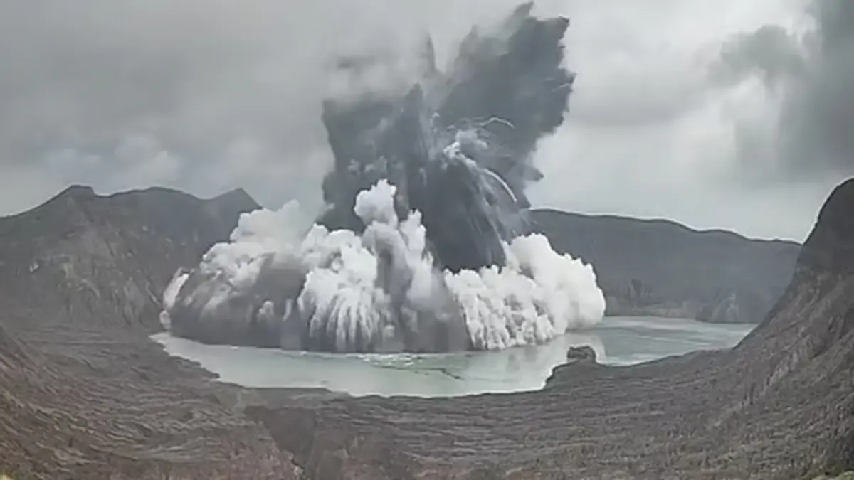
Why in news? On 2 July 2026, the Philippine Institute of Volcanology and Seismology reported a brief phreatomagmatic eruption at Taal Volcano. The explosion lasted around four minutes and sent a plume about 450 m into the sky. Although minor, it reminded authorities and residents of the volcano’s persistent hazards.
Background
Taal Volcano is located in Batangas Province on Luzon island, roughly 50 km south of Manila. It sits within a large volcanic caldera nearly 30 km in diameter that is now filled by Taal Lake【257044585378252†L90-L100】. Within the lake lies Volcano Island, which rises about 5 km across and contains its own crater lake【941902588488793†L107-L116】. Over the past four and a half centuries, Taal has produced at least 34 recorded eruptions, making it one of the Philippines’ most active volcanoes【257044585378252†L122-L139】.
What is a phreatomagmatic eruption?
A phreatomagmatic eruption occurs when magma comes into contact with groundwater, lake water or water‑rich rocks. The intense heat rapidly converts water into steam, causing explosive fragmentation of both magma and surrounding rock【219661471575879†L30-L61】. Such eruptions often produce fine ash, volcanic bombs and base surges. The 2026 event resulted from rising magma interacting with the crater lake on Volcano Island.
Geological features of Taal
- Complex volcano: Taal does not form a single cone but comprises several overlapping stratovolcanoes and maars, giving it a complex structure. Conical hills and crater lakes dot Volcano Island【586318716541884†L304-L317】.
- Caldera and lakes: The outer caldera formed during prehistoric eruptions between about 140,000 and 5,380 BCE【586318716541884†L320-L321】. Taal Lake, roughly 265 sq km in area, fills the depression and is about 100–150 m deep. Within it, Volcano Island contains a 1.2 sq km crater lake with a small volcanic plug called Vulcan Point.
- Activity and hazards: Because Taal lies on the Pacific Ring of Fire, it is frequently restless. Past eruptions have included base surges, ashfall and lahars. Dense populations live along the lake’s shore, so even modest eruptions can pose risks.
Conclusion
The July 2026 eruption underscores the need for continuous monitoring of Taal Volcano. Understanding its complex geology and the nature of phreatomagmatic explosions helps authorities plan evacuations and manage hazards. Residents and visitors should heed official advisories and respect exclusion zones around Volcano Island.
Sources: IE