Why in news?
On 21 June 2026 tourists hiking on Guatemala’s Volcan de Fuego were forced to run for safety when the volcano suddenly erupted. Video shared online showed glowing rocks raining down as hikers scrambled down the slopes. Although no serious injuries were reported, the incident underscored the risks of visiting an active volcano.
Background
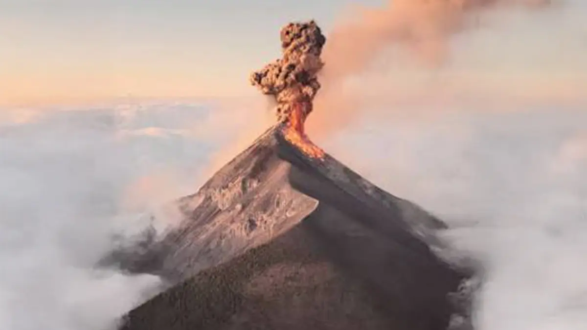
Volcan de Fuego, meaning “Volcano of Fire,” is an active basaltic‑and andesite stratovolcano in Guatemala. Rising 3,763 metres above sea level, it sits between the Acatenango and Agua volcanoes near the colonial city of Antigua. Guatemala lies on the boundary between the Cocos and Caribbean tectonic plates, part of the Pacific “Ring of Fire.” Fuego has an open vent system that allows gas and magma to escape continuously. It has erupted more than sixty times in the past 500 years. A major eruption in June 2018 produced pyroclastic flows that killed at least 194 people.
Recent activity
- Strombolian explosions: From 4 to 10 June 2026 the Smithsonian’s Global Volcanism Program recorded 4–12 explosions per hour that sent gas and ash plumes up to 1.1 kilometres above the summit.
- Block avalanches and lahars: Ash and rock rolled down the flanks of the volcano into valleys. Heavy rain triggered lahars – torrents of mud and debris – in drainages such as Las Lajas and Santa Teresa.
- Continuous venting: Fuego’s open vent allows frequent release of pressure, resulting in small eruptions many times a day. This regular activity lures tourists but can become dangerous without warning.
- Risk management: After the June 21 eruption, authorities reminded visitors to stay in designated zones and respect local warnings. The 2018 disaster led to improvements in monitoring and evacuation planning, but incidents like this illustrate that hazards remain.
Conclusion
Volcan de Fuego’s spectacular eruptions attract travellers, yet its activity is a constant reminder of the power of tectonic forces. Respecting safety advisories and supporting monitoring efforts can reduce the risk of tragedy while allowing people to appreciate one of Central America’s most active volcanoes.