

Why in news?
Ladakh’s administration has resumed proceedings to determine rights within the Changthang High Altitude Cold Desert Wildlife Sanctuary. A notice published on 17 September described directions issued at a meeting in Nyoma the previous day. The process will examine land ownership, customary use and traditional grazing alongside wildlife habitats and security requirements. This matters because the protected landscape also contains settlements, pastoral areas and government installations. The immediate action is an inquiry into existing rights, with claims, surveys and hearings. It is not an announcement that the sanctuary has been abolished, that all claims are accepted or that residents have been ordered to leave.
A cold desert is still a living landscape
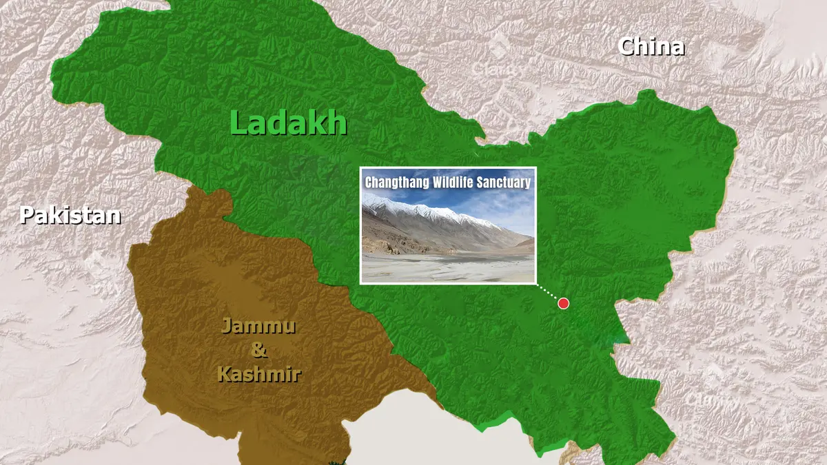
Changthang lies in the high-elevation landscape of eastern Ladakh, adjoining the wider Tibetan Plateau. Ladakh is a Union Territory, not part of the present Union Territory of Jammu and Kashmir. The term Changthang describes a broad geographical region as well as appearing in the sanctuary’s name. The region’s extent should not be substituted for the legally notified protected-area boundary.
The landscape combines open high-altitude terrain with wetlands and grazing areas. “Cold desert” describes a dry environment with severe cold; it does not mean an absence of life. Water and vegetation are concentrated unevenly, making particular meadows, streams and lake margins important to animals and pastoral communities. Conservation therefore involves connected habitats, not only conspicuous mountain scenery.
Why the wetlands matter
The Tso Kar Wetland Complex illustrates this ecological variety. Its official Ramsar record describes freshwater Startsapuk Tso to the south and highly saline Tso Kar to the north. Evaporation leaves visible salt around Tso Kar’s edges. Two nearby water bodies can therefore support different conditions within the same basin, and should not both be described simply as freshwater lakes.
The wetland complex supports breeding and migratory birds, including the black-necked crane. Surrounding habitats are also used by animals such as the kiang, or Tibetan wild ass. The Ramsar site has its own defined boundary and an area of 9,577 hectares. That figure describes the wetland complex, not the total area of Changthang Wildlife Sanctuary.
The same record documents pastures used by Changpa pastoralists around the lakes. This is why conservation and livelihood questions meet in the landscape rather than existing in separate spaces. Recognising that overlap does not decide every legal claim. It explains why an inquiry must examine actual patterns of use alongside the ecological importance of particular places.
What the rights inquiry will do
The administration says public notices will invite individuals and communities to submit claims within the applicable statutory period. Revenue and other departments will prepare a village-wise inventory of private, community, government and pastoral land. The notice does not provide a new calendar deadline for readers to assume. Claimants will need to follow the formal proclamation and instructions issued for their locality.
The announcement refers to the sanctuary’s historical notification under the Jammu and Kashmir Wildlife (Protection) Act, 1978. It also identifies the Collector’s earlier designation and the departmental direction issued in August 2026. These references explain the administrative continuity of the proceedings. They should not be read as the passage of a new wildlife law in September.
A map records location; a hearing determines the claim
The proposed work combines ground verification with satellite imagery and geographical information systems, which organise location-based information in map layers. Global Positioning System measurements help locate features on the ground. A map can show a path, pasture or building, but it does not by itself prove ownership or a customary right. Documentary evidence and the opportunity to be heard remain important.
Wildlife officials will separately map critical habitats and movement corridors. Comparing these layers can reveal where human use overlaps sensitive ecological areas. The administration also requires coordination with police and defence authorities where surveys concern security-sensitive installations. The public purpose is to resolve competing requirements through an organised process, not to disclose sensitive operational locations.
Participation and protection must proceed together
The Collector has promised hearings and reasoned final orders. A reasoned order explains why a claim is accepted or rejected, instead of giving only a bare result. The announcement also states that the exercise will not validate fresh encroachments or unauthorised construction after relevant cut-off dates. Resuming an old inquiry is therefore not an invitation to establish a new claim by occupying land now.
Habitat management remains necessary while that process continues. In June, the administration reported action against illegal vehicle movements in protected areas, including lake-edge driving and an alleged wildlife chase. Such incidents are different from established pastoral use that requires examination through the rights process. Treating all activity alike would obscure both legitimate livelihood questions and preventable damage.
Conclusion
The Changthang inquiry seeks a clearer record of rights within a sensitive and inhabited protected landscape. Its value will depend on accessible notices, reliable field evidence, fair hearings and transparent reasons for decisions. Ecological maps and community knowledge both have a role. Neither a map alone nor a general conservation slogan can settle the specific rights being examined.