

Why in news?
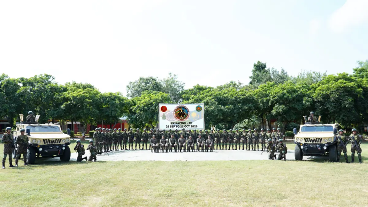
A sixty-member Indian Armed Forces contingent departed for Oskemen, Kazakhstan, on 28 September for the ninth KAZIND exercise. The India–Kazakhstan programme was scheduled for 28 September to 11 October, with a matching Kazakh contingent. Its focus was joint counter-terrorism training in semi-urban and mountainous settings, including coordination between ground personnel and air support. Such an exercise allows forces with different procedures to practise working together before any real contingency. The announced activities use a simulated threat and a United Nations-mandate scenario. They are a training programme, not evidence that either contingent has begun a United Nations operation in Kazakhstan.
The geographical setting
Kazakhstan lies in Central Asia, with land borders shared with Russia, China, Kyrgyzstan, Uzbekistan and Turkmenistan. Russia lies broadly to its north and west, China to the east, and the three other neighbours to the south. Kazakhstan has a Caspian Sea coast but remains landlocked: the Caspian does not provide a direct ocean coast.
Oskemen, also known as Ust-Kamenogorsk, is in eastern Kazakhstan at the meeting of the Irtysh and Ulba rivers. Its wider regional setting includes the Altai mountain landscape. These geographical references help place the exercise without confusing the city with Kazakhstan's capital. The announced training's mountain component also makes terrain a relevant part of the story, rather than an unrelated country profile.
What interoperability means in practice
The exercise's stated objective is to improve interoperability, meaning the ability of different forces to work together effectively. Sharing an objective does not automatically produce shared procedures. Personnel need to understand how information is passed, who makes decisions and how separate activities are coordinated. Training gives them a controlled setting in which to identify misunderstandings before those misunderstandings carry operational consequences.
The Indian group was drawn mainly from the Garhwal Rifles, alongside other arms, services and Air Force personnel. The announced programme included a joint command post, surveillance coordination, air mobility and the use of unmanned aerial systems. These elements belong together: information must reach decision-makers, and decisions must translate into coordinated movement and action.
A command post is the organisational point from which an operation is planned and directed. Surveillance supplies observations about the surroundings and possible threats. Air mobility concerns moving personnel or material by air. None of these functions works in isolation. Their value depends on reliable communication and a common understanding of what the other participants are doing.
Different terrain creates different coordination problems
Mountainous and semi-urban settings are not interchangeable training environments. Mountain terrain can restrict routes and lines of sight, while built-up areas place operations close to buildings and civilians. These differences help explain why rehearsing one routine is insufficient. Forces must adapt their procedures to the setting and the limits under which they are expected to operate.
The defence ministry also identified drones and counter-drone capabilities in the programme. A drone can provide an additional observation platform; responding to an unwanted drone raises a different problem. The inclusion of both highlights the need to connect observation, identification and response. It does not establish that every technical system has been demonstrated successfully under combat conditions.
A mandate scenario is not a deployment mandate
A United Nations mandate sets out the authorised purpose and tasks of an actual mission. The organisation's peacekeeping framework also emphasises consent, impartiality and limits on force, with force permitted for self-defence and defence of the mandate. These principles explain why tactical skill alone does not define an international operation. Authority and operating rules are also essential.
For KAZIND, the ministry described training under a United Nations-mandate scenario. That wording should not be mistaken for a separate United Nations decision to deploy this exercise. A simulated setting allows personnel to practise relevant procedures. It neither changes the legal status of Kazakhstan nor demonstrates that a real mission has been authorised there.
Conclusion
KAZIND's immediate purpose is to rehearse coordination between Indian and Kazakh personnel in demanding settings. The useful measure of such training is whether participants improve shared procedures and identify weaknesses during practice. The programme was scheduled to conclude with a simulated validation exercise. Its announcement establishes the training's scope and aims, while any claim about achieved operational capability would require evidence from its conduct and assessment.