

Why in news?
Ladakh’s administration announced a project to send glacial-stream water towards the shrinking Tso Kar lake in the Changthang region. Its 14 September 2026 statement described a route through natural depressions, check dams and connecting channels. The aim is to support the lake, nearby pastures and communities dependent on this high-altitude landscape. Officials quoted a planned diversion capacity of about 320 million litres a day. The initial flow reported from 9 September was much smaller: 20 cubic feet per second into the first depression. That was not a report that the full proposed volume had already reached the lake. The intervention had begun, but ecological recovery remained an intended outcome requiring measurement.
Two connected lakes, with different kinds of water
Tso Kar is part of a wetland complex on Ladakh’s high plateau, not an isolated freshwater reservoir. The Ramsar information sheet distinguishes the saline Tso Kar in the north from freshwater Startsapuk Tso to its south. A small connecting channel allows water exchange. Their different water conditions help support a varied wetland environment.
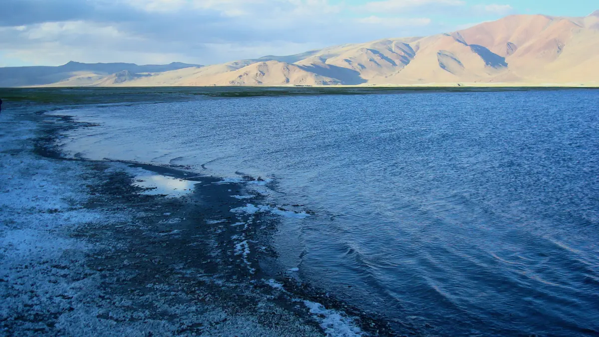
The name Tso Kar refers to a white lake, associated with salt deposits around its margins. Evaporation removes water while leaving dissolved salts behind. In a basin without an effective outward drainage route, this process can concentrate salts. Adding freshwater therefore changes more than the visible water level: it can also affect salinity and habitat conditions.
The complex received Ramsar designation on 17 November 2020. Its information sheet records a site area of 9,577 hectares. That is the designated wetland complex, including associated habitats, not the changing surface area of Tso Kar alone. Comparing these different areas as though they measured the same thing would be misleading.
How the proposed diversion is meant to work
The administration identified glacial water in the Rupsho–Kharnak area for diversion towards the lake. The scheme uses the natural slope to move water through a sequence of depressions. These act as intermediate storage areas before water travels further along the route. Check dams and connecting works are intended to regulate its movement.
Gravity-based movement can reduce the need for pumping, but it does not make a project free of engineering requirements. Channel gradients, blockage, erosion and the stability of structures still matter. A route that carries water successfully during one flow condition may need maintenance or adjustment when sediment loads and discharge change.
The official account describes reuse of existing channels alongside other works. It should therefore not be read as a claim that no built structures are involved. Similarly, allowing sediment to settle in a depression does not by itself establish drinking-water quality. Sediment removal and the removal of dissolved chemicals or pathogens are different processes.
Capacity, actual flow and recovery are separate measures
The announcement’s large daily-volume figure describes the intended scale of diversion. Its reference to an initial 20-cusec flow concerns water entering the first depression. A cusec means one cubic foot per second. Neither figure is a direct measurement of the amount ultimately retained in Tso Kar after storage changes, seepage and evaporation.
The administration also reported a substantial historical reduction in the lake’s area and expressed hope for revival within a year. These are an official assessment and a forecast, respectively. Consistent satellite measurements, dated shoreline surveys and a water balance would be needed to establish the scale and persistence of recovery.
A water balance compares inputs, outputs and changes in storage. For this scheme, it would include diverted water, other inflows and precipitation, alongside evaporation and seepage. Seasonal variation is especially important where meltwater contributes to supply. A peak-season flow cannot automatically be assumed to continue unchanged throughout the year.
Restoring a wetland means more than filling a basin
The Ramsar record identifies the complex as an important site for migratory waterbirds and breeding black-necked cranes. It also records use of the wider landscape by wild mammals and Changpa pastoralists. The lake margins, freshwater areas and surrounding pastures are connected parts of this setting, rather than interchangeable stretches of empty land.
These ecological relationships make water quality and timing as important as quantity. Raising water levels may help some habitats while altering others. A useful monitoring programme would therefore track salinity, shoreline vegetation, bird use and grazing conditions alongside lake area. More water is not, by itself, a complete measure of restoration success.
The source stream also belongs to a wider drainage system. The administration’s account places its existing flow towards the Indus. Describing that water as unused does not establish that diversion has no downstream effects. Those effects, and local users’ needs, belong within the assessment of the project’s overall benefits and costs.
Conclusion
The Tso Kar project links a visible water shortage with a practical diversion proposal. Its success will depend on water actually reaching the wetland and sustaining its ecological character. Transparent seasonal measurements can show whether the scheme restores a functioning lake-and-pasture system, rather than merely meeting an engineering flow target.