

Why in news?
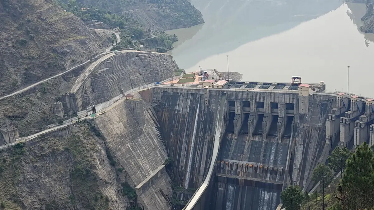
The Deputy Commissioners of Udhampur and Ramban visited the Sawalkote Hydroelectric Project headquarters at Tanger. Senior district and project officials reviewed pre-construction work, coordination and local issues. The proposed project lies on the Chenab in Jammu and Kashmir. Its official installed capacity is 1,856 megawatts, although early reports sometimes rounded the figure to 1,800 megawatts.
The visit did not mean that the main dam had entered construction. NHPC Limited still lists Sawalkote as a project awaiting required approvals. Geological investigations and preparatory activities are continuing. The distinction is important because a headquarters, surveys and early works can exist before investment approval. Full construction depends on clearances, finance and final contractual decisions.
Location and project design
Sawalkote is planned on the Chenab near Sidhu and Tanger in Ramban district. The wider project area also affects Udhampur and Reasi districts. Official appraisal records place the main site near 33 degrees north and 75 degrees east. This is rugged Himalayan terrain with steep valley sides. The river runs through a geologically young and seismically active mountain region.
NHPC describes the scheme as a run-of-river project with pondage. The plan includes a concrete dam about 192.5 metres high and an underground powerhouse. Eight generating units would have 225 megawatts each. A ninth unit would add 56 megawatts. Together they produce the official figure of 1,856 megawatts.
The project’s stated design energy is about 7,994.73 million units in a 90 per cent dependable year. That figure describes expected generation under defined hydrological assumptions. Actual annual output would vary with river flows, outages and operating rules. Installed capacity should never be confused with constant production. Hydropower generation changes across seasons.
The Chenab’s geography
The Chenab begins where the Chandra and Bhaga rivers meet at Tandi in Himachal Pradesh. Their headwaters rise in the high, cold mountains of Lahaul and Spiti. The combined river enters Jammu and Kashmir and cuts through deep valleys. It later flows into Pakistan and joins the Indus river system. Sawalkote therefore sits on a major transboundary basin.
Within Jammu and Kashmir, several hydropower projects use the Chenab’s steep fall. Baglihar lies upstream of Sawalkote, while Salal lies downstream. This sequence makes cumulative planning essential. Operations at one structure can influence flow timing and sediment conditions at another. Basin studies should examine combined effects rather than reviewing each project only in isolation.
Indus Waters Treaty context
The Indus Waters Treaty of 1960 classified the Indus, Jhelum and Chenab as western rivers. It permitted India specified domestic, agricultural and non-consumptive uses, along with hydropower under detailed conditions. India placed the treaty in abeyance in April 2025 after the Pahalgam terrorist attack. The government said that position would continue until Pakistan met the stated condition on cross-border terrorism.
The treaty’s present political status adds strategic attention to Chenab projects. However, engineering requirements do not disappear with a diplomatic decision. A large dam still needs sound geology, environmental review and social safeguards. Project documents must clearly identify which design assumptions remain applicable. Public discussion should separate national water policy from the project’s own readiness.
Potential benefits
Sawalkote could add substantial renewable electricity to the northern grid. Hydropower can respond more quickly than many thermal plants when demand changes. Stored pondage may help generation during selected hours. Construction can also create local contracts, roads and employment. These benefits depend on timely completion and realistic control of cost.
Large hydropower can support a power system with growing solar and wind capacity. Yet output depends on water availability and reservoir rules. Climate change may alter snowmelt and extreme rainfall across the basin. Planners should test the project under varied future flow scenarios. A high capacity figure alone does not guarantee dependable energy in every season.
Environmental and social questions
A tall dam and reservoir can submerge land, alter sediment movement and affect river habitats. Roads, tunnels and spoil disposal disturb slopes during construction. Forest diversion requires compensatory measures, but replacement planting cannot recreate mature habitat immediately. Environmental flows must support downstream ecology and users. Monitoring should remain public throughout construction and operation.
Project-affected families need accurate land surveys and understandable rehabilitation terms. Compensation should reflect legal rights and actual livelihood loss. Construction jobs are temporary, so skill development must have value beyond the project. Grievance systems should work locally and in relevant languages. District coordination matters because impacts extend across more than one administrative boundary.
Himalayan geology needs continuous investigation. Tunnels can encounter weak rock, groundwater and unexpected faults. Design changes after construction begins can cause delay and cost escalation. Independent review and instrumentation can identify movement or seepage early. Emergency plans should include downstream warning, evacuation routes and coordination with existing dams.
What must happen before main construction
NHPC’s current status information shows that Sawalkote remains within the clearance and approval process. Preparatory tenders and site activity do not replace final investment approval. Updated costs, power-sale arrangements and financing must be credible. Statutory environmental, forest and other conditions need documented compliance. Procurement should begin at a scale matched to actual readiness.
The official schedule allows 96 months from investment approval. Such a long period requires stable oversight and regular public reporting. Authorities should publish milestones for land, clearances, contracts and rehabilitation. Independent audits can distinguish genuine progress from repeated announcements. Transparent sequencing also prevents local communities from living indefinitely under uncertain acquisition plans.
Proposed does not mean under construction
Officials reviewed preparation at the project headquarters. Surveys and early works can occur before the main construction decision. NHPC’s own status still places the 1,856-megawatt scheme before final approval. Reporting should preserve this stage clearly.
Conclusion
Sawalkote is a major hydropower proposal with national and local significance. Its Chenab location gives it energy value and transboundary attention. Those features also raise the standard of scrutiny required. Geological safety, river ecology and rehabilitation cannot be treated as later details. Strong preparation is useful only when it produces defensible decisions.
The district visit should therefore be read as coordination during an unfinished process. Clearances and final approval remain decisive milestones. Public reporting should use the exact capacity and current status. If the project proceeds, transparent construction and cumulative basin monitoring will be essential. Good governance must advance at the same pace as engineering ambition.