

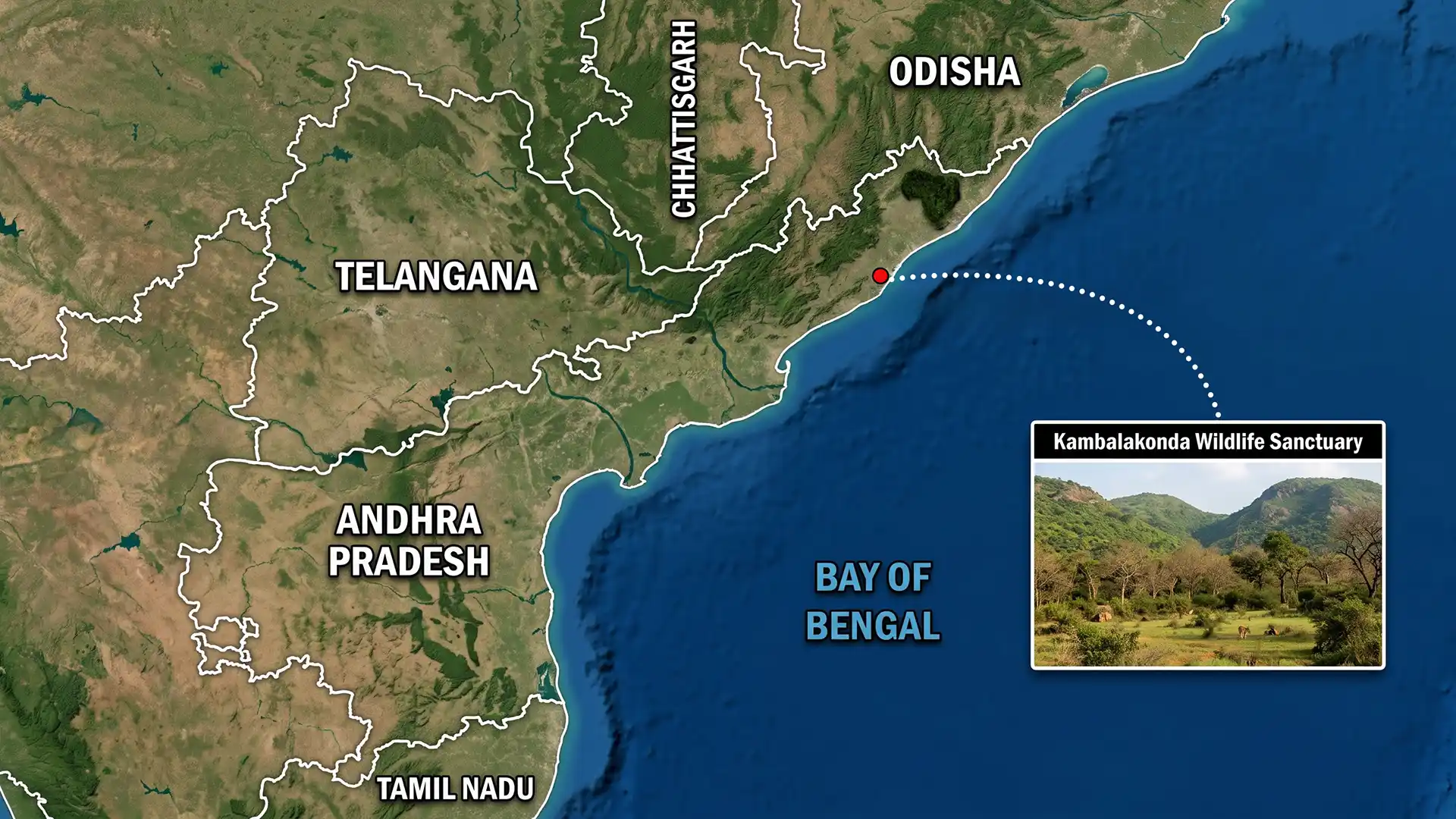
Why in news?
The Andhra Pradesh High Court reportedly advanced a hearing concerning Kambalakonda Wildlife Sanctuary. The case involves land and proposed data-centre development nearby; the hearing was moved from 2 September to 24 August 2026. The activist-petitioner said the court also sought counter-affidavits.
These are reported procedural steps in a pending case; they are not a judgment on legality or environmental effects.
The sanctuary and its urban setting
Kambalakonda Wildlife Sanctuary covers 71.39 square kilometres near Visakhapatnam; it was notified in 2002. It protects dry evergreen and mixed scrub-forest habitats; these occur across Eastern Ghats hills, slopes and valleys.
The sanctuary sits within a rapidly expanding urban region; this makes its ecological functions especially important.
A Wildlife Institute of India assessment calls it an important green lung. The assessment also notes pressure from nearby settlements and infrastructure.
A Union Government notification dated 28 April 2017 records rich biodiversity. It lists 73 tree species and 39 herbs and shrubs. The list also includes 18 climbers, two bamboos and seven grasses; it records 23 mammals and seven reptiles.
More than 90 bird species were recorded; these figures describe the inventory then available, not a permanent ceiling.
Future surveys may revise the totals. Habitat value also depends on connected slopes, drainage, stable soil and wildlife movement.
How the eco-sensitive zone is designed
The 2017 notification establishes a 30.51-square-kilometre Eco-Sensitive Zone (ESZ) around the sanctuary; it lists 14 villages within the framework. The zone’s width is not uniform; it falls to zero where the northern boundary meets a national highway.
Elsewhere, it extends up to 4.33 kilometres. Therefore, the notified map must guide any site-specific decision.
Every protected area does not automatically have the same ten-kilometre buffer; such a claim would misstate this notification.
An Eco-Sensitive Zone is a transition and shock-absorbing area; it does not necessarily stop every human activity. The Kambalakonda notification prohibits commercial mining and specified polluting industries; other activities are regulated rather than universally prohibited.
Regulated matters include tree felling, land-use conversion, major commercial construction and infrastructure; the notification also protects springs, catchments and channels.
A zonal master plan should guide development. A monitoring committee should examine compliance.
| Legal or planning question | Why it matters |
|---|---|
| Exact survey number and ESZ map | Location decides the applicable rule. The land may fall within the sanctuary, notified ESZ, a one-kilometre construction-restricted belt or an adjoining catchment. |
| Land-use status and conversion | Ownership or allotment does not by itself answer whether conversion and construction comply with the ESZ notification and local plans. |
| Water and drainage | Levelling, roads and large roofs can alter runoff towards the Mudasarlova catchment and natural streams even outside a habitat patch. |
| Project-specific approvals | Environmental clearance, wildlife scrutiny, building permission and other approvals depend on size, location and the laws actually triggered. |
What the petition alleges
Reports say the public-interest litigation challenges an allotment of about 160 acres; the land is associated with Simhachalam Devasthanam. The proposed use is a hyperscale data-centre park; the petitioner alleges land levelling, tree felling and construction activity.
The petition also alleges risks to natural streams, the sanctuary and Mudasarlova reservoir. No final court finding has established these claims.
Respondents’ affidavits will help test them; official maps, permissions and technical studies will also be important.
Advancing a hearing does not show that the court accepted either side’s case. Courts adjust dates and seek responses routinely. Responsible discussion must separate four things; they are the proposal, allegations, any interim direction and a final judgment.
Procedural accuracy matters
The available report attributes the new date and counter-affidavit direction to the activist-petitioner; the public court order requires examination. Until then, those details should remain described as reported; a petition alone does not prove illegality or ecological damage.
Data centres and environmental scrutiny
Data centres support digital services, cloud computing and artificial intelligence; they can also attract large investment. They need highly reliable electricity, backup systems and cooling; some designs also require substantial water.
Transmission infrastructure and large built surfaces can add impacts; the footprint varies with technology, climate and water source.
The power mix and design also matter. Therefore, a single water or electricity figure cannot describe every data centre.
A hill-and-reservoir setting requires assessment beyond the building plot. Slope cutting and soil compaction can increase runoff and erosion. New roads and utilities may fragment habitat. Lighting and noise can affect wildlife.
Water withdrawal or heated discharge can burden local systems; the extent depends on the actual project design.
A project cannot be rejected merely because a sanctuary lies nearby; its legal location and regulated activities must be established.
Applicable approvals and credible impact evidence must also be examined; that approach protects both legality and environmental quality. Good planning should publish georeferenced boundaries and survey numbers. Maps should show both the project and supporting infrastructure.
Water and energy balances should be disclosed. Designs should retain natural drainage and account for extreme rainfall.
Authorities should compare alternative sites and designs. Residents and independent specialists should be able to examine the evidence.
The Union Environment Ministry reconstituted the Kambalakonda monitoring committee in 2025; its actions form part of the present governance context.
A wider lesson for rapidly growing cities
Visakhapatnam needs economic infrastructure and ecological security. Hills and forest patches moderate heat. Reservoirs and streams store and channel water; together, these natural systems can reduce disaster risk.
Fragmentation can make their functions costly or impossible to restore. Unclear maps and unpredictable approvals can also create avoidable litigation.
Accessible land records and updated zonal plans would reduce uncertainty. Early environmental screening protects both nature and responsible investment.
Conclusion
The Kambalakonda case has produced a reported hearing change, not a verdict; its merits remain open. The court and authorities need the exact location, notified rules and land records. Clearance documents and cumulative impacts also matter.
Transparent scrutiny is not opposed to development; it helps an ecologically constrained city decide where safe development is possible.