

Why in news?
A vehicle carrying ten people fell into the Lohit River in Arunachal Pradesh on 13 August 2026. The accident occurred near Sarti on the Walong–Hawai road in Anjaw district. The district’s initial account recorded one death, six injured survivors and three missing people. The incident highlights difficult rescue conditions along this steep, strategically important river valley.
What happened and why the location matters
The vehicle left National Highway 113 and fell into a gorge. An account issued through the District Disaster Management Authority described a coordinated rescue effort. Police, the Army, state disaster responders and local residents participated. The reported casualty figures describe that initial response.
A river accident in such terrain creates several simultaneous problems. Rescuers must reach the road edge, descend safely and locate people in moving water. Injured survivors then need evacuation to medical care. Each stage requires different equipment, trained personnel and reliable communication.
The incident’s cause should be separated from its consequences. The available account establishes the crash and rescue operation. It does not establish a final technical finding about road design or driver conduct. A proper investigation must examine those questions independently.
Following the Lohit from Tibet to Assam
The Lohit is an important eastern tributary of the Brahmaputra river system. Its upper catchment lies in Tibet, China. It enters Arunachal Pradesh near the Kibithoo sector. The river then passes through mountainous terrain before reaching the Assam plains.
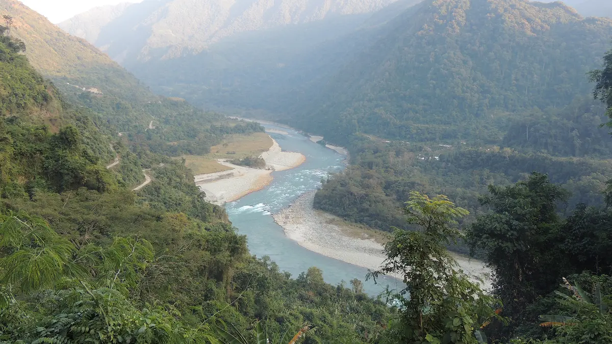
The upper river cuts through the Mishmi Hills in steep valleys. Rapids and confined channels reflect the sharp fall in elevation. Around the Parshuram Kund area, the river approaches the plains. Its character changes as the valley becomes broader and less steep.
Farther downstream, the Lohit connects with the Dibang and Siang river system in eastern Assam. Their combined waters form the Brahmaputra’s major upper course within Assam. The river therefore links a high mountain catchment with extensive downstream floodplains. Upstream and downstream conditions cannot be understood separately.
Anjaw lies in Arunachal Pradesh’s eastern border region. Tibet lies to its north, and Myanmar lies to its east. The district headquarters is Hawai. Roads along the Lohit connect settlements such as Hawai and Walong with the wider transport network.
How the mountain river behaves
The basin receives both rainfall and water from snow-fed upper areas. Monsoon rainfall can increase discharge and sediment transport. Narrow gorges leave little space for water to spread sideways. This can produce powerful currents even where the channel looks relatively narrow.
Once the river enters the plains, flowing water can spread across a wider channel. Sediment carried from the hills contributes to bars and changing riverbanks. Flood management therefore needs different approaches in mountains and plains. A single engineering solution cannot suit the entire basin.
Roads in steep valleys also face interacting hazards. Intense rain can affect slopes, drainage channels and the road surface together. Blocked drainage may concentrate runoff at vulnerable points. These are general risk pathways, not established explanations for this particular accident.
Safety, access and practical priorities
Border connectivity serves civilians as well as security requirements. Reliable roads support healthcare, education, supplies and emergency movement. Their value depends on safe everyday use, not merely construction. Maintenance and rescue planning should therefore accompany road expansion from the beginning.
Road inspections should identify exposed bends, unstable slopes and damaged protective barriers. Drainage must remain functional during heavy rainfall. Warning systems should communicate temporary hazards clearly to drivers. Local reporting can help authorities identify fresh cracks, debris and blocked culverts quickly.
Emergency preparation must account for the river below the road. Rescue teams need suitable access points and arrangements for medical evacuation. Communication links require backup where terrain interrupts mobile coverage. Regular coordination between district agencies can reduce delays during a real incident.
Communities have valuable knowledge of river crossings and seasonal changes. Their participation can improve both prevention and response. However, volunteers should not be expected to undertake dangerous water rescues without training. Public participation works best alongside properly equipped professional teams.
Conclusion
The Lohit is both a vital river corridor and a demanding mountain environment. The August accident underlines the importance of safe access and coordinated rescue. Better roads must be supported by maintenance, communication and local preparedness. River-basin knowledge can guide these decisions at every stage. Protecting lives should remain central to development in the border valley.