

Why in news?
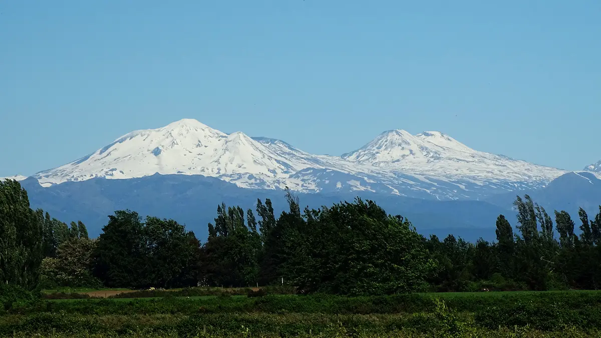
Chile's Nevados de Chillán volcanic complex produced an ash-emitting pulse on 18 September 2026. Chilean public broadcaster 24 Horas reported the geological service's account of a column rising about 380 metres above the crater. The emission lasted roughly 45–50 minutes, and the authorities reported no harmful impact on nearby people or territory. The complex remained under a Yellow Technical Alert, indicating activity above its normal baseline and a need for enhanced monitoring. The pulse occurred within an existing period of unrest; the alert did not escalate because of this emission. Its significance lies in how changing activity is assessed in an inhabited, snow-covered Andean landscape.
Locating the volcano
Nevados de Chillán lies in Chile's Ñuble Region, in the Andes of South America. Chile occupies a long strip along the continent's Pacific side, with Argentina across much of its eastern mountain boundary. Peru and Bolivia are its other land neighbours farther north. The complex is near 37 degrees south latitude, well south of those northern borders. It belongs to the volcanic belt associated with the Pacific margin, rather than an isolated volcanic island.
The Smithsonian's Global Volcanism Program describes a compound volcanic system with several cones, lava domes and older calderas. A caldera is a large depression associated with the collapse of a volcanic system after magma withdrawal. A lava dome forms when relatively thick lava accumulates near a vent rather than spreading easily. The name Nevados de Chillán therefore refers to a complex landscape, not one simple cone with an unchanging opening at its summit.
The plate boundary beneath the Andes
Along this part of South America, the oceanic Nazca Plate descends beneath the South American Plate. This process is called subduction. Water and other volatile substances released from the descending plate promote melting in the mantle above it. Some of the resulting magma rises through the continental crust. The same converging boundary also produces powerful earthquakes and contributes to mountain building. However, an earthquake does not automatically mean that a nearby volcano will erupt.
Magma contains dissolved gases. As it rises and pressure falls, those gases can expand. If gas escapes gradually, activity may be less explosive; if pressure accumulates behind obstructed pathways, it can fragment material violently. Real volcanic systems are more complicated than a single pressure chamber, and magma can also interact with groundwater. This is why scientists use several measurements rather than predicting an eruption from one photograph of a plume.
What ash height does and does not tell us
The reported 380 metres was measured above the crater, not above sea level. The distinction matters because the crater already stands high in the Andes. Plume height describes one feature of an event; it does not alone measure its total erupted volume or damage. Wind also changes where fine material travels. A modest column can affect a nearby area in one wind direction while leaving another place untouched.
Volcanic ash is made of small fragments of rock, minerals and volcanic glass, rather than the soft residue of burnt wood. It can irritate eyes and airways, contaminate equipment and disrupt transport. The severity depends on concentration, exposure and the amount deposited. Ash suspended in the atmosphere also presents an aviation hazard. None of these general hazards establishes that every one occurred during the September pulse; the contemporary report described no nearby harmful impact.
Why the ground and valleys also matter
Not all volcanic danger rises into the sky. A pyroclastic flow is a hot, fast-moving mixture of gas and fragmented volcanic material travelling near the ground. A lahar is a flow of water mixed with volcanic debris, usually channelled down valleys. They are different processes and should not be used as alternative names for a lava flow. Their routes depend strongly on terrain, so distance from the summit alone is an incomplete measure of exposure.
Snow and ice can provide water if heated or melted during an eruption. Heavy rain can also remobilise loose volcanic material after an eruptive episode has ended. Consequently, some hazards persist beyond the visible emission of ash. Understanding drainage channels, steep slopes and settlements downstream is part of risk planning. A clear sky does not necessarily show that every deposit on a volcano's slopes has become stable.
Reading the alert in its proper context
Chile's National Geology and Mining Service, known by its Spanish abbreviation Sernageomin, had raised the complex's alert to Yellow in June. Its announcement described increased seismic activity and evidence consistent with new magma beneath part of the system. Yellow signalled instability above the baseline, requiring closer surveillance. The September broadcaster's account said the alert remained at that level. It did not report a fresh escalation caused by the 380-metre pulse.
Technical monitoring and emergency response have related but different roles. Scientists assess changes in the volcano through instruments and observations. Civil-protection authorities use that information alongside exposure and local conditions when deciding protective measures. An alert colour is not a precise eruption clock. Its purpose is to communicate the state of concern and guide preparedness, with updates as evidence changes.
Conclusion
Nevados de Chillán remained an unsettled volcanic system after a limited ash emission that caused no reported nearby harm. Continuing monitoring matters because later activity can differ in size, material and direction. Its surrounding valleys and snow-covered slopes also shape the hazards that authorities must assess. The September pulse is therefore one observation within a changing system, whose risk cannot be judged from a plume's appearance alone.