

Why in news?
A study published on 24 September 2026 found that metal-rich drainage can affect Arctic rivers far beyond its point of entry. A University of California, Davis team and its partners examined six watersheds in Alaska's Brooks Range during 2022–24. They investigated a process in which water encounters minerals exposed as frozen ground thaws, releasing acidity and metals into streams. Some effects persisted for more than 100 kilometres along the Salmon River. Importantly, the main river could neutralise much of the acidity while elevated metal concentrations remained. The finding shows why a river's colour or acidity alone cannot describe its condition. It does not establish that every Arctic river or downstream community faces the same exposure.
Permafrost is a ground-temperature condition
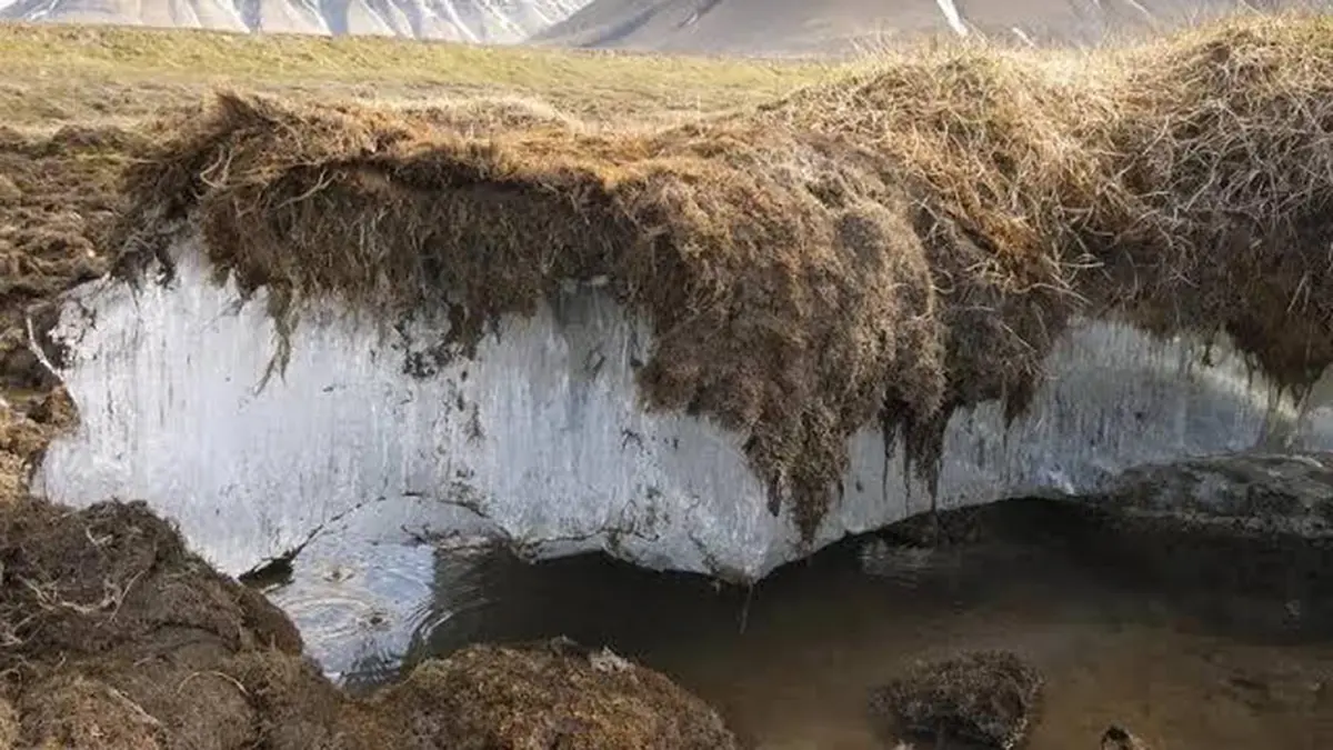
Permafrost is ground that remains at or below 0°C for at least two consecutive years. It can consist of soil, sediment or rock, with varying amounts of ice. The term does not mean a glacier, permanent snow cover or a solid underground block of ice. It describes the temperature history of the ground, which is why apparently different landscapes can contain permafrost.
The ground above permafrost commonly thaws during summer and freezes again in winter. This seasonally changing layer is called the active layer. When warming allows thaw to penetrate farther, water can follow different routes and contact material that was previously frozen. Much permafrost lies in the Arctic, but it also occurs in high mountains and some Antarctic environments.
The mountain-to-river connection in Alaska
The study concerns northwestern Alaska's Brooks Range, a mountain landscape with connected slopes, streams and larger rivers. This geography matters because a chemical change beginning on a hillside need not remain there. Groundwater can emerge through a seep, enter a tributary and then reach a main river. The eventual effect depends on the materials and waters encountered along that route.
The wider regional drainage illustrates this connection. The Noatak flows west through the Brooks Range landscape between the De Long and Baird mountains, before turning towards Kotzebue Sound. Smaller tributaries feed such larger systems. Studying headwater changes therefore requires following the water downstream. A small discoloured source can influence a much longer river section through the material it releases.
Why some streams turn orange
Minerals containing sulfur, including pyrite, can react when exposed to oxygen and water. This weathering can generate acidity and release metals. Scientists call the resulting process acid rock drainage. Mining can expose reactive minerals, but a mine is not required for the chemistry to occur. Changes in thaw depth and groundwater movement can also bring water into contact with such material.
Iron compounds contribute to the orange appearance recorded in affected streams. Earlier National Park Service research connected this discoloration with altered chemistry and effects on aquatic life. The visible colour is a useful observation, but it does not reveal every dissolved substance. Water that looks less orange farther downstream may still carry material released upstream.
What the new measurements establish
The researchers compared hillside seeps, tributaries and river sections upstream and downstream of affected inputs. Acidic seeps differed sharply from the main rivers. The main channels had enough buffering capacity to prevent comparable acidification. Buffering means that chemical processes neutralise added acidity and resist a large change in pH, the measure used to describe acidity.
That resilience did not remove all the other chemical changes. The study found elevated concentrations of some metals and sulfate downstream, including persistent effects along a 103-kilometre Salmon River sampling reach. Substances travelled in different forms, including material dissolved in water and material associated with particles. A stable pH therefore did not mean that the river's composition was unchanged.
What remains uncertain, and why monitoring matters
The University of California, Davis account links the recent changes with thaw and increased contact between water and minerals. The timing also coincided with unusually warm and snowy conditions. Snow can insulate the ground, affecting winter refreezing. However, the study could not directly inspect every underground pathway or mineral source. Its chemical evidence supports a mechanism without supplying a complete map of the subsurface process.
The implications concern both ecosystems and people who depend on rivers. Earlier work documented local declines in fish and aquatic invertebrates in affected waters. That does not demonstrate widespread illness or uniform damage across all catchments. Exposure depends on the particular water, substances, concentrations and uses involved. Measurements of water chemistry and biological conditions are needed to identify where consequences are occurring.
Monitoring must also capture change through time. The university describes a sharp rise in chemical indicators followed by some recovery, rather than a simple uninterrupted increase everywhere. Repeated sampling can distinguish a persistent problem from a temporary pulse and reveal whether downstream conditions improve. A single photograph or water sample cannot answer those longer-term questions.
Conclusion
The Alaska findings connect permafrost thaw with a less obvious consequence of warming: changing river chemistry. Neutralising acidity does not necessarily prevent metals from travelling downstream. Following the chemical pathways alongside ecological effects can help identify vulnerable watersheds. That combined evidence is needed to assess what changing water conditions mean for surrounding communities.