

Why in news?
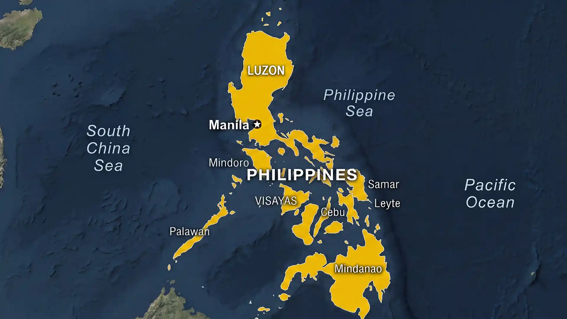
On 4 May 2026 a magnitude‑6.0 earthquake struck Samar Island in Eastern Samar province in the Philippines. The quake, which occurred at a depth of around 56 km, caused no major damage, although minor cracks were reported. The event highlighted the archipelago’s exposure to seismic hazards along the Pacific “Ring of Fire”.
Background
The Philippines is a Southeast Asian archipelago of more than 7,600 islands spread over roughly 300,000 km². The country is divided into three main island groups: Luzon in the north, the Visayas in the centre and Mindanao in the south. It lies between the Philippine Sea to the east and the South China Sea to the west. Rugged mountains run through the islands and include numerous volcanoes, such as Mayon and Taal. Mount Apo on Mindanao is the highest peak at 2,954 m. Major rivers include the Cagayan, Mindanao (Rio Grande de Mindanao) and Agusan, while large lakes such as Laguna de Bay and Lake Lanao provide fisheries and freshwater.
The climate is tropical maritime, with warm temperatures year‑round. Two monsoon seasons shape rainfall: the northeast monsoon brings wet conditions to the east coast from November to April, while the southwest monsoon brings heavy rain to the west coast from May to October. Central and southern islands receive rainfall more evenly throughout the year. The country is rich in natural resources — it is among the world’s largest producers of nickel and has significant deposits of copper, gold, cobalt and petroleum. The Philippines is also the third‑largest geothermal energy producer globally. Its location on the Ring of Fire results in frequent earthquakes and volcanic eruptions.
Key points
- Seismic activity: More than 800 earthquakes are recorded in the Philippines each year. Most are minor tremors, but occasional high‑magnitude events can cause serious damage. The May 2026 quake was moderate and prompted warnings of aftershocks.
- Geography: The Philippine archipelago stretches north–south and separates the South China Sea from the Philippine Sea. Its varied landscape includes mountain ranges, coastal plains, active volcanoes and fertile river valleys.
- Climate: The northeast monsoon (amihan) causes wetter conditions on the east coasts during the Northern Hemisphere winter, while the southwest monsoon (habagat) brings heavy rain to western coasts in summer. Temperatures typically range from 23–32°C.
- Natural resources: The country’s mineral wealth includes nickel, copper, gold, silver and cobalt, as well as geothermal reservoirs that produce around 1,900 MW of electricity. These resources support the economy but also raise environmental concerns.
Significance
The earthquake underscores the Philippines’ vulnerability to natural hazards. Understanding the archipelago’s geology, climate and resource base is essential for disaster preparedness and sustainable development. Geothermal energy development offers a cleaner power source, while mineral exploitation must balance economic gains with environmental protection.
Sources: The Hindu