

Why in news?
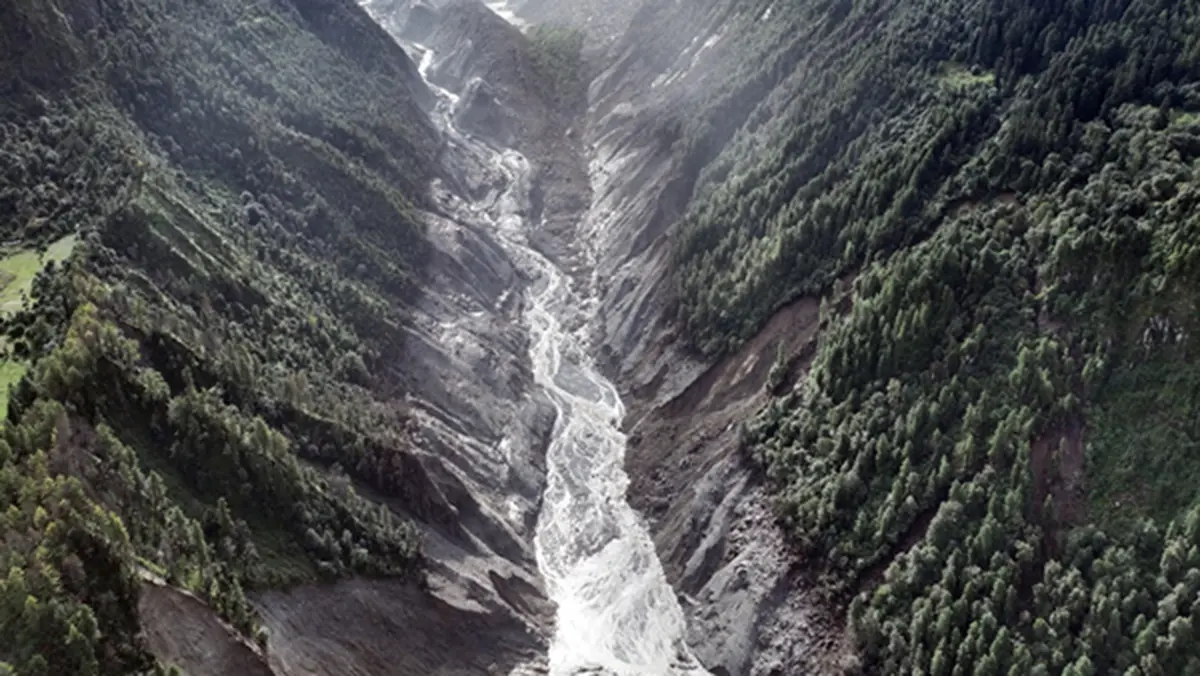
A new barrier lake formed in Tibet after the deadly Rasuwa border flood. Avalanche and landslide debris blocked a river flowing towards Nepal. Satellite analysis placed the lake around eighteen kilometres upstream of Rasuwagadhi. Water began escaping, but authorities continued warning communities about possible sudden flooding.
What happened in the border valley
A destructive flash flood struck the Kyirong–Rasuwa corridor on 26 August 2026. The event damaged settlements and infrastructure on both sides of the border. It followed a mass movement involving ice, rock and debris. Fast water then travelled through a steep Himalayan river system.
Nepal’s disaster authority reviewed Planet and Landsat satellite images on 27 August. It identified another blockage on the Lhende Khola upstream of Rasuwagadhi. The newly impounded water covered about 0.11 square kilometres. Officials warned that failure could produce another large flood.
Water later started flowing through the natural barrier. That outflow can reduce pressure behind a dam. However, it does not immediately prove long-term stability. Continued erosion can widen a channel and release water much faster.
How a barrier lake forms
A barrier lake develops when rock, soil, ice or other debris blocks a valley stream. Water collects because its normal route is obstructed. Such lakes can appear rapidly after earthquakes, landslides or avalanches. Their natural dams usually lack engineered foundations and spillways.
Water may overtop the lowest part of the blockage. The flow can then cut into loose material. Seepage through the dam can also carry particles away. Either process may enlarge suddenly and release a destructive surge.
This event should not be described simply as a glacial lake outburst. The reported barrier was created by avalanche and landslide debris. Ice and changing mountain conditions may have influenced the initial slope failure. The immediate reservoir still resulted from a blocked river valley.
Exact geographic setting
Rasuwa district lies in northern Bagmati Province of Nepal. Its northern edge meets the Tibet Autonomous Region of China. Rasuwagadhi is a border settlement and trade crossing on the Bhote Koshi corridor. Kyirong, also written Gyirong, lies north of the frontier.
High tributaries descend through narrow valleys towards Nepal. The Bhote Koshi later meets the Langtang Khola near Syabrubesi. The river system then continues as the Trishuli. Communities and infrastructure therefore share risks along one connected downstream corridor.
The border route is strategically important for trade and movement between Nepal and China. Roads, bridges and customs facilities occupy limited valley space. Steep slopes leave few alternative routes. A single flood can therefore isolate communities and interrupt national connections.
Why Himalayan lakes demand caution
Young Himalayan mountains have steep slopes and fractured rock. Intense rainfall, earthquakes and freeze-thaw cycles can weaken them. Warming can also alter glaciers and high-altitude permafrost. These processes can combine without one simple cause.
A new barrier can change quickly within hours. Satellite images provide vital regional information, especially across a border. Ground observations reveal flow, dam material and local damage. Both forms of evidence are needed for reliable warnings.
Downstream risk depends on stored volume, dam strength and channel shape. It also depends on settlements and bridges in the flood path. A smaller lake can still cause severe local damage. Officials should avoid both false reassurance and unsupported catastrophe claims.
Preparedness across the border
China controls the upstream site while Nepal faces major downstream exposure. Timely information sharing is therefore essential. Useful data include lake level, breach width, rainfall and fresh slope movement. Alerts must reach local governments and residents without delay.
Communities need marked evacuation routes leading above expected flood levels. Sirens and mobile messages should use simple local language. Night-time events require backup power and trained volunteers. Regular drills can reveal blocked paths before an emergency.
Long-term planning should limit new construction in active flood channels. Important roads and bridges need designs suited to debris-rich flows. Early-warning systems should cover connected tributaries, not one lake alone. Mountain hazard planning must treat the valley as a changing system.
Outflow does not end the risk
A natural outlet may lower the lake gradually. It may also erode rapidly and trigger a larger release. Continued monitoring remains necessary until the barrier stabilises.
Conclusion
The new lake shows how one Himalayan flood can create another hazard. Its cross-border location makes fast official cooperation indispensable. Satellite monitoring must be joined with local observation and clear warnings. Downstream communities need practical routes to safe ground. Resilient planning should recognise that steep river valleys can change within hours.