

Why in news?
A scientific expedition left on 29 September 2026 to install an early-warning system at Vasundhara Lake in Uttarakhand. The Indian Express described it as the state’s first such system for a glacial lake. Researchers from the Central Building Research Institute and the Wadia Institute of Himalayan Geology are involved. Their task is to measure changing conditions around a high-altitude water body and relay information to people downstream. Glacial lakes can release destructive floods if their natural barriers fail or water overtops them. Timely observations could therefore provide a chance to respond before floodwater reaches settlements. The expedition’s work was scheduled through 15 October; installation was underway, not an already completed warning service.
A lake within a connected mountain drainage
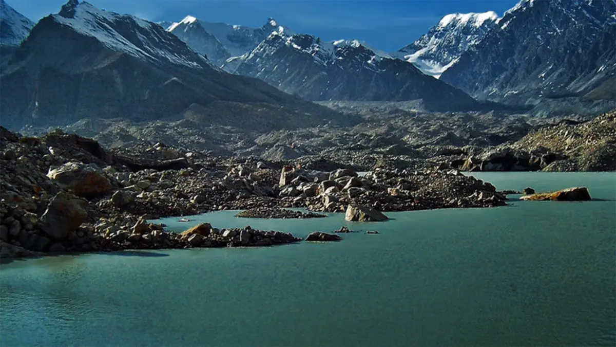
Vasundhara, also recorded as Vasudhara Tal, lies in Chamoli district’s high Himalayan landscape, at approximately 4,700 metres. Scientific and state inventories use slightly different elevations and lake boundaries. The lake is associated with the Raikana glacier system near Purbi Kamet. It belongs to the Raikana–Dhauliganga drainage, rather than an isolated basin with no downstream connection. This geographical relationship explains why observations at the lake matter beyond its immediate surroundings.
The western Dhauliganga carries water towards the Alaknanda, which it joins at Vishnuprayag. These linked valleys can carry a disturbance far beyond the glacier where it began. The route, however, is not a simple pipe. Valley width, slope, tributaries and sediment affect how floodwater travels. Scientists must therefore examine both the lake and the downstream channel before estimating which places could be affected and how quickly.
How stored meltwater becomes a flood hazard
Glaciers erode and transport rock, leaving deposits called moraines around their margins. Water can collect behind these deposits as ice retreats. Such a barrier differs from an engineered dam: its material may be uneven, permeable or partly frozen. A glacial lake outburst flood occurs when stored water escapes rapidly. The existence of a lake alone does not establish that an outburst is imminent.
Several processes can disturb this balance. An ice or rock avalanche may enter a lake and generate a wave that overtops its barrier. Seepage can remove material within a loose dam, while melting buried ice can weaken its structure. Once escaping water cuts into the barrier, erosion may enlarge the opening. The resulting flow can entrain sediment and boulders, increasing its destructive force along steep channels.
Lake growth is consequently a reason for closer investigation, not a countdown to disaster. Satellite images help identify changing surface area, but they cannot alone establish the volume of stored water. A shallow, broad lake and a deeper lake of similar area hold different quantities. Measurements of depth, barrier condition and surrounding unstable slopes are needed to turn an image-based concern into a useful hazard assessment.
From instruments to an actionable message
The expedition’s reported programme combines mapping, lake-depth measurements and instrument installation. Planned equipment includes water-level and weather sensors, with observations of snow and ground conditions. Solar power and satellite communication are intended to support operation in this remote terrain. These measurements answer different questions: a rising lake level concerns storage, while rainfall and temperature help explain what may be driving a change.
For an operational warning system, measurements must become understandable decisions. United Nations disaster-risk guidance connects risk knowledge, monitoring, communication and response. Authorities need to know who examines an abnormal reading, who issues an alert and who receives it. Instruments can fail or transmit misleading values, so maintenance and interpretation remain part of the system after the expedition leaves.
India’s SACHET disaster-alert platform illustrates the wider communication requirement: authoritative warnings must reach the people in the affected area. At village level, an alert also needs a recognisable meaning and a practicable response. A warning that arrives promptly but gives no clear action is incomplete. Local preparedness, accessible escape routes and rehearsed responsibilities determine whether additional information becomes additional safety.
Conclusion
The Vasundhara initiative aims to connect a remote glacial lake with downstream decision-making. Its value will depend on dependable measurements, working communication and prepared communities, not simply equipment installed at altitude. Monitoring cannot strengthen a natural barrier or guarantee advance notice of every sudden event. It can, however, support better decisions when lake conditions change, provided the whole warning chain remains functional.