

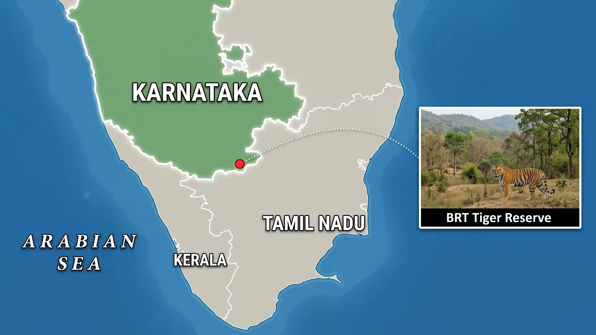
Why in news?
Authorities at Biligiri Ranganatha Swamy Temple (BRT) Tiger Reserve have sought action over fallow land near villages in Karnataka's Chamarajanagar district. A 17 September Times of India report identified officials' concerns about dense growth on unused plots and water-filled abandoned quarries. They linked these features with tiger movement outside the reserve, following a fatal attack on a farmer and reported livestock losses. Officials had submitted locations to the district administration for coordinated action. This is a conflict-management concern around settlements, not a proposal to remove the reserve's protected forest. It shows why tiger conservation must consider the land between protected habitats and everyday human activity.
A bridge between two major hill systems
BRT lies in the Biligiri hills of southern Karnataka, in Chamarajanagar district near Tamil Nadu. Its ecological importance comes partly from its position between the Western Ghats and Eastern Ghats. It forms part of the landscape connecting these hill systems rather than an isolated patch of forest. The reserve takes its name from the hilltop temple of Ranganatha, a form of Vishnu, associated with the conspicuous pale rocky hill.
The National Tiger Conservation Authority (NTCA) lists a total area of 574.82 square kilometres. This comprises 359.10 square kilometres of core and 215.72 square kilometres of buffer. These are management categories within the tiger reserve, not two unrelated protected areas. The official reserve profile places its tiger-reserve notification in 2010–11. Changes in elevation and rainfall across the hills create different growing conditions and help explain the reserve's varied vegetation.
That variation supports a mosaic of scrub, deciduous and evergreen vegetation, river-side habitats, grasslands and higher-elevation forest patches. Tigers share this landscape with leopards, dholes, gaur and several deer species. Habitat diversity matters because predators depend on prey and usable space, while prey depend on food, cover and water. Protecting the reserve therefore means sustaining ecological relationships, not simply maintaining a boundary around tiger sightings.
Why unused land can become a conflict concern
The recent report described officials' concern about plots left uncultivated for many years. Dense vegetation can provide concealment, while abandoned quarry pits can retain water. Where such features occur near livestock or frequently used paths, wildlife and people may encounter one another more often. This does not make all fallow land dangerous or prove one explanation for every attack. The concern is about particular sites and animal movements identified in the local assessment.
Officials reported a tigress with cubs and a male moving outside the reserve, supported by camera-trap and drone observations. They also described warnings to villages and capture preparations under applicable guidance. The report's account of identified plots is therefore a starting point for coordinated management. It is not evidence that all animals seen outside a reserve are habitually dangerous, or that clearing vegetation everywhere would solve the problem.
Responding to a dangerous situation with evidence
The National Tiger Conservation Authority's procedures call for identifying the animal, assessing recent incidents and coordinating technical and local officials. Camera-trap images can help distinguish individual tigers rather than attributing every sighting to the same animal. Veterinary expertise and public communication also matter. Verified movement helps officials identify where warnings and protective action are needed. An indistinct sighting or a rumour cannot provide the same basis for decisions affecting both residents and wildlife.
Keeping crowds away from an animal and coordinating with district authorities can reduce additional danger during an emergency. Longer-term work has a different purpose: understanding why repeated encounters occur and reducing exposure. Safer livestock arrangements, reliable warnings and attention to specific cover or water sites may form part of that assessment. The appropriate response depends on the place and evidence; emergency capture is not a substitute for managing the wider landscape.
Connectivity and community rights belong in the same discussion
Wildlife does not recognise the administrative line between a core, buffer and neighbouring land. Movement outside protected areas can support connections between populations, but it can also bring animals into conflict with people. This creates a real planning challenge. Land-use decisions must consider both ecological continuity and the safety of residents. Treating every movement corridor as empty land would ignore the farms, settlements and livelihoods already present.
The Soliga community has a long association with the BRT landscape. The Ashoka Trust for Research in Ecology and the Environment (ATREE) documented community forest-rights recognition in October 2011. The district administration distributed rights to Soliga communities from 25 village assemblies in the sanctuary and adjoining areas. This was an administrative process under the Forest Rights Act, not a newly issued court judgment. It illustrates why conservation planning must engage rights-holders as participants.
Community knowledge can assist understanding of animal movement, seasonal resource use and changes in the forest. Participation also matters when proposed measures affect access or land use. The immediate fallow-land concern should therefore lead to site-specific assessment and coordination, not a general assumption that conservation requires excluding local people. Protecting residents and sustaining wildlife habitat are practical responsibilities that have to be addressed together.
Conclusion
BRT's importance extends beyond its notified area because it links habitats and supports a lived-in landscape around them. The present concern requires careful identification of risky sites and animals, prompt protection for residents and coordinated district action. Over time, reducing conflict will depend on land-use planning and cooperation with local communities. That approach preserves the reserve's connecting role while recognising that conservation cannot succeed by overlooking the safety and rights of its neighbours.