

Why in news?
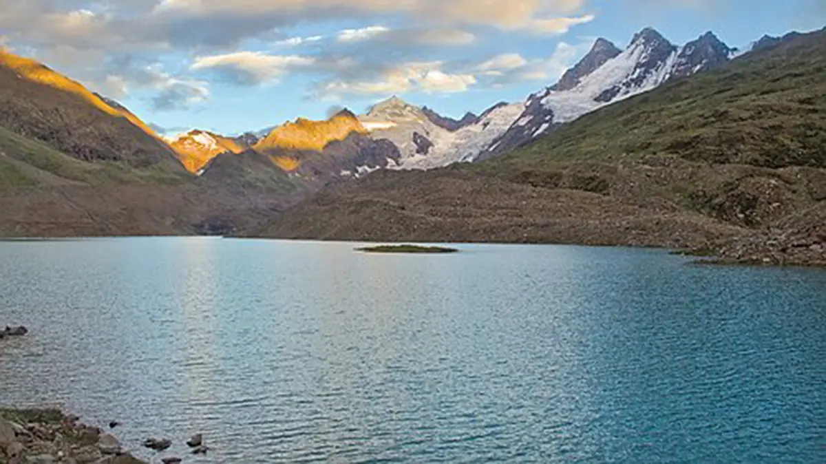
A new risk assessment has renewed attention on the rapidly expanding Ghepan Lake in Himachal Pradesh. The glacial lake lies above Sissu in the Lahaul valley. Modelled flood scenarios identified 34 settlements that could face different levels of exposure. The finding strengthens calls for monitoring, warning systems and carefully planned evacuation routes.
What the assessment indicates
The assessment examined a possible glacial lake outburst flood, commonly shortened to GLOF. Such a study maps water movement under selected breach assumptions. It does not predict that a breach will definitely occur. Its purpose is to show where preparation is most urgent.
The reported exposure covers 34 settlements along downstream channels. Sissu is a prominent settlement within this wider risk area. Exposure can differ sharply between locations and scenarios. Local elevation, channel width, bridges and debris can all change the outcome.
Authorities therefore need settlement-level maps rather than a single valley-wide warning. Safe routes must remain usable during rain, snowmelt or road damage. Warning messages also need clear thresholds and trusted local channels. Regular drills can reveal weaknesses before an emergency.
Where Ghepan Lake is located
Official studies also call the waterbody Ghepang Gath or Ghepang Ghat Lake. It lies near 4,068 metres in Lahaul and Spiti district. The lake occupies the upper Chandra sub-basin. Its outlet enters Sissu Nala before reaching the Chandra River.
The Chandra and Bhaga rivers meet at Tandi to form the Chenab. The Chenab later flows through Jammu and Kashmir into Pakistan. It belongs to the wider Indus river system. A high mountain hazard can therefore sit within a much larger transboundary basin.
Sissu lies along the Manali–Leh road corridor, north of the Atal Tunnel. Steep slopes and narrow valleys limit alternative access. Tourism and seasonal traffic can increase the number of people present. This geography makes communication and evacuation planning especially important.
How the lake has changed
Indian Space Research Organisation satellite analysis tracked a large increase over several decades. The mapped area grew from 36.49 hectares in 1989 to 101.30 hectares in 2022. That represents an increase of about 178 per cent. The reported average expansion was roughly 1.96 hectares each year.
Retreating glacier ice can leave a depression that fills with meltwater. Ice and loose moraine material may form part of the natural barrier. As water volume grows, pressure and wave effects can increase. However, lake size alone does not establish an immediate breach.
Risk depends on the dam, surrounding slopes and possible triggers. An ice avalanche or rockfall can create a displacement wave. Intense rain, rapid melt or internal erosion may also weaken a barrier. Scientists therefore combine satellite mapping with field measurements.
The natural dam and downstream pathway
A Himachal Pradesh study describes Ghepan as a moraine-dammed lake. Loose rock and sediment left by a glacier form its barrier. Such material can remain stable for long periods. Its condition still requires repeated inspection as the lake and climate change.
The same study recorded a lake length near 2.48 kilometres and maximum width near 0.59 kilometres. Measurements can vary with date and mapping method. The outlet and downstream face deserve particular attention. Overtopping water could erode unconsolidated material quickly.
A breach wave would follow the steep Sissu Nala towards the Chandra. It could carry sediment, boulders and woody debris. Bridges and narrow bends may temporarily obstruct the flow. Sudden blockage failure can then create another surge downstream.
What risk reduction should include
Satellite images can show seasonal lake-area change and movement around the dam. Automatic water-level and weather sensors add local evidence. Cameras and field surveys can detect cracks, seepage or slope instability. No single instrument provides a complete warning.
Authorities can connect thresholds with sirens and mobile alerts. Villages need marked assembly areas above modelled flood levels. Road agencies should identify bridges and culverts that may fail. Tourism operators should receive the same emergency instructions as residents.
Engineering intervention needs exceptional care in remote terrain. Controlled drainage may reduce pressure in some lakes. Poorly designed work can instead disturb a stable barrier. Decisions should follow field investigation, environmental review and long-term maintenance planning.
Exposure is not a forecast of destruction
The 34-settlement figure comes from modelled flood scenarios. It identifies places needing preparedness, not places certain to be inundated.
Conclusion
Ghepan Lake shows how glacier retreat can create a growing mountain hazard. Its position above Sissu gives the issue an immediate human dimension. Satellite evidence establishes substantial expansion, while models describe possible downstream exposure. Monitoring must therefore connect directly with warnings, roads and community drills. Preparedness can reduce loss even when the timing of a breach remains uncertain.